Country Club Section in Coral Gables in Miami-Dade County, Florida — The American South (South Atlantic)
Coral Gables Rapid Transit
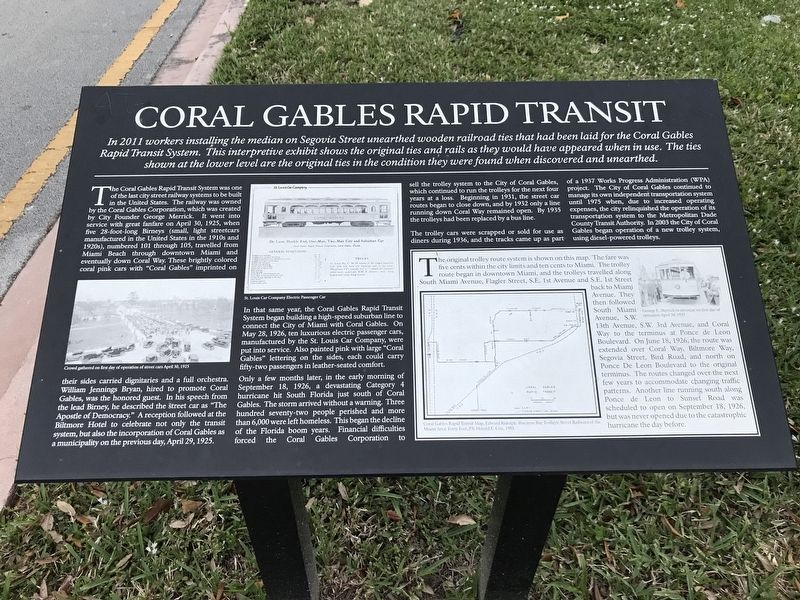
The Coral Gables Rapid Transit System was one of the last city street railway systems to be built in the United States. The railway was owned by the Coral Gables Corporation, which was created by City Founder George Merrick. It went into service with great fanfare on April 30, 1925, when five 28-foot-long Birneys (small, light streetcars manufactured in the United States in the 1910s and 1920s), numbered 101 through 105, travelled from Miami Beach through downtown Miami and eventually down Coral Way. These brightly colored coral pink cars with “Coral Gables” imprinted on their sides carried dignitaries and a full orchestra. William Jennings Bryan, hired to promote Coral Gables, was the honored guest. In his speech from the lead Birney, he described the street car as “The Apostle of Democracy.” A reception followed at the Biltmore Hotel to celebrate not only the transit system, but also the incorporation of Coral Gables as a municipality on the previous day, April 29, 1925.
In that same year, the Coral Gables Rapid Transit System began building a high-speed suburban line to connect the City of Miami with Coral Gables. On May 28, 1926, ten luxurious electric passenger cars, manufactured by the St. Louis Car Company, were put into service. Also painted pink with large “Coral Gables” lettering on the sides, each could carry fifty-two passengers in leather-seated comfort.
Only a few months later, in the early morning of September 18, 1926, a devastating Category 4 hurricane hit South Florida just south of Coral Gables. The storm arrived without a warning. Three hundred seventy-two people perished and more than 6,000 were left homeless. This began the decline of the Florida boom years. Financial difficulties forced Coral Gables Corporation to sell the trolley system to the City of Coral Gables, which continued to run the trolleys for the next four years at a loss. Beginning in 1931, the street car routes began to close down, and by 1932 only a line running down Coral Way remained open. By 1935 the trolleys had been replaced by a bus line.
The trolley cars were scrapped or sold for use as diners during 1936, and the tracks came up as part of a 1937 Works Progress Administration (WPA) project. The City of Coral Gables continued to manage its own independent transportation system until 1975 when, due to increased operating expenses, the city relinquished the operation of its transportation system to the Metropolitan Dade County Transit Authority. In 2003 the City of Coral Gables began operation of a new trolley system, using diesel-powered trolleys.
Inset box (lower right)
The original trolley route system is shown on this map. The fare was five cents within the city limits and ten cents to Miami. The trolley route began in downtown Miami, and the trolleys travelled along South Miami Avenue, Flagler Street, S.E. 1st Avenue and S.E. 1st Street back to Miami Avenue. They then followed South Miami Avenue, S.W. 13th Avenue, S.W. 3rd Avenue, and Coral Way to the terminus at Ponce de Leon Boulevard. On June 18, 1926, the route was extended over Coral Way, Biltmore Way, Segovia Street, Bird Road, and north on Ponce De Leon Boulevard to the original terminus. The routes changed over the next few years to accommodate changing traffic patterns. Another line running south along Ponce de Leon to Sunset Road scheduled to open on September 18, 1926, but was never opened due to the catastrophic hurricane the day before.
Captions:
(Left) Crowd gathered on first day of operation of street cars April 30, 1925.
(Center) St. Louis Car Company Electric Passenger Car.
(Inset)
• (left) Coral Gables Rapid Transit Map, Edward Ridolph, Biscayne Bay Trolleys: Street Railways of the Miami Area. Forty Fort, PA: Harold E. Cox, 1981.
• (right) George E. Merrick in streetcar on first day of operation April 30, 1925.
Topics. This historical marker is listed in these topic lists: Disasters • Railroads & Streetcars. A significant historical date for this entry is April 30, 1925.
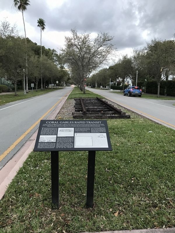
Location. 25° 44.388′ N, 80° 15.981′ W. Marker is in Coral Gables, Florida, in Miami-Dade County. It is in the Country Club Section. Marker is on Segovia Street north of Aledo Avenue, in the median. Touch for map. Marker is at or near this postal address: 3443 Segovia St, Miami FL 33134, United States of America. Touch for directions.
Other nearby markers. At least 8 other markers are within walking distance of this marker. The Historic 1926 White Way Lights (about 400 feet away, measured in a direct line); U of M Opened Here (about 500 feet away); Ruth Bryan Owen Waterway Park (approx. 0.6 miles away); Venetian Pool (approx. 0.6 miles away); George Edgar Merrick (approx. 0.7 miles away); George E. Merrick (approx. 0.7 miles away); Coral Gables Miracle Mile (approx. 0.7 miles away); Coral Gables Merrick House (approx. ¾ mile away). Touch for a list and map of all markers in Coral Gables.
Credits. This page was last revised on February 3, 2023. It was originally submitted on March 4, 2022, by Duane and Tracy Marsteller of Murfreesboro, Tennessee. This page has been viewed 342 times since then and 55 times this year. Photos: 1, 2. submitted on March 4, 2022, by Duane and Tracy Marsteller of Murfreesboro, Tennessee.

