Charlotte Amalie in St. Thomas, Virgin Islands — The Caribbean (The West Indies)
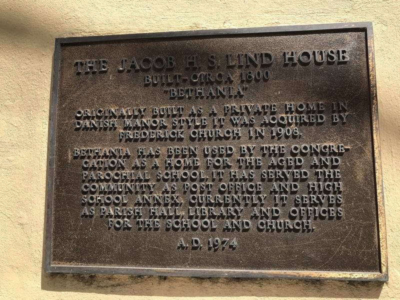
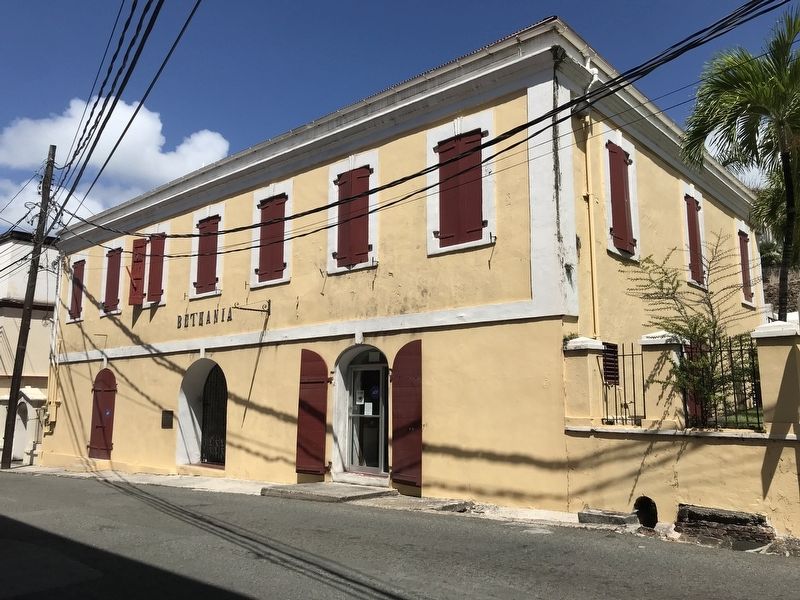
The Jacob H. S. Lind House
Built – circa 1800
— “Bethania” —
Originally built as a private home in Danish Manor style, it was acquired by Frederick Church in 1908.
Bethania has been used by the congregation as a home for the aged and parochial school. It has served the community as a post office and high school annex. Currently it serves as parish hall, library and offices for the school and church.
Erected 1974 by Frederick Lutheran Church.
Topics. This historical marker is listed in these topic lists: Architecture • Churches & Religion • Education. A significant historical year for this entry is 1800.
Location. 18° 20.504′ N, 64° 55.8′ W. Marker is in Charlotte Amalie in St. Thomas, Virgin Islands. Marker is on Norre Gade west of Torvet State Road, on the right when traveling west. Touch for map. Marker is at or near this postal address: 5046 Norre Gade, St Thomas VI 00802, United States of America. Touch for directions.
Other nearby markers. At least 8 other markers are within walking distance of this marker. Frederick Lutheran Church (a few steps from this marker); St. Thomas Community Bandmaster (within shouting distance of this marker); America's First Lady Addressed the People of St. Thomas (within shouting distance of this marker); Landing of Virginia Settlers (about 300 feet away, measured in a direct line); Fort Christian (about 300 feet away); St. Thomas' Liberty Bell Reproduction: (about 300 feet away); Frederick Lutheran Church Parsonage (about 300 feet away); Capitol Building (about 700 feet away). Touch for a list and map of all markers in Charlotte Amalie.
Also see . . .
1. Jacob H.S. Lind House. Photos and drawings of the building, taken as part of the Historic American Buildings Survey. (Library of Congress) (Submitted on March 15, 2022, by Duane and Tracy Marsteller of Murfreesboro, Tennessee.)
2. Historic Architecture of the Virgin Islands (PDF). Histories, architectural features and other details about selected buildings, including the Lind House, as documented by the Historical American Buildings Survey. The section on the Lind House, listed as Bethania, begins on page 106 of the document. (Historic American Buildings Survey, 1966) (Submitted on March 15, 2022, by Duane and Tracy Marsteller of Murfreesboro, Tennessee.)
Credits. This page was last revised on March 19, 2024. It was originally submitted on March 15, 2022, by Duane and Tracy Marsteller of Murfreesboro, Tennessee. This page has been viewed 112 times since then and 10 times this year. Photos: 1, 2. submitted on March 15, 2022, by Duane and Tracy Marsteller of Murfreesboro, Tennessee.

