Marker Logo HMdb.org THE HISTORICAL
MARKER DATABASE
“Bite-Size Bits of Local, National, and Global History”
Charlotte Amalie in St. Thomas, Virgin Islands — The Caribbean (The West Indies)
 

Capitol Building


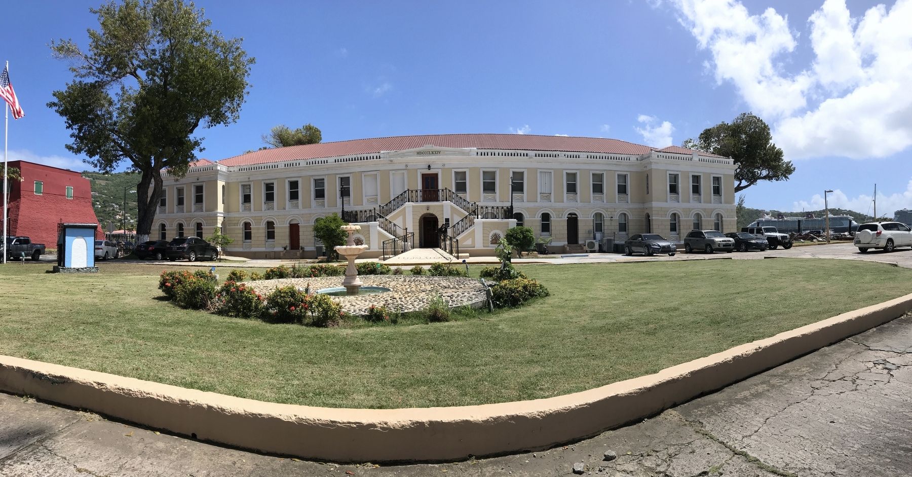
Capitol Building Marker image. Click for full size.
Photographed By Duane and Tracy Marsteller, March 9, 2022
1. Capitol Building Marker
Inscription. Built in 1874 to replace a wooden structure, this neo-classical building served as a military barracks for Fort Christian. It later housed the Charlotte Amalie High School, and today the Virgin Islands Legislature. A grand staircase with wrought iron railing leads up to the main level. This was the site of the transfer of the Territory from Denmark to the United States in 1917. The site features mahogany trees and the sea waves crashing at the gun battery along the shore.
 
Erected by St. Thomas/St. John Historic Preservation Commission.
 
Topics. This historical marker is listed in these topic lists: ArchitectureEducationForts and CastlesGovernment & Politics. A significant historical year for this entry is 1874.
 
Location. 18° 20.399′ N, 64° 55.778′ W. Marker is in Charlotte Amalie in St. Thomas, Virgin Islands. Marker can be reached from Veterans Drive east of Forte Strade, on the right when traveling east. Touch for map. Marker is in this post office area: St Thomas VI 00802, United States of America. Touch for directions.
 
Other nearby markers. At least 8 other markers are within walking distance of this marker. Fort Christian (about 300 feet away, measured in a direct line); St. Thomas Community Bandmaster (about 500 feet away); America's First Lady Addressed the People of St. Thomas (about 500 feet away); Landing of Virginia Settlers
Paid Advertisement
Click on the ad for more information.
Please report objectionable advertising to the Editor.
Click or scan to see
this page online
(about 500 feet away); St. Thomas' Liberty Bell Reproduction: (about 500 feet away); Frederick Lutheran Church (about 600 feet away); The Jacob H. S. Lind House (about 700 feet away); Frederick Lutheran Church Parsonage (approx. 0.2 miles away). Touch for a list and map of all markers in Charlotte Amalie.
 
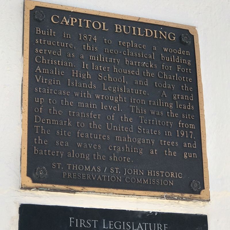
Capitol Building Marker image. Click for full size.
Photographed By Duane and Tracy Marsteller, March 9, 2022
2. Capitol Building Marker
Featured marker, and a secondary marker below it, are to the right of the central entrance.
Seconday Marker image. Click for full size.
Photographed By Duane and Tracy Marsteller, March 9, 2022
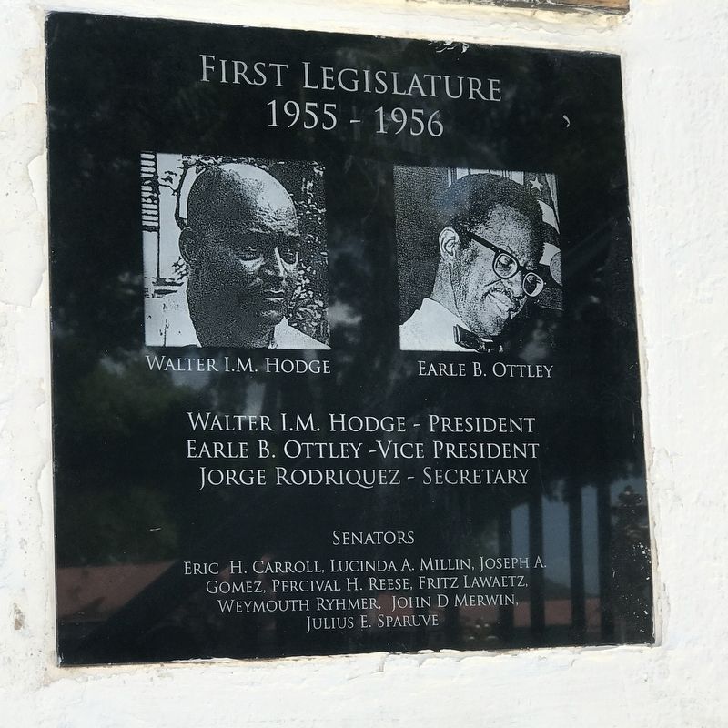
3. Seconday Marker
This plaque, below the Capitol Building plaque, details the first Virgin Islands Legislature in 1955-56.
 
 
Credits. This page was last revised on October 2, 2022. It was originally submitted on March 15, 2022, by Duane and Tracy Marsteller of Murfreesboro, Tennessee. This page has been viewed 295 times since then and 73 times this year. Photos:   1, 2, 3. submitted on March 15, 2022, by Duane and Tracy Marsteller of Murfreesboro, Tennessee.
Share this page.  
Share on Tumblr
m=193621

CeraNet Cloud Computing sponsors the Historical Marker Database.
This website earns income from purchases you make after using our links to Amazon.com. We appreciate your support.
Paid Advertisement
Apr. 28, 2024