Wayne in Delaware County, Pennsylvania — The American Northeast (Mid-Atlantic)
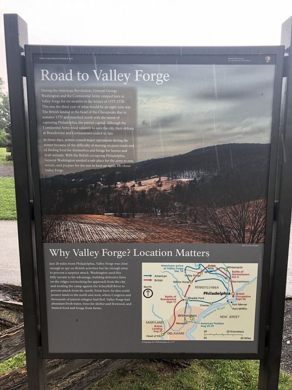
Road to Valley Forge
In those days, armies ceased major operations during the winter because of the difficulty of moving on poor roads and of finding food for themselves and forage for horses and draft animals. With the British occupying Philadelphia, General Washington needed a safe place for the army to rest, retrain, and prepare for the war to heat up again. He chose Valley Forge.
Why Valley Forge? Location Matters
Just 20 miles from Philadelphia, Valley Forge was close enough to spy on British activities but far enough away to prevent a surprise attack. Washington used this hilly terrain to his advantage, building defensive lines on the ridges overlooking the approach from the city and nestling the camp against the Schuylkill River to prevent attack from the north. From here, he also could protect lands to the north and west, where Congress and thousands of patriot refugees had fled. Valley Forge had abundant fresh water, trees for shelter and firewood, and limited food and forage from farms.
Caption: Campaign for Philadelphia in 1777
Erected by National Park Service.
Topics. This historical marker is listed in this topic list: War, US Revolutionary.
Location. 40° 5.84′ N, 75° 25.526′ W. Marker is in Wayne, Pennsylvania, in Delaware County. Marker is on North Outer Line Drive, on the right when traveling west. Touch for map. Marker is in this post office area: Wayne PA 19087, United States of America. Touch for directions.
Other nearby markers. At least 8 other markers are within walking distance of this marker. Log City (here, next to this marker); A City of Huts (here, next to this marker); An Essential Position on the Front Line (here, next to this marker); Greene’s Division (a few steps from this marker); Winter Encampment (within shouting distance of this marker); Soldiers’ Huts (within shouting distance of this marker); Transformation of the American Army (about 300 feet away, measured in a direct line); On the Lookout (about 500 feet away). Touch for a list and map of all markers in Wayne.
Credits. This page was last revised on April 17, 2022. It was originally submitted on March 16, 2022, by Pete Skillman of Townsend, Delaware. This page has been viewed 107 times since then and 14 times this year. Photo 1. submitted on March 16, 2022, by Pete Skillman of Townsend, Delaware. • J. Makali Bruton was the editor who published this page.
