Port Jervis in Orange County, New York — The American Northeast (Mid-Atlantic)
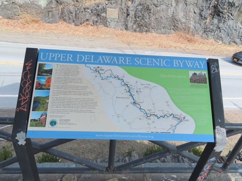
Upper Delaware Scenic Byway
The Upper Delaware Scenic Byway (New York State Route 97) follows the Upper Delaware River through the western parts of Delaware, Sullivan, and Orange Counties. This unique highway connects the rafting and bluestone village of Hancock to the historic railroad city of Port Jervis, some 70 miles downstream.
On and around the Byway, you'll find country eateries, farmers' markets, art galleries, museums, theaters, antique shops and general stores... all surrounded by undulating hills, long valley vistas and rock cut landscapes.
Motorcycle magazines cite the Route 97 Byway as one of the best riding roads in the Northeast. Portions of the Byway are designated as Bike Route 17 for bicycling enthusiasts.
The nationally-renowned Upper Delaware Scenic and Recreational River, which the highway follows, offers fishing, swimming, boating, canoeing, and whitewater sports at numerous public and private access areas.
The Upper Delaware Scenic Byway was added to the New York State Scenic Byways System on August 6, 2002. A non-profit organization comprised of volunteer representatives from each participating municipality promotes the protection and enhancement of the Scenic Byway's natural and cultural resources. Municipalities include the Counties of Delaware, Sullivan, and Orange; the Village of Hancock; the Towns of Delaware, Cochecton, Tusten, Highland, Lumberland, and Deerpark; and the City of Port Jervis.
Scenic byways are dedicated to protecting their region's outstanding character, heritage, and beauty, while encouraging economic development through tourism and recreation.
The Upper Delaware Scenic Byway Charming. Historic. Natural.
Port Jervis was first incorporated as a village in 1853. After being partitioned from the Town of Deerpark, it became a city in 1907. It has long been a transportation nexus, serving as stops along the Delaware River for Native Americans and later timber log raftsmen.
Por: Jervis was an important location on the Delaware and Hudson Canal from 1828-1898 and was named for John B. Jervis, the canal's chief engineer. The Erie Railroad arrived in 1847 and successor companies continued to maintain a major presence here until the 1960's.
From 1875-1930 it was a major industrial and economic center. It was also home to a number of important figures including author Stephen Crane and painter John Newton Howitt.
It continues to serve as the region's economic hub and is now benefiting from the tourism opportunities that abound nearby. The City of Port Jervis is the southern gateway for the Upper Delaware Scenic Byway.
( photo caption )
Built prior to 1760, Fort Decker was damaged in an attack by Joseph Brant, with his Indian and British allies, on July 20, 1779. Rebuilt by Martinus Decker in 1793, Fort Decker is the oldest building in Port Jervis. Minisink Valley Historical Society has owned and maintained the building as a museum since 1970.
Topics. This historical marker is listed in this topic list: Industry & Commerce. A significant historical date for this entry is July 20, 1779.
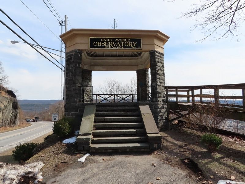
Location. 41° 22.765′ N, 74° 41.863′ W. Marker is in Port Jervis, New York, in Orange County. Marker is on Park Avenue (New York State Route 42) north of W Main Street, on the left when traveling north. Located in the Park Avenue Observatory. Touch for map. Marker is in this post office area: Port Jervis NY 12771, United States of America. Touch for directions.
Other nearby markers. At least 8 other markers are within walking distance of this marker. Port Jervis (a few steps from this marker); Park Avenue (a few steps from this marker); Tow Path (about 300 feet away, measured in a direct line); Fort Decker (approx. 0.2 miles away); Fort Burned by Indians (approx. 0.2 miles away); Decker Fort (approx. 0.2 miles away); Erie Turntable (approx. ¼ mile away); Bridge Ca. 1855 (approx. 0.3 miles away). Touch for a list and map of all markers in Port Jervis.
Credits. This page was last revised on March 24, 2022. It was originally submitted on March 24, 2022, by Michael Herrick of Southbury, Connecticut. This page has been viewed 99 times since then and 8 times this year. Photos: 1, 2. submitted on March 24, 2022, by Michael Herrick of Southbury, Connecticut.

