New Albany in Floyd County, Indiana — The American Midwest (Great Lakes)
Western Line of the Clark (Illinois) Grant
Inscription.
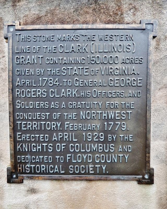
This stone marks the western line of the Clark (Illinois) Grant containing 150,000 acres given by the State of Virginia, April, 1784, to General George Rogers Clark, his Officers, and Soldiers as a gratuity for the conquest of the Northwest Territory, February 1779.
Erected April 1929 by the Knights of Columbus and dedicated to the Floyd County Historical Society.
Erected 1929 by Knights of Columbus.
Topics. This historical marker is listed in these topic lists: Settlements & Settlers • War, US Revolutionary. A significant historical month for this entry is April 1784.
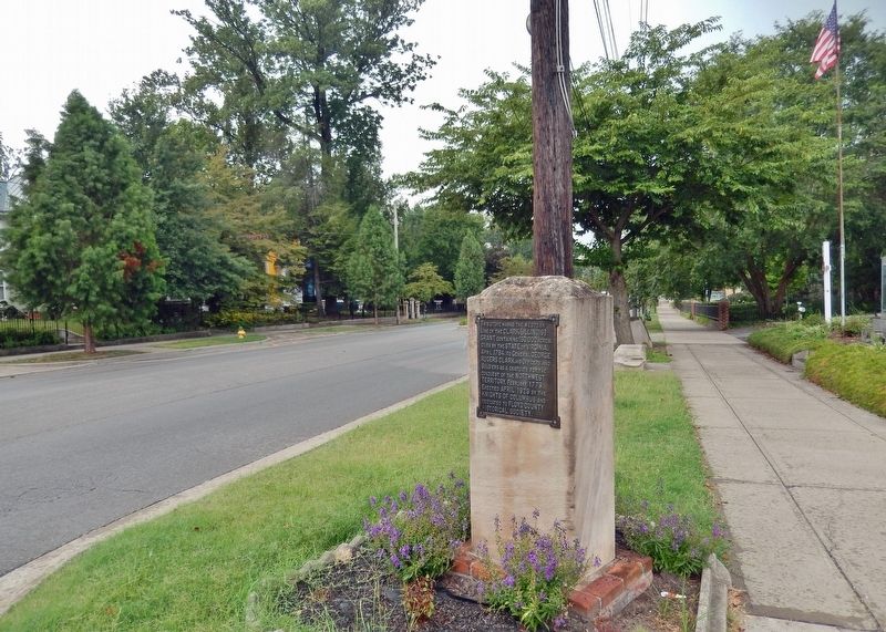
Location. 38° 17.18′ N, 85° 48.865′ W. Marker is in New Albany, Indiana, in Floyd County. Marker is on East Main Street (Ohio River Scenic Byway) (Indiana Route 111) just west of East 9th Street, on the right when traveling west. Marker is located beside the sidewalk, directly in front of the Knights of Columbus hall. Touch for map. Marker is at or near this postal address: 809 East Main Street, New Albany IN 47150, United States of America. Touch for directions.
Other nearby markers. At least 8 other markers are within walking distance of this marker. Floyd County World War I Memorial (a few steps from this marker); Nunemacher-Hangary House (about 300 feet away, measured in a direct line); Culbertson Mansion (about 400 feet away); Culbertson Widows' Home (about 400 feet away); Mansions of New Albany (about 400 feet away); The Culbertson House (about 500 feet away); First Catholic Church in New Albany (about 600 feet away); First Successful Manufacture of Plate Glass in America (about 600 feet away). Touch for a list and map of all markers in New Albany.
Also see . . .
1. Illinois Campaign.
The Illinois campaign, also known as Clark's Northwestern campaign, was a series of events during the American Revolutionary War in which a small force of Virginia militiamen, led by George Rogers Clark, seized control of several British posts in what are now Illinois and Indiana. The campaign was funded in large part by local residents and merchants of the Illinois country. Although Clark submitted his receipts to Virginia, many of these men were never reimbursed. However, Clark and his soldiers were given land. This Clark's Grant formed much of what would become Clark and eastern Floyd County, Indiana.(Submitted on March 25, 2022, by Cosmos Mariner of Cape Canaveral, Florida.)
2. George Rogers Clark - Clark's Grant.
The land was selected on the north side of the Ohio River. It is situated in Clark, Floyd and Scott counties, Indiana, but mainly in the first named county. It was, in early times, generally called "Illinois Grant," but now, more frequently, "Clark's Grant, '' or simply, "The Grant." The location of the land was vested by the law "in a majority of the officers," but the tract selected was always a favorite locality with General Clark, and his choice was adopted by common consent.(Submitted on March 25, 2022, by Cosmos Mariner of Cape Canaveral, Florida.)
Credits. This page was last revised on March 25, 2022. It was originally submitted on March 24, 2022, by Cosmos Mariner of Cape Canaveral, Florida. This page has been viewed 94 times since then and 8 times this year. Photos: 1, 2. submitted on March 25, 2022, by Cosmos Mariner of Cape Canaveral, Florida.

