Grapevine in Tarrant County, Texas — The American South (West South Central)
Land Patent Office
Photographed by Thomas Smith, March 6, 2022
1. Land Patent Office Marker
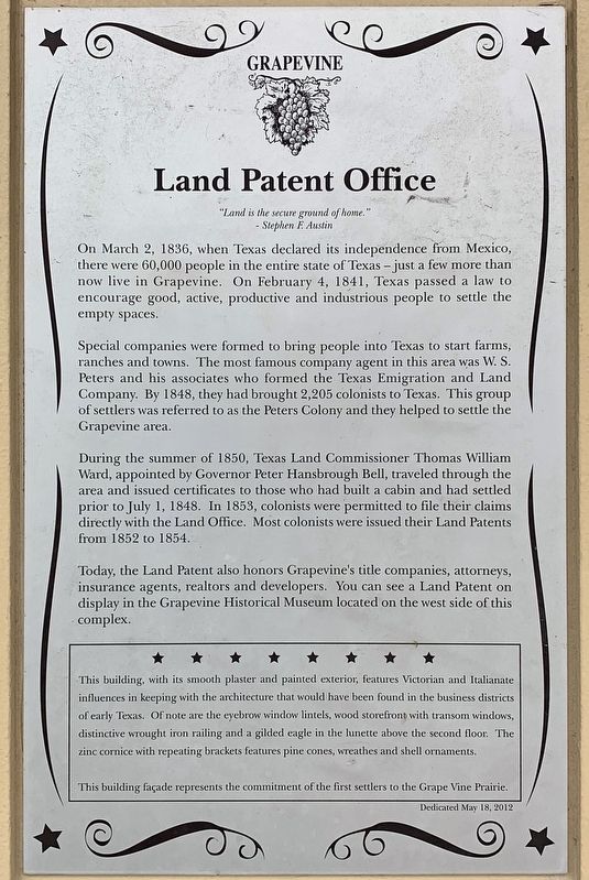
"Land is the secure ground of home."
- Stephen F. Austin
On March 2, 1836, when Texas declared its independence from Mexico, there were 60,000 people in the entire state of Texas – just a few more than now live in Grapevine. On February 4, 1841, Texas passed a law to encourage good, active, productive and industrious people to settle the empty spaces.
Special companies were formed to bring people into Texas to start farms, ranches and towns. The most famous company agent in this area was W. S. Peters and his associates who formed the Texas Emigration and Land Company. By 1848, they had brought 2,205 colonists to Texas. This group of settlers was referred to as the Peters Colony and they helped to settle the Grapevine area.
During the summer of 1850, Texas Land Commissioner Thomas William Ward, appointed by Governor Peter Hansbrough Bell, traveled through the area and issued certificates to those who had built a cabin and had settled prior to July 1, 1848. In 1853, colonists were permitted to file their claims directly with the Land Office. Most colonists were issued their Land Patents from 1852 to 1854.
Today, the Land Patent also honors Grapevine's title companies, attorneys, insurance agents, realtors and developers. You can see a Land Patent on display in the Grapevine Historical Museum located on the west side of this complex.
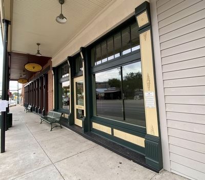
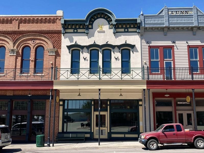
This building, with its smooth plaster and painted exterior, features Victorian and Italianate influences in keeping with the architecture that would have been found in the business districts of early Texas. Of note are the eyebrow window lintels, wood storefront with transom windows, distinctive wrought iron railing and a gilded eagle in the lunette above the second floor. The zinc cornice with repeating brackets features pine cones, wreathes and
this page online
Dedicated May 18, 2012
Erected 2012.
Topics. This historical marker is listed in this topic list: Settlements & Settlers. A significant historical year for this entry is 1836.
Location. 32° 56.089′ N, 97° 4.711′ W. Marker is in Grapevine, Texas, in Tarrant County. It is on Main Street south of College Street, on the right when traveling south. Touch for map. Marker is at or near this postal address: 636 S Main St, Grapevine TX 76051, United States of America. Touch for directions.

Regionally, this marker is in the Prairies & Lakes Region and in the Dallas-Fort Worth Metropolitan Area. It is also in the American South. Globally, it is in North America, a Gulf of Mexico state, the Western Hemisphere, the Western World, and the Anglosphere. Historically, it finds itself in what was once New Spain, the Republic of Texas, and one of the Confederate States of America.
Other nearby markers. At least 8 other markers are within walking distance of this marker: Dunn Mercantile (here, next to this marker); Grapevine Dairy Producers Building
Photographed by Morgan Petermann, September 12, 2023
2. Land Patent Office Marker
Photographed by Craig Baker, April 5, 2024
3. Land Patent Office
Credits. This page was last revised on April 15, 2024. It was originally submitted on March 25, 2022, by Thomas Smith of Waterloo, Ill. This page has been viewed 428 times since then and 35 times this year. Photos: 1. submitted on March 25, 2022, by Thomas Smith of Waterloo, Ill. 2. submitted on September 20, 2023, by Morgan Petermann of Hurst, Texas. 3. submitted on April 15, 2024, by Craig Baker of Sylmar, California. • J. Makali Bruton was the editor who published this page.
