Riverside in Burlington County, New Jersey — The American Northeast (Mid-Atlantic)
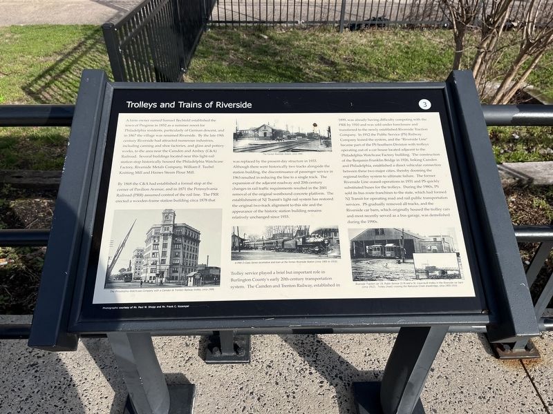
Trolleys and Trains of Riverside
A farm owner named Samuel Bechtold established the town of Progress in 1852 as a summer resort for Philadelphia residents, particularly of German descent, and in 1867 the village was renamed Riverside. By the late 19th century Riverside had attracted numerous industries, including canning and shoe factories, and glass and pottery works, to the area to the area near the Camden and Amboy (C&A) Railroad. Several buildings located near this light-rail station stop historically housed the Philadelphia Watchcase Factory, Riverside Metals Company, William F. Taubel Knitting Mill and Haines Steam Flour Mill.
By 1868 the C&A had established a formal stop at the corner of Pavilion Avenue, and in 1871 the Pennsylvania Railroad (PRR) assumed control of the rail line. The PRR erected a wooden frame station building circa 1878 that was replaced by the present-day structure in 1933. Although there were historically two tracks alongside the station building, the discontinuance of passenger service in 1963 resulted in reducing the line to a single track. The expansion of the adjacent roadway and 20th century changes in rail traffic requirements resulted in the 2001 removal of the original westbound concrete platform. The establishment of NJ Transit's light-rail system had restored the original two-track alignment to this site and the appearance of the historic station building remains relatively unchanged since 1933.
Trolley service played a brief but important role in Burlington County's early 20th century transportation system. The Camden and Trenton Railway, established in 1899, was already having difficulty competing with the PRR by 1910 and was sold under foreclosure and transferred to the newly established Riverside Traction Company. In 1912 the Public Service (PS) Railway Company leased the system, and the "Riverside Line" became part of the PS Southern Division with trolleys operating out of a car house located adjacent to the Philadelphia Watchcase Factory building. The construction of the Benjamin Watchcase Factory building. The construction of the Benjamin Franklin Bridge in 1926, linking Camden and Philadelphia, established a direct vehicular connection between these two major cities, thereby dooming the regional trolley system to ultimate failure. The former Riverside Line cased operations in 1931 and PS quickly substituted buses for the trolleys. During the 1980s, PS sold its bus route franchises to the state, which had formed NJ Transit for operating road and rail public transportation services. PS gradually removed all tracks, and the Riverside car barn, which originally housed the trolley cars and most recently served as a bus garage, was demolished during the 1990s.
Erected by
Topics. This historical marker is listed in these topic lists: Industry & Commerce • Railroads & Streetcars • Settlements & Settlers. A significant historical year for this entry is 1852.
Location. 40° 2.362′ N, 74° 57.53′ W. Marker is in Riverside, New Jersey, in Burlington County. Marker is at the intersection of Zurbrugg Way and North Pavilion Avenue (County Road 543), on the right when traveling west on Zurbrugg Way. Touch for map. Marker is at or near this postal address: 1 N Pavilion Ave, Riverside NJ 08075, United States of America. Touch for directions.
Other nearby markers. At least 8 other markers are within walking distance of this marker. Keystone Watchcase Clock Tower Restoration and Lighting (within shouting distance of this marker); World War I Memorial (about 500 feet away, measured in a direct line); Korea and Vietnam Wars Memorial (about 500 feet away); World War II Memorial (about 500 feet away); St. Peter's Church (approx. 0.2 miles away); St. Peter's Catholic Church (approx. 0.2 miles away); Riverside-Delanco Bridge (approx. 0.4 miles away); Delanco's Tribute to Those Who Lost Their Lives in the Second World War 1941 - 1945 (approx. 0.4 miles away). Touch for a list and map of all markers in Riverside.
Credits. This page was last revised on April 3, 2022. It was originally submitted on April 3, 2022, by Devry Becker Jones of Washington, District of Columbia. This page has been viewed 297 times since then and 85 times this year. Photos: 1, 2. submitted on April 3, 2022, by Devry Becker Jones of Washington, District of Columbia.

