Potter Township near Centre Hall in Centre County, Pennsylvania — The American Northeast (Mid-Atlantic)
Potter's Fort
Photographed by Craig Swain, May 23, 2009
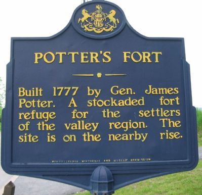
1. Potter's Fort Marker
A stockaded fort refuge for the settlers of the
valley region. The site is on the nearby rise.
Erected 1947 by Pennsylvania Historical and Museum Commission.
Topics and series. This historical marker is listed in these topic lists: Forts and Castles • Settlements & Settlers • War, US Revolutionary. In addition, it is included in the Pennsylvania Historical and Museum Commission (PHMC) series list. A significant historical year for this entry is 1777.
Location. 40° 50.169′ N, 77° 40.422′ W. Marker is near Centre Hall, Pennsylvania, in Centre County. It is in Potter Township. It is at the intersection of Old Fort Road (State Highway 144) and Earlystown Road (State Highway 45), on the right when traveling north on Old Fort Road. Touch for map. Marker is at or near this postal address: 2903 Penns Valley Pike, Centre Hall PA 16828, United States of America. Touch for directions.

Regionally, this marker is in the Pennsylvania Wilds. It is also in the American Northeast, in the Mid-Atlantic, in Appalachia, and specifically in Northern Appalachia. Globally, it is in North
this page online
Other nearby markers. At least 8 other markers are within 5 miles of this marker, measured as the crow flies: Location of Potter's Fort (about 400 feet away, measured in a direct line); Veterans Memorial (approx. 0.2 miles away); War Memorial (approx. 0.2 miles away); Smith-Pletcher American Legion Post No. 779 (approx. 0.2 miles away); Thomas Van Doran and Jacob Shadecre (approx. 1.4 miles away); Arms For Peace (approx. 3.6 miles away); The Legend of Penn's Cave (approx. 4½ miles away); Penn's Cave Hotel (approx. 4.6 miles away). Touch for a list and map of all markers in Centre Hall.
Related marker. Click here for another marker that is related to this marker.
Also see . . .
1. Brief Discussion of Potter's Fort. From Centre County History. (Submitted on June 1, 2009, by Craig Swain of Leesburg, Virginia.)
2. James Potter at FindAGrave.com. (Submitted on July 14, 2011, by Mike Wintermantel of Pittsburgh, Pennsylvania.)
Additional commentary.
1.
Photographed by Craig Swain, May 23, 2009
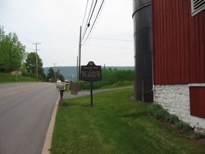
2. Potter's Fort Marker
The Report of the Commission to locate the site of the frontier forts of Pennsylvania published in 1916 stated the fort was located on a rise of ground on the south boundary of Centre Hall. As stated on the marker the fort was built in 1777. At least one action was fought nearby with Indian raiding parties. In 1916, the commission stated remains of the fort were seen near McCoy Tavern standing at the intersection of the highways.
— Submitted June 1, 2009, by Craig Swain of Leesburg, Virginia.
Photographed by Craig Swain, May 23, 2009
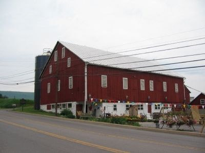
3. Potter's Fort Marker and Old Barn
The barn, while not directly associated with the fort, stands near the fort site.
Credits. This page was last revised on June 22, 2023. It was originally submitted on June 1, 2009, by Craig Swain of Leesburg, Virginia. This page has been viewed 3,125 times since then and 182 times this year. Photos: 1, 2, 3. submitted on June 1, 2009, by Craig Swain of Leesburg, Virginia.
