Tamaqua in Schuylkill County, Pennsylvania — The American Northeast (Mid-Atlantic)
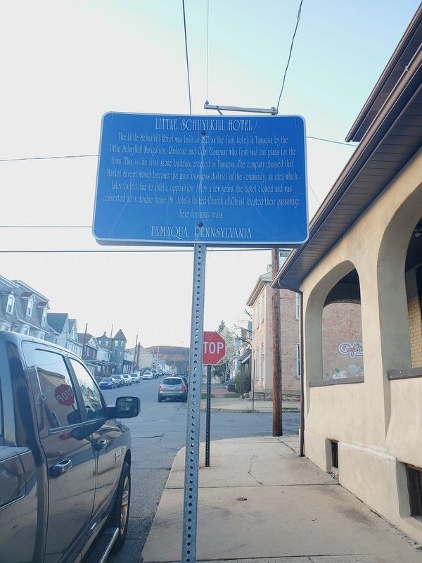
Little Schuylkill Hotel
Topics. This historical marker is listed in these topic lists: Architecture • Industry & Commerce • Railroads & Streetcars. A significant historical year for this entry is 1827.
Location. 40° 47.935′ N, 75° 57.909′ W. Marker is in Tamaqua, Pennsylvania, in Schuylkill County. Marker is at the intersection of Market Street and Mauch Chunk Street, on the right when traveling north on Market Street. Touch for map. Marker is at or near this postal address: 45 Market St, Tamaqua PA 18252, United States of America. Touch for directions.
Other nearby markers. At least 8 other markers are within walking distance of this marker. Burkhardt Moser Log Home (about 500 feet away, measured in a direct line); The Jno. F. McGinty Brewery (about 700 feet away); Tamaqua (approx. ¼ mile away); Colliery Bell (approx. ¼ mile away); Little Schuylkill Railroad (approx. ¼ mile away); Anthracite Railroader Memorial (approx. ¼ mile away); Reading & Northern Railroad (approx. ¼ mile away); Anthracite Bank of Tamaqua (approx. 0.4 miles away). Touch for a list and map of all markers in Tamaqua.
Additional keywords. Anthracite
Credits. This page was last revised on April 25, 2022. It was originally submitted on April 17, 2022. This page has been viewed 172 times since then and 19 times this year. Photos: 1. submitted on April 17, 2022. • Bill Pfingsten was the editor who published this page.
