Mount Pleasant in Jefferson County, Ohio — The American Midwest (Great Lakes)
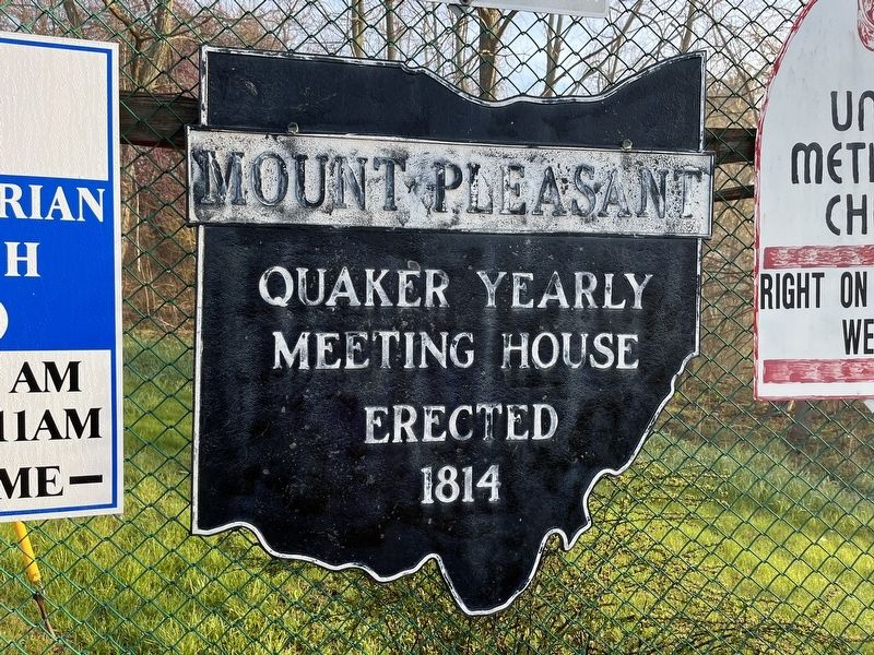
Mount Pleasant
Erected by Ohio Historical Society.
Topics and series. This historical marker is listed in these topic lists: Churches & Religion • Settlements & Settlers. In addition, it is included in the Ohio Historical Society / The Ohio History Connection, and the Quakerism series lists. A significant historical year for this entry is 1814.
Location. 40° 10.526′ N, 80° 47.532′ W. Marker is in Mount Pleasant, Ohio, in Jefferson County. Marker is on Union Street (Ohio Route 647) 0.2 miles east of Glen Robbins Lane, on the right when traveling north. Touch for map. Marker is at or near this postal address: 6 Union St, Rayland OH 43943, United States of America. Touch for directions.
Other nearby markers. At least 8 other markers are within walking distance of this marker. Mt. Pleasant High School (approx. 0.4 miles away); World Wars I and II Memorial (approx. 0.4 miles away); Mount Pleasant Historic Underground Railroad District (approx. 0.4 miles away); Mount Pleasant Veterans Memorial (approx. 0.4 miles away); Elizabeth House Mansion (approx. half a mile away); Samuel Gill House (approx. 0.6 miles away); Mount Pleasant's Beginnings / The Testimony of Equality (approx. 0.6 miles away); Building the Meetinghouse / Abolition (approx. 0.6 miles away). Touch for a list and map of all markers in Mount Pleasant.

Photographed By Devry Becker Jones (CC0), April 22, 2022
3. Mount Pleasant Marker
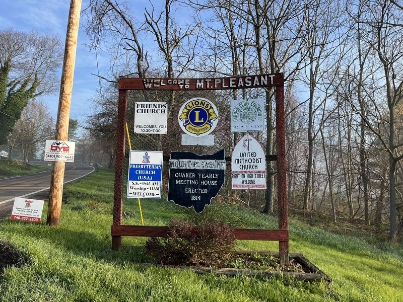
While most of the corporation limit markers in Ohio are freestanding, this marker has been affixed to the village's welcome display.
Credits. This page was last revised on April 23, 2022. It was originally submitted on April 23, 2022, by Devry Becker Jones of Washington, District of Columbia. This page has been viewed 98 times since then and 9 times this year. Photos: 1, 2, 3. submitted on April 23, 2022, by Devry Becker Jones of Washington, District of Columbia.

![Mount Pleasant Marker [Reverse]. Click for full size. Mount Pleasant Marker [Reverse] image. Click for full size.](Photos6/650/Photo650820.jpg?423202244200PM)