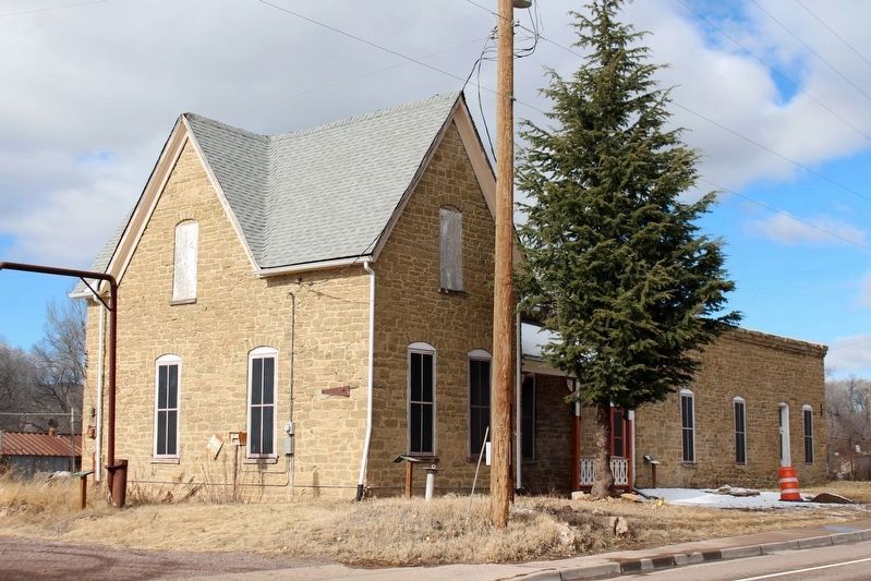
Silver City in Grant County, New Mexico — The American Mountains (Southwest)
Silver City Water Works

cmh2315fl via Flickr (CC BY-NC 2.0), December 26, 2015
1. Silver City Water Works Marker
National Register of Historic Places Nomination Form
Click for more information.
Click for more information.
• In 1887, the Waterworks provided the very first municipal water supply for Silver City, operated under franchise by the Silver City Water Company.
• In 1925, when sold to Silver City, it included a 30-acre parcel!
• In the 1920s, the waterworks property was used as a training ground for the 111th cavalry unit.
• In 1949, the metal shop was added!
• The building was used as a residence for city employees until 1967.
• We are doing our best to save it, but it’s going to cost a lot of money!
Angélica, ALHS 2012
[Caption] The Silver City Waterworks, 1890
Erected 2012.
Topics. This historical marker is listed in these topic lists: Architecture • Charity & Public Work. A significant historical year for this entry is 1887.
Location. 32° 46.997′ N, 108° 16.742′ W. Marker is in Silver City, New Mexico, in Grant County. Marker is on Little Walnut Road, 0.2 miles north of U.S. 180, on the left when traveling north. Touch for map. Marker is at or near this postal address: 1717 Little Walnut Rd, Silver City NM 88061, United States of America. Touch for directions.
Other nearby markers. At least 8 other markers are within walking distance of this marker. Silver City (approx. 0.3 miles away); GFWC Silver City Women's Club (approx. 0.4 miles away); Changing Values (approx. 0.9 miles away); Silver City Centennial (approx. 0.9 miles away); Protecting our Watershed (approx. 0.9 miles away); Destroyed by Floods (approx. 0.9 miles away); An Oasis in the Desert (approx. 0.9 miles away); Municipal Museum (approx. 0.9 miles away). Touch for a list and map of all markers in Silver City.

cmh2315fl via Flickr (CC BY-NC 2.0), December 26, 2015
2. Silver City Water Works Marker
Marker is at the corner of the building.
Credits. This page was last revised on April 25, 2024. It was originally submitted on April 27, 2022, by Duane and Tracy Marsteller of Murfreesboro, Tennessee. This page has been viewed 155 times since then and 33 times this year. Photos: 1, 2. submitted on April 27, 2022, by Duane and Tracy Marsteller of Murfreesboro, Tennessee.