Adel in Cook County, Georgia — The American South (South Atlantic)
Cook County Tornado of 2017
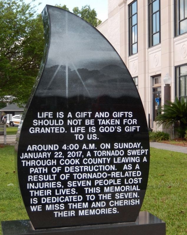
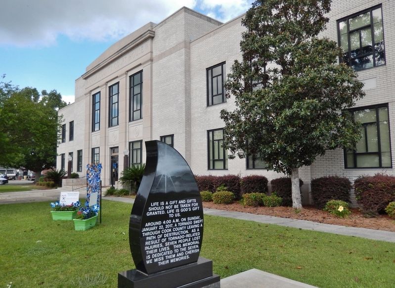
Life is a gift and gifts should not be taken for granted. Life is Godís gift to us.
Around 4:00 A.M. on Sunday, January 22, 2017, a tornado swept through Cook County leaving a path of destruction. As a result of tornado-related injuries, seven people lost their lives. This memorial is dedicated to the seven. We miss them and cherish their memories.
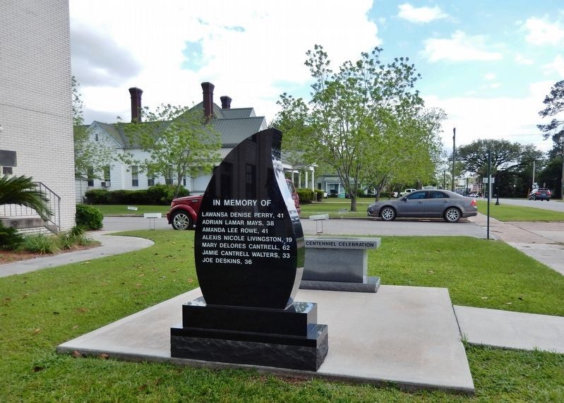
Adrian Lamar Mays, 38,
Amanda Lee Rowe, 41
Alexis Nicole Livingston, 19
Mary Delores Cantrell, 62
Jamie Cantrell Walters, 33
Joe Deskins, 36
Erected 2021.
Topics. This historical marker is listed in this topic list: Disasters. A significant historical date for this entry is January 22, 2017.
Location. 31° 8.343′ N, 83° 25.436′ W. Marker is in Adel, Georgia, in Cook County. Marker is on North Hutchinson Avenue (U.S. 41) just north of Alley Street, on the right when traveling north. Memorial marker is located near the southwest corner of the Cook County Courthouse grounds. Touch for map. Marker is at or near this postal address: 212 North Hutchinson Avenue, Adel GA 31620, United States of America. Touch for directions.
Other nearby markers. At least 8 other markers are within 8 miles of this marker, measured as the crow flies. Cook County Courthouse (a few steps from this marker); Cook County (a few steps from this marker); Cook County Veterans Memorial (within shouting distance of this marker); Old United States Post Office, Adel, Georgia (about 700 feet away, measured in a direct line); SOWEGA Building (approx. 0.2 miles away); Adel Lime Sink (approx. ľ mile away); Old Coffee Road (approx. 6Ĺ miles away); Reed Bingham State Park Bridge (approx. 7.1 miles away). Touch for a list and map of all markers in Adel.
Also see . . .
1. Memorial unveiled honoring lives lost in 2017 Cook County tornado. WALB News10 website entry:
A memorial now stands in front of Cook Countyís courthouse, honoring the lives lost, those who lived through it and for the future generations to never forget the tornado that blew through the area. A teardrop and a sunrise, representing loss but also a new beginning.(Submitted on April 28, 2022, by Cosmos Mariner of Cape Canaveral, Florida.)
2. Adel Tornado: Looking Back Two Years Later. WTXL News 27 website entry:
During the pre-dawn hours on January 22nd, 2017, the EF-3 twister came through the western sections of the trailer park in southern Cook County and left a path of destruction in its wake. Some of the damage is still visible two years later. 11 people died as a result of the EF-3 tornado that ripped through South Georgia. Two in Brooks County, two in Berrien County, and seven in Cook County.(Submitted on April 28, 2022, by Cosmos Mariner of Cape Canaveral, Florida.)
3. Deadly Tornado Outbreak January 22, 2017. National Weather Service website entry:
The tornado crossed Georgia Route 76 at EF-3 strength and ripped about a third of the second story from a well-built brick home. A short distance up the road, the tornado shifted a wood-framed home about 12 feet off its foundation while removing its second story. The tornado then continued into Cook County. Still at EF-3 strength, it swept about 35 manufactured homes into a pile of rubble at the far end of the Sunshine Acres mobile home park. Seven people lost their lives. The tornado then went on to destroy about two thirds of a brick home on Val Del Road, collapsing in two walls and removing most of the second story. Another home built of concrete blocks was destroyed. A nearby farm had several concrete anchors for a large metal structure pulled from the ground. (Submitted on April 28, 2022, by Cosmos Mariner of Cape Canaveral, Florida.)
Credits. This page was last revised on April 29, 2022. It was originally submitted on April 28, 2022, by Cosmos Mariner of Cape Canaveral, Florida. This page has been viewed 153 times since then and 23 times this year. Photos: 1, 2, 3, 4. submitted on April 28, 2022, by Cosmos Mariner of Cape Canaveral, Florida.


