Glen Carbon in Madison County, Illinois — The American Midwest (Great Lakes)
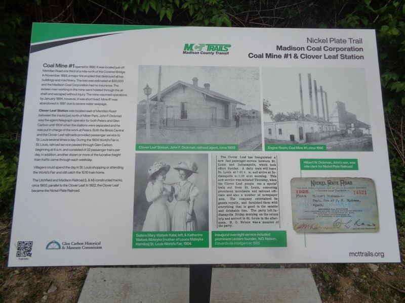
Madison Coal Corporation Coal Mine #1 & Clover Leaf Station
Nickel Plate Trail
Inscription.
Coal Mine #1 opened in 1892, it was located just off Meridian Road one third of a mile north of the Covered Bridge. In November 1893, a major fire erupted that destroyed all top buildings and machinery. The loss was estimated at $30,000 and the Madison Coal Corporation had no insurance. The sixteen men working in the mine were hoisted through the air shaft and escaped without injury. The mine resumed operations by January 1894, however, it was short lived. Mine #1 was abandoned in 1897 due to severe water seepage.
Clover Leaf Station was located east of Meridian Road between the tracks just north of Miner Park. John F. Dickman was the agent/telegraph operator for both Peters and Glen Carbon until 1904 when the stations were separated and he was put in charge of the work at Peters. Both the Illinois Central and the Clover Leaf railroads provided passenger service to St. Louis several times a day. During the 1904 World's Fair in St. Louis, railroad service passed through Glen Carbon beginning at 6 a.m. and consisted of 22 passenger trains per day. In addition, another dozen or more of the lucrative freight train traffic came through each weekday.
Villagers could spend the day in St. Louis shopping or attending the World's Fair and still catch the 10:10 train home.
The Litchfield and Madison Railroad (L&M) constructed tracks, circa 1900, parallel to the Clover Leaf. In 1922, the Clover Leaf became the Nickel Plate Railroad.
Erected 2021 by MCT Trails/Madison County Transit and Glen Carbon Historical & Museum Commission.
Topics. This historical marker is listed in these topic lists: Disasters • Industry & Commerce • Railroads & Streetcars. A significant historical month for this entry is January 1894.
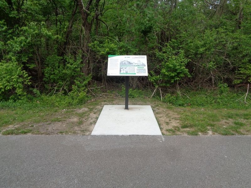
Location. 38° 45.067′ N, 89° 58.956′ W. Marker is in Glen Carbon, Illinois, in Madison County. Marker is located off Nickel Plate Trail. It is accessible from Miner Park, or from Meridian Road by bike or on foot. Touch for map. Marker is at or near this postal address: 11 E Guy Ave, Glen Carbon IL 62034, United States of America. Touch for directions.
Other nearby markers. At least 8 other markers are within walking distance of this marker. Imaginary Theatre in Henry's Park (about 600 feet away, measured in a direct line); Railroads (approx. 0.2 miles away); Glen Carbon (approx. 0.2 miles away); Churches (approx. 0.2 miles away); a different marker also named Railroads (approx. 0.2 miles away); Glen Carbon Won the Inter-City Championship in 1934 (approx. 0.2 miles away); Homesteads (approx. 0.2 miles away); Yanda Log Cabin (approx. 0.2 miles away). Touch for a list and map of all markers in Glen Carbon.
Also see . . . MCT Trails (official website).
Information on several trails that are all over Madison County, Illinois. Many of them were former railroads, as part of the "Rails to Trails" program. (Submitted on April 29, 2022, by Jason Voigt of Glen Carbon, Illinois.)
Credits. This page was last revised on April 29, 2022. It was originally submitted on April 29, 2022, by Jason Voigt of Glen Carbon, Illinois. This page has been viewed 186 times since then and 17 times this year. Photos: 1, 2, 3. submitted on April 29, 2022, by Jason Voigt of Glen Carbon, Illinois.


