Wrayswood in Greene County, Georgia — The American South (South Atlantic)
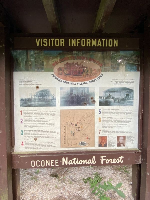
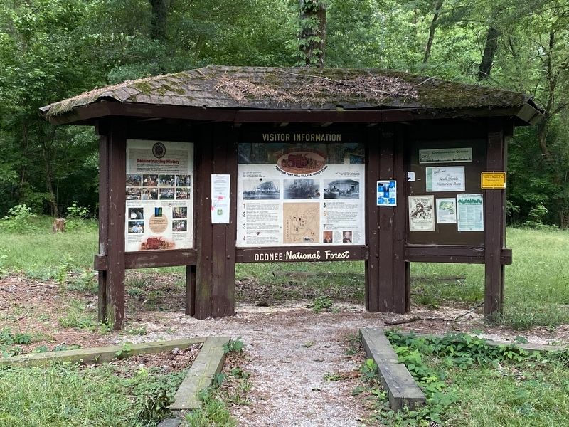
Frontier Fort, Mill Village, Ghost Town
Welcome to Scull Shoals
— Oconee National Forest —
Inscription.
1784 First white settlers arrive
1793 Fort Clark built
1810 Georgia's first paper mill
1845 Fire destroyed mills, rebuilt 1847
1861-65 No damages here in Civil War
1887 Flood covered town, removed bridge
1897 Mills sold, town abandoned
1935 US. Government bought land
1 Superintendent's House
From his house downtown, the Superintendent could observe all town activities. A large root cellar was built of blue granite from a quarry on Rose Creek across the river, The house was damaged by a flood in 1908, but stood until the 1930's.
2 Blacksmith Shop and Covered Bridge
The Blacksmith made and fixed mill and farm equipment, served town needs, and collected bridge tolls.
The covered toll bridge was first built in 1809, lost in 1841 Harrison Freshet (flood), then again in the disastrous 1887 flood. A ferry was used to cross the river when the bridge was not available.
3 Power Plant and Raceway Bridge
Built in 1846, this power plant held a horizontal turbine that powered all the mills. Water from Oconee River entered the power plant by the raceway (canal) from the dam.
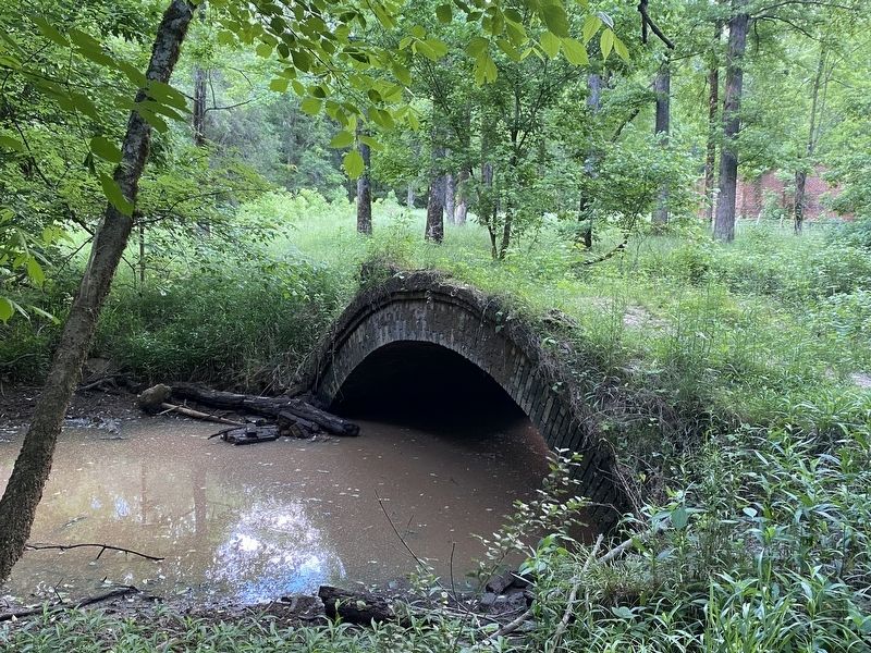
The arched brick raceway bridge allowed villagers access to mill buildings from downtown. It was damaged by a tree fall in 1999.
4 Manager's House
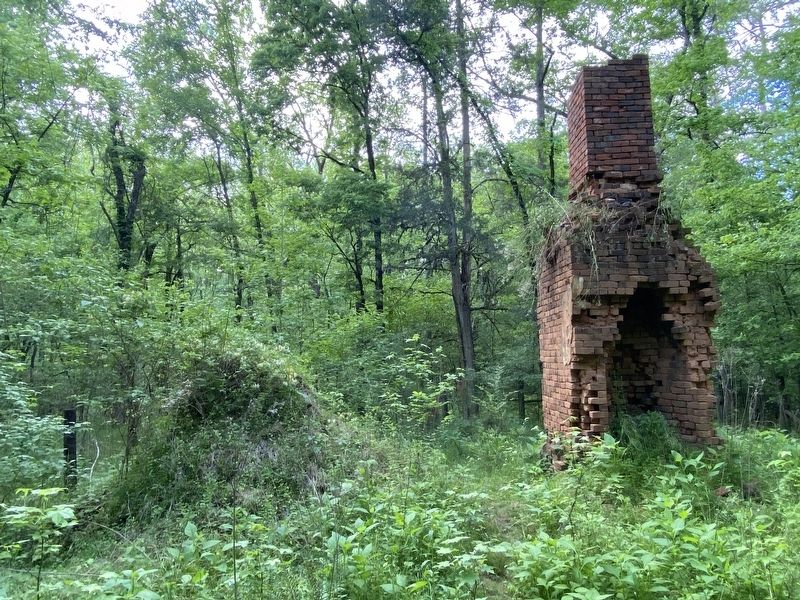
This two-chimney house was built in early 1800's and remained occupied until removed in 1935. The four-room house had two porches, facing to the river and along Greensboro Road. The photograph of the village was made from the front yard of this house.
5 Company Store and Warehouse
Rebuilt in brick after the 1845 fire that destroyed the whole mill complex, the store served ihe community and the mills. It was under water for four days in 1887 flood, destroying 600 bushels of wheat waiting to be ground into flour.
6 Frontier Fort Clark
Built in 1793 by Michael Cupp for $45.00, this wooden fort was a fortified house with a stockade, 11 feet high, and 29 yards long by 19 yards wide. It was garrisoned by Greene County Militia, who were led by Cornett Peyton Smith.
The fort's location was unknown until 1999, when archaeologists found remains of a large post with pottery dated from 1780-1820.
7 Mill Houses
Located around the village, these houses were provided by the owners. Today they are marked by chimney bases, wells, and some vegetation.
(captions)
Dr. Lindsey Durham (1789-1859) and his medical family had a large hospital and developed patent medicines from his 13 acre herb garden across the Oconee River.
Dr. Thomas N. Poullain (1792-1859) owned and operated Scull Shoals Mills
from 1827-1868. He lived here until 1838 when he moved into Greensboro.
Topics. This historical marker is listed in these topic lists: Forts and Castles • Industry & Commerce • Settlements & Settlers. A significant historical year for this entry is 1784.
Location. 33° 44.003′ N, 83° 17.377′ W. Marker is in Wrayswood, Georgia, in Greene County. Marker is on Skull Shoals Road, 3 miles west of Macedonia Road, on the left when traveling west. Touch for map. Marker is in this post office area: Watkinsville GA 30677, United States of America. Touch for directions.
Other nearby markers. At least 8 other markers are within 11 miles of this marker, measured as the crow flies. Elder Mill Covered Bridge (approx. 6.4 miles away); A.T. Brightwell Schools Inc (approx. 6.8 miles away); “Old Mercer” (approx. 8 miles away); Apalachee (approx. 8.9 miles away); John Andrew (approx. 9.1 miles away); Fort Mathews (approx. 9.2 miles away); In Honor of all American Veterans (approx. 10˝ miles away); E. D. Stroud School (approx. 10˝ miles away).
Credits. This page was last revised on May 14, 2022. It was originally submitted on May 13, 2022, by Darren Jefferson Clay of Duluth, Georgia. This page has been viewed 146 times since then and 17 times this year. Photos: 1, 2, 3, 4, 5, 6. submitted on May 13, 2022, by Darren Jefferson Clay of Duluth, Georgia. • Bernard Fisher was the editor who published this page.
