Potomac Overlook Regional Park in Arlington in Arlington County, Virginia — The American South (Mid-Atlantic)
Old Barns at Potomac Overlook
Potomac Overlook Regional Park
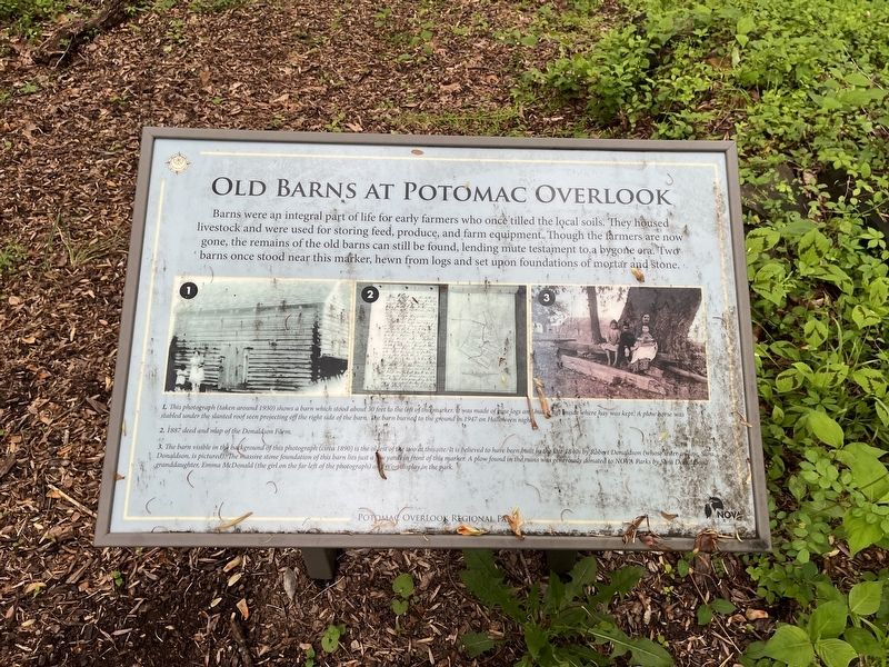
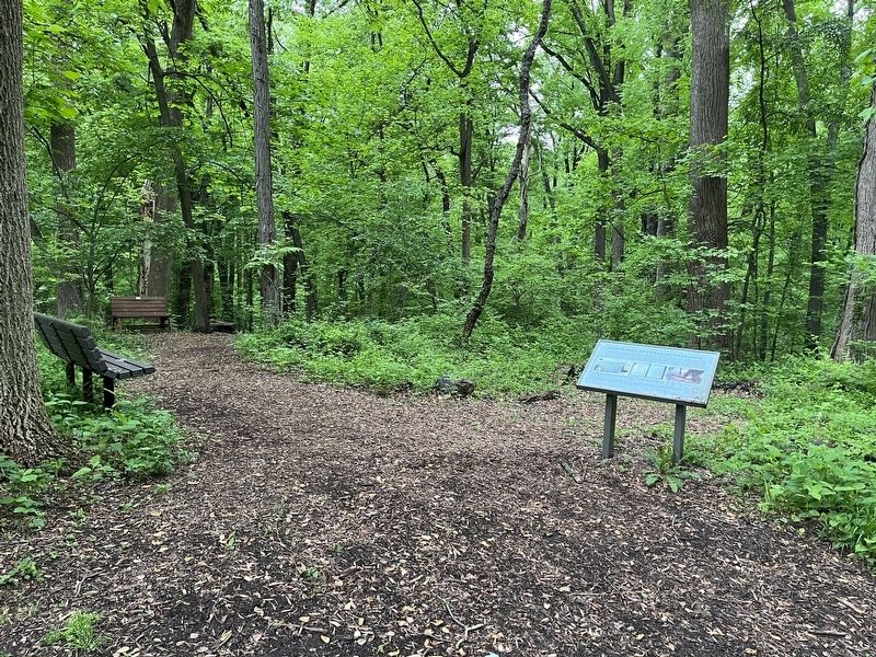
Barns were an integral part of life for early farmers who once tilled the local soils. They housed livestock and were used for storing feed, produce, and farm equipment. Though the farmers are now gone, the remains of the old barns can still be found, lending mute testament to a bygone era. Two barns once stood near this marker, hewn from logs and set upon foundations of mortar and stone.
[Captions:]
1. This photograph (taken around 1930) shows a barn which stood about 30 feet to the left of this marker. It was made of pine logs and had a loft inside where hay was kept. A plow horse was stabled under the slanted roof seen projecting off the right side of the barn. The barn burned to the ground in 1947 on Halloween night.
2. 1887 deed and map of the Donaldson Farm.
3. The barn visible in the background of this photograph (circa 1890) is the oldest of the two at this site. It is believed to have been built in the late 1840s by Robert Donaldson (whose sister-in-law, Sara Donaldson, is pictured). The massive stone foundation of this barn lies just a few yards in front of this marker. A plow found in the ruins was generously donated to NOVA Parks by Sara Donaldson's granddaughter, Emma McDonald (the girl on the far left of the photograph) and is on display in the park.
Erected by NOVA Parks.
Topics and series. This historical marker is listed in these topic lists: African Americans • Notable Buildings. In addition, it is included in the NOVA Parks series list. A significant historical date for this entry is October 31, 1947.
Location. 38° 54.745′ N, 77° 6.493′ W. Marker is in Arlington, Virginia, in Arlington County. It is in Potomac Overlook Regional Park. Marker is on Marcey Road, 0.3 miles north of North Beechwood Place, on the left when traveling north. Touch for map. Marker is at or near this postal address: 2845 Marcey Rd, Arlington VA 22207, United States of America. Touch for directions.
Other nearby markers. At least 8 other markers are within walking distance of this marker. The Farm Road (within shouting distance of this marker); This is Potomac Overlook! (about 500 feet away, measured in a direct line); History of the Nature Center (about 700 feet away); The Indian Spring (approx. 0.2 miles away); Native American Home Site (approx. ¼ mile away); Glenmore (approx. half a mile away); Navigation of the Potomac (approx. 0.6 miles away in District of Columbia); Abner Cloud House (approx. 0.6 miles away in District of Columbia). Touch for a list and map of all markers in Arlington.
Credits. This page was last revised on March 3, 2023. It was originally submitted on May 15, 2022, by Devry Becker Jones of Washington, District of Columbia. This page has been viewed 115 times since then and 21 times this year. Photos: 1, 2. submitted on May 15, 2022, by Devry Becker Jones of Washington, District of Columbia.

