
Forest in Bedford County, Virginia — The American South (Mid-Atlantic)
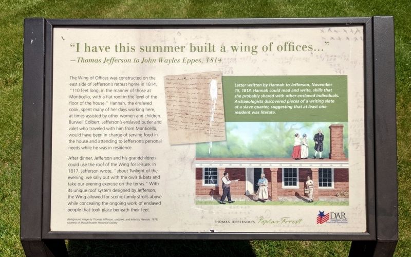
“I have this summer built a wing of offices...”
—Thomas Jefferson to John Wayles Eppes, 1814
Photographed by Bernard Fisher, May 17, 2022
1. “I have this summer built a wing of offices...” Marker
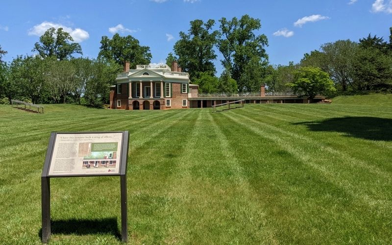
After dinner, Jefferson and his grandchildren could use the roof of the Wing for leisure. In 1817, Jefferson wrote, "about Twilight of the evening, we sally out with the owls & bats and take our evening exercise on the terras." With its unique roof system designed by Jefferson, the Wing allowed for scenic family strolls above while concealing the ongoing work of enslaved people that took place beneath their feet.
this page online
(caption)
Background image by Thomas Jefferson, undated, and letter by Hannah, 1818; courtesy of Massachusetts Historical Society
Erected by Thomas Jefferson’s Poplar Forest, Daughters of the American Revolution.
Topics and series. This historical marker is listed in these topic lists: African Americans • Architecture. In addition, it is included in the Daughters of the American Revolution (DAR) series list. A significant historical year for this entry is 1814.
Location. 37° 20.839′ N, 79° 15.862′ W. Marker is in Forest, Virginia, in Bedford County. It can be reached from the intersection of Poplar Forest Drive and Foxhall Drive, on the left when traveling east. Touch for map. Marker is at or near this postal address: 1542 Bateman Bridge Road, Forest VA 24551, United States of America. Touch for directions.

Regionally, this marker is in Southwest Virginia. It is also in the American South and specifically in the Upper South. Globally, it is in North America, the Western Hemisphere, the Western World, and the Anglosphere.
Photographed by Bernard Fisher, May 17, 2022
2. “I have this summer built a wing of offices...” Marker
Other nearby markers. At least 8 other markers are within 3 miles of this marker, measured as the crow flies: Crafting a Masterpiece, Longing for Home (within shouting distance of this marker); Mounds Made of Ideas and Sweat (about 300 feet away, measured in a direct line); Poplar Forest Planting Memorandum 1812 (about 300 feet away); Plantation Worker Housing (about 300 feet away); Transforming a Plantation into a Private Retreat, 1806—1826 (about 400 feet away); "A Culture Productive of Infinite Wretchedness” (about 400 feet away); Poplar Forest (approx. 1.3 miles away); St. Stephen's Church (approx. 2½ miles away). Touch for a list and map of all markers in Forest.
Other markers no longer nearby. Why is the lawn sunken? (was here, next to this marker but has been replaced with another marker now near it); What happened to Poplar Forest after Jefferson's death? (was within shouting distance of this marker but has been replaced with another marker now near it); Why build the mounds? (was about 300 feet away but has been replaced with another marker now near it); How was the landscape partitioned? (was about 400 feet away but has been replaced with another marker now near it); Commemorating Lewis and Clark (was about 400 feet away but has been replaced with another marker now near it).
Related marker. Click here for another marker that is related to this marker. Old Marker At This Location titled "Why is the lawn sunken?".
Credits. This page was last revised on May 19, 2022. It was originally submitted on May 18, 2022, by Bernard Fisher of Richmond, Virginia. This page has been viewed 477 times since then and 25 times this year. Photos: 1, 2. submitted on May 18, 2022, by Bernard Fisher of Richmond, Virginia.
