St. Thomas in Elgin County, Ontario — Central Canada (North America)
St. Thomas Canada Southern Railway Station / Gare ferroviaire de St. Thomas

cmh2315fl via Flickr (CC BY-NC 2.0), July 2, 2012
1. St. Thomas Canada Southern Railway Station Marker
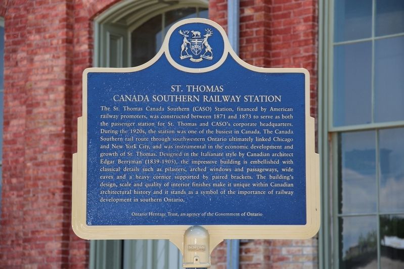
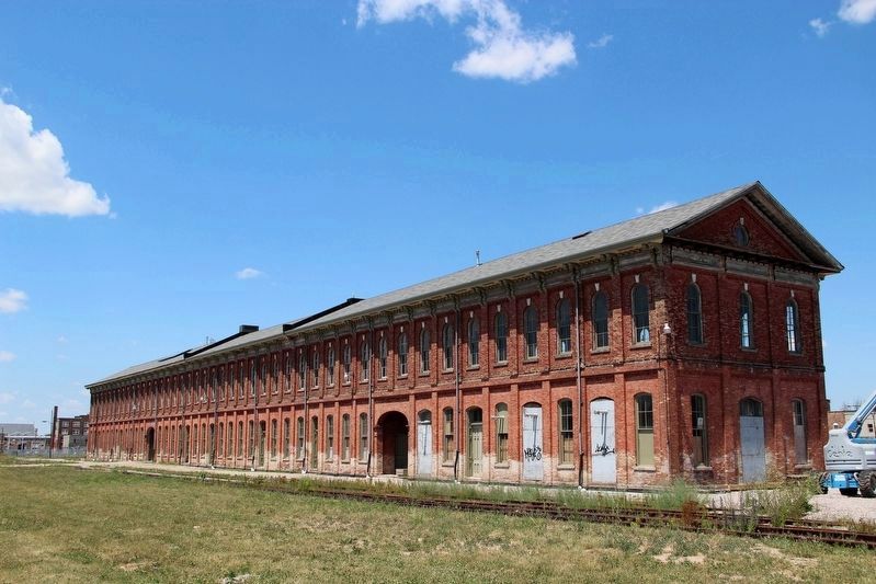
[English] The St. Thomas Canada Southern (CASO) Station, financed by American railway promoters, was constructed between 1871 and 1873 to serve as both the passenger station for St. Thomas and CASO's corporate headquarters. During the 1920s, the station was one of the busiest in Canada. The Canada Southern rail route through southwestern Ontario ultimately linked Chicago and New York City, and was instrumental in the economic development and growth of St. Thomas. Designed in the Italianate style by Canadian architect Edgar Berryman (1839-1905), the impressive building is embellished with classical details such as pilasters, arched windows and passageways, wide eaves and a heavy cornice supported by paired brackets. The building's design, scale and quality of interior finishes make it unique within Canadian architectural history and it stands as a symbol of the importance of railway development in southern Ontario.
[Francais] Financée par des promoteurs américains, cette gare de la Compagnie du chemin de fer du sud du Canada est construite entre 1871 et 1873. L'édifice doit alors faire office de gare de voyageurs pour la ville de St. Thomas, mais aussi de siège social de la compagnie ferroviaire. Au cours des années 1920, cette gare est l'une des plus fréquentées du Canada. Le chemin de fer du sud du Canada sillonne la région du Sud-Ouest de l'Ontario pour relier à terme les villes de Chicago et de New York. Il joue ainsi un rôle clé dans le développement économique et la croissance de St. Thomas. Conçu dans le style italianisant par l'architecte canadien Edgar Berryman (1839-1905), cet édifice impressionnant est rehaussé de détails d'inspiration classique : pilastres, fenêtres et couloirs en arcade, larges débords et lourde corniche soutenue par des corbeaux doubles. La conception, l'envergure et la qualité des finitions intérieures du bâtiment en font un chef-d'œuvre unique dans l'histoire de l'architecture canadienne, symbole de l'importance du développement des chemins de fer dans le Sud de l'Ontario.
Erected by Ontario Heritage Trust.
Topics and series. This historical marker is listed in these topic lists: Architecture • Railroads & Streetcars. In addition, it is included in the Canada, Ontario Heritage Foundation series list. A significant historical year for this entry is 1873.
Location. 42° 46.681′ N, 81° 11.199′ W. Marker is in St. Thomas, Ontario, in Elgin County. Marker can be reached from Talbot Street east of Horton Street, on the right when traveling east. Touch for map. Marker is at or near this postal address: 750 Talbot St, St Thomas ON N5P 1E2, Canada. Touch for directions.
Other nearby markers. At least 5 other markers are within 24 kilometers of this marker, measured

cmh2315fl via Flickr (CC BY-NC 2.0), July 2, 2012
2. St. Thomas Canada Southern Railway Station
It has since been restored and now is home to a railway museum and hall of fame.
Also see . . . CASO Station. Website homepage (Submitted on December 11, 2022, by Larry Gertner of New York, New York.)
Credits. This page was last revised on December 11, 2022. It was originally submitted on May 21, 2022, by Duane and Tracy Marsteller of Murfreesboro, Tennessee. This page has been viewed 88 times since then and 11 times this year. Photos: 1, 2. submitted on May 21, 2022, by Duane and Tracy Marsteller of Murfreesboro, Tennessee.
Editor’s want-list for this marker. Closeup of marker's French side • Wide shot of marker and surrounding area in context. • Can you help?