Clarksville in Clark County, Indiana — The American Midwest (Great Lakes)
Scenic Spans
| — | Ohio River Scenic Byway | — |
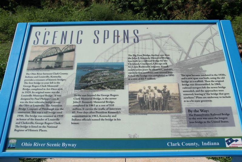
To the east beyond the George Rogers Clark Memorial Bridge, is the newer John F. Kennedy Memorial Bridge, completed in 1963 at a cost of $10 million. It carries the traffic of Interstate 65. Four days after President Kennedy's assassination in 1963, Kentucky and Indiana officials named the bridge in his honor.
The Big Four Bridge, further east than the John F. Kennedy Memorial Bridge, was built as a railroad bridge for the Cleveland, Cincinnati, Chicago and St. Louis Railroad Company.
this page online
The span became outdated in the 1920s, and a new span was built, using the old bridge as a scaffold. Then the original bridge was disassembled. In 1968, railroad mergers left the newer bridge unneeded, and the approaches were removed, leaving it “the bridge that goes nowhere.” Plans are underway to include it in a bi-state greenway.
By the Way The Pennsylvania Railroad Bridge to the west was once the longest iron bridge in the United States.
Captions (left to right)
• Image of the Big Four Bridge with a car on the tracks. New Albany Floyd County Public Library
• Image of the John F. Kennedy, George Rogers Clark and Pennsylvania Railroad bridges. New Albany Floyd County Public Library
• Image of the crew of the K&I Bridge. New Albany Floyd County Public Library
Erected by Ohio River Scenic Byway.
Topics. This historical marker is listed in this topic list: Bridges & Viaducts. A significant historical year for this entry is 1929.
Location. 38° 16.211′ N, 85° 45.299′ W. Marker is in Clarksville, Indiana, in Clark County. It can be reached from Ohio River Scenic Byway 0.1 miles west of Main Street, on the left when traveling west. Marker is in Ashland Park. Touch for map. Marker is at or near this postal address: 415 Ohio River Scenic Byway, Clarksville IN 47129, United States of America. Touch for directions.

Regionally, this marker is in Southern Indiana. It is also in the American Midwest, in the Ohio River Valley, and in the Corn Belt. Globally, it is in North America, the Western Hemisphere, the Western World, and the Anglosphere. Historically, it finds itself in what was once the territory of the Mississippian Culture and also the Northwest Territory.
Other nearby markers. At least 8 other markers are within walking distance of this marker: Railroad Cars to Go (approx. ¼ mile away); Fossils at the Falls (approx. ¼ mile away); History’s Great Explorers (approx. 0.6 miles away); Historic Flood of 1937 (approx. 0.6 miles away); John A. Munz and Coast Guard Ohio River History (approx. 0.6 miles away); Navigating the Falls of the Ohio (approx. 0.6 miles away); Falls of the Ohio Fossil Beds (approx. 0.7 miles away); Duty Honor Country (approx. 0.7 miles away). Touch for a list and map of all markers in Clarksville.
Another marker is no longer nearby. River Navigation (was approx. 0.6 miles away but has been confirmed missing).
Credits. This page was last revised on May 23, 2022. It was originally submitted on May 23, 2022, by Duane and Tracy Marsteller of Murfreesboro, Tennessee. This page has been viewed 469 times since then and 45 times this year. Photo 1. submitted on May 23, 2022, by Duane and Tracy Marsteller of Murfreesboro, Tennessee.
Editor’s want-list for this marker. Wide shot of marker and surrounding area in context. • Can you help?
