Eagle River in Keweenaw County, Michigan — The American Midwest (Great Lakes)
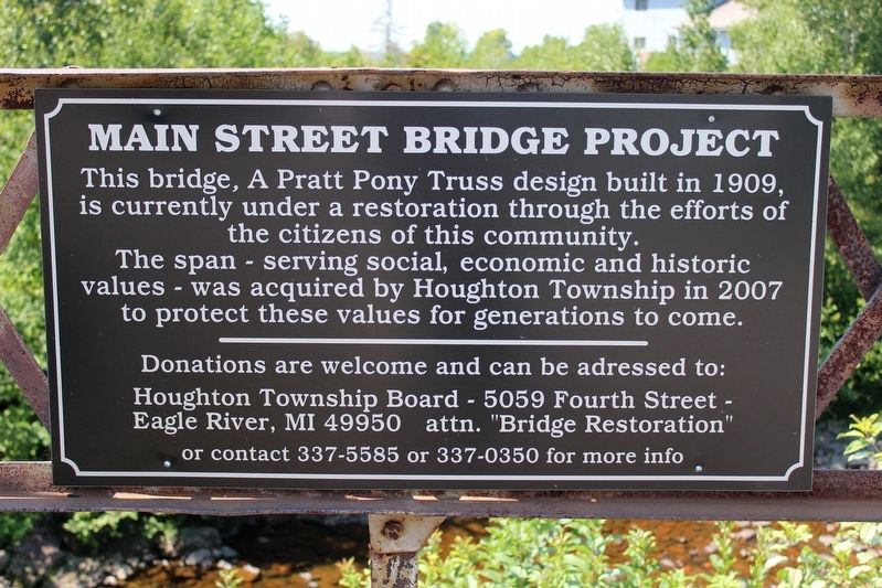
Main Street Bridge Project
The span – serving social, economic and historic values - was acquired by Houghton Township in 2007 to protect these values for generations to come.
Donations are welcome and can be addressed to:
Houghton Township Board – 5059 Fourth Street -
Eagle River, MI 49950 attn. "Bridge Restoration"
or contact 337-5585 or 337-0350 for more info
Erected by Houghton Township Board.
Topics. This historical marker is listed in this topic list: Bridges & Viaducts. A significant historical year for this entry is 1909.
Location. 47° 24.825′ N, 88° 17.866′ W. Marker is in Eagle River, Michigan, in Keweenaw County. Marker is on East Main, 0.1 miles north of Sand Dunes Drive (State Highway 26), on the left when traveling north. Touch for map. Marker is in this post office area: Mohawk MI 49950, United States of America. Touch for directions.
Other nearby markers. At least 8 other markers are within 5 miles of this marker, measured as the crow flies. Lake Shore Drive Bridge / Eagle River (about 500 feet away, measured in a direct line); Douglass Houghton (about 500 feet away); Joseph Blight, Sr. (about 600 feet away); a different marker also named Douglass Houghton (approx. 0.2 miles away); Eagle River (approx. 0.2 miles away); Sand Hills Lighthouse (approx. 3.7 miles away); New Snowfall Record 390.4 Inches (approx. 3.8 miles away); Lake Superior (approx. 4.3 miles away). Touch for a list and map of all markers in Eagle River.
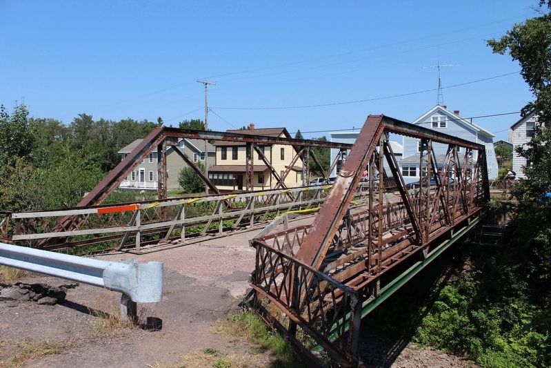
Also see . . . Main Street Bridge. The bridge might be the smallest one to have a permanent inspection traveler, which allow inspectors and maintenance workers to move under the bridge from one end to the other and side to side. (HistoricBridges.org) (Submitted on May 23, 2022, by Duane and Tracy Marsteller of Murfreesboro, Tennessee.)
Credits. This page was last revised on May 23, 2022. It was originally submitted on May 23, 2022, by Duane and Tracy Marsteller of Murfreesboro, Tennessee. This page has been viewed 59 times since then and 4 times this year. Photos: 1, 2. submitted on May 23, 2022, by Duane and Tracy Marsteller of Murfreesboro, Tennessee.

