Romeoville in Will County, Illinois — The American Midwest (Great Lakes)
Historic Swing Bridge
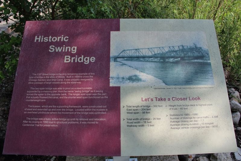
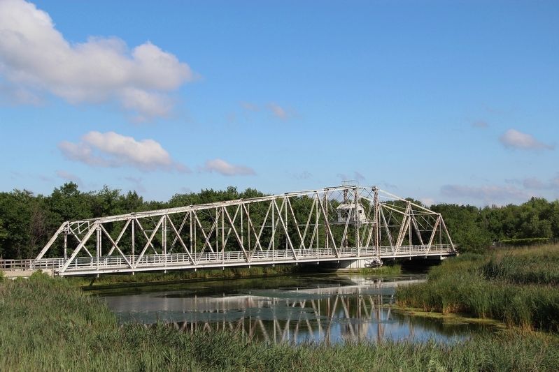
This two-span bridge was able to pivot on a steel turntable supported by a masonry pier; thus the name "swing bridge” as it swung across the water to the opposite bank. The longer east span was the part that actually crossed the canal, and the shorter west span functioned as the counterweight arm.
The trusses, which are the supporting framework, were constructed out of steel and extended up and over the bridge. Located within the trusses is an overhead pilothouse where the movement of the bridge was controlled.
The bridge was a busy, active bridge up until its removal and relocation. After its closing in 1990 due to structural problems, it was moved to Centennial Trail for preservation.
Let's Take a Closer Look
• Total length of bridge-302 feet
East span - 204 feet
West span - 98 feet
• Total width of bridge - 26 feet
Road width - 18 feet
Walkway width - 5 feet
• Height from bridge deck to highest point of truss – 40 feet
• Statistics for 1989-1990:
Number of closings for canal traffic - 4,598
Average closings per day - 7.7
Average closing duration - 15 minutes
Average vehicle crossings per day - 9000
Caption: 135th Street Bridge. January 12, 1940. Credit: Lewis University Canal and Regional History Collection.
Topics. This historical marker is listed in this topic list: Bridges & Viaducts. A significant historical year for this entry is 1899.
Location. Marker has been reported missing. It was located near 41° 38.479′ N, 88° 3.799′ W. Marker was in Romeoville, Illinois, in Will County. Marker was on Des Plaines River Drive north of East Romeo Road, on the left when traveling east. Marker was located at the Centennial Trail - Schneider's Passage trailhead. Touch for map. Marker was at or near this postal address: 600 E Romeo Rd, Romeoville IL 60446, United States of America. Touch for directions.
Other nearby markers. At least 8 other markers are within 4 miles of this location, measured as the crow flies. Good Eating on Route 66 (approx. 2.4 miles away); Romeoville, Illinois (approx. 2.9 miles away); Patrick Fitzpatrick House (approx. 2.9 miles away); Gaylord Donnelly Canal Trail Mile Marker 29.1 (approx. 3½ miles away); Lockport Works World War II Memorial (approx. 3½ miles away); Abraham Lincoln (approx. 3½ miles away); "Whittling Their Time Away" (approx. 3½ miles away); William Schuler (approx. 3½ miles away). Touch for a list and map of all markers in Romeoville.
Credits. This page was last revised on May 24, 2022. It was originally submitted on May 24, 2022, by Duane and Tracy Marsteller of Murfreesboro, Tennessee. This page has been viewed 233 times since then and 52 times this year. Photos: 1, 2. submitted on May 24, 2022, by Duane and Tracy Marsteller of Murfreesboro, Tennessee.
Editor’s want-list for this marker. Wide shot of marker and surrounding area in context. • Can you help?

