Hagwilget in Kitimat-Stikine, British Columbia — Canada’s West Coast (North America)
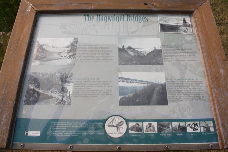
The Hagwilget Bridges
Described as a graceful wooden spiderweb, the first Hagwilget Bridge was built by the indigenous population using only knives and axes. It was 150 feet long, and swayed 100 feet above the churning waters of the Hagwilget Canyon. Six foot wide planking was lashed to the frame with cedar ropes, and load capacity was approximately 500 pounds. In 1866 it was reinforced with wire intended for the telegraph line that was being installed to the north of Hazelton. Fully loaded pack animals were led across one at a time.
Second bridge built in 1880
Abandoned material from the Collins Telegraph Line was incorporated extensively, with the same basic cantilever design as the first bridge, but with the addition of king post trusses at each end and a queen post truss in the centre. It is reported that the completed bridge was tested by sending local women across with fully loaded packs, while the men were underneath with poles, ready to reinforce the structure as needed.
Third bridge built in 1913
With the completion of the Grand Trunk Pacific Railway, commerce between Hazelton and New Hazelton expanded quickly; therefore a new one-lane wide high-level Caddock bridge was constructed. At 260 feet above the water, it swayed violently in the wind, and crossing it was said to be an unnerving experience that could cause symptoms of motion sickness. Remnants of the second bridge are visible below the third bridge.
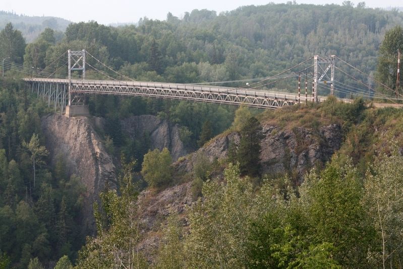
Fourth (current) bridge built in 1931
Designed by A.L. Carruthers, who was known as the father of Canadian bridge building, the present bridge is one of the highest suspension bridges in North America. The Hagwilget Bridge is 16 feet wide, spans 460 feet, and is a dizzying 262 feet above the river. Over 1 million pounds of steel cable, and 6 miles of 1˝ inch wire rope were used in its construction. A very hard, thick, erosion-resistant sandstone layer protrudes as a rib into both sides of the canyon and on both sides provides a foundation for the bridge. This is an example of engineers taking advantage of geology.
White eagle down (mix"kaax) is a traditional symbol of peace and friendship for the Gitksan and Wet'suwet'en people. Eagle down is sprinkled before guests in welcome dances, and utilized in traditional ceremonies as a pledge of peace and settlement. The intent of this trail is to unite, and facilitate safe pedestrian circulation through five distinct communities (namely the Village of Hazelton, Gitanmaax, Two-Mile, Hagwilget, and New Hazelton).
Erected by The Real Estate Foundation of British Columbia.
Topics. This historical marker is listed in this topic list:
Location. 55° 15.415′ N, 127° 36.024′ W. Marker is in Hagwilget, British Columbia, in Kitimat-Stikine. Marker is on Highway 62 just north of Tse Kya Road, on the left when traveling north. Marker is in an overlook on the southbound side. Touch for map. Marker is in this post office area: Hagwilget BC V0J 2J0, Canada. Touch for directions.
Other nearby markers. At least 2 other markers are within 5 kilometers of this marker, measured as the crow flies. People of the Skeena (approx. 1.1 kilometers away); Hazelton (approx. 4.8 kilometers away).
Credits. This page was last revised on May 25, 2022. It was originally submitted on May 25, 2022, by Duane and Tracy Marsteller of Murfreesboro, Tennessee. This page has been viewed 275 times since then and 63 times this year. Photos: 1, 2. submitted on May 25, 2022, by Duane and Tracy Marsteller of Murfreesboro, Tennessee.
Editor’s want-list for this marker. Wide shot of marker and surrounding area in context. • Can you help?

