San Sebastián in Ezequiel Montes, Querétaro, Mexico — The Central Highlands (North America)
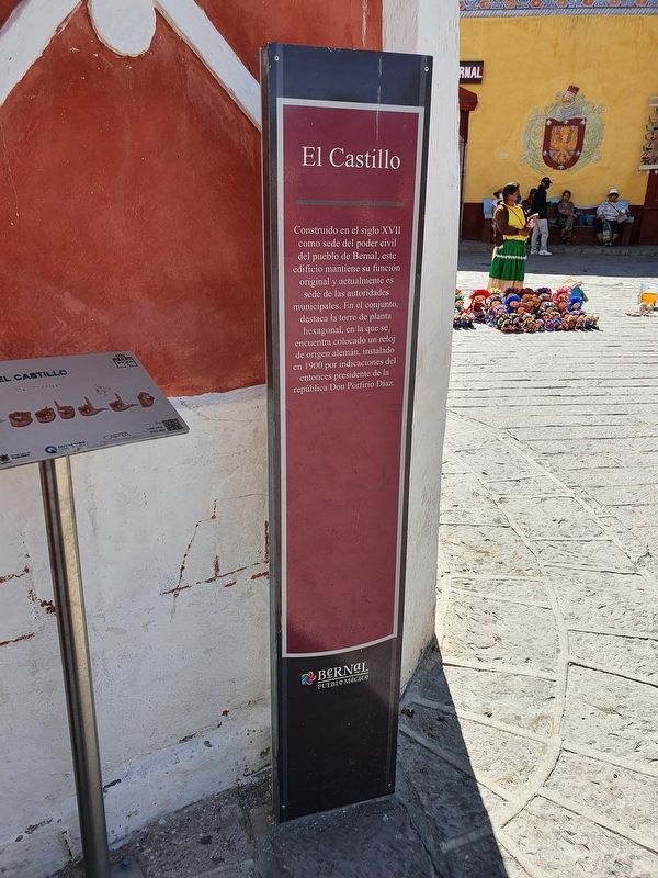
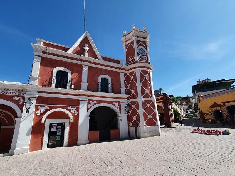
The Castle
Construido en el siglo XVII como sede del poder civil del pueblo de Bernal, este edificio mantiene su función original y actualmente es sede de las autoridades municipales. En el conjunto, destaca la torre de planta hexagonal, en la que se encuentra colocado un reloj de origen alemán, instalado en 1900 por indicaciones del entonces presidente de la república Don Porfirio Díaz.
The Castle
Built in the seventeenth century as the seat of civil power of the town of Bernal, this building maintains its original function and is currently the seat of the municipal authorities. In the structure the hexagonal tower stands out, in which a clock of German origin is placed, installed in 1900 by indications of the then president of the republic Porfirio Díaz.
Topics. This historical marker is listed in this topic list: Architecture. A significant historical year for this entry is 1900.
Location. 20° 44.434′ N, 99° 56.479′ W. Marker is in San Sebastián, Querétaro, in Ezequiel Montes. Marker is at the intersection of Calle Miguel Hidalgo and Calle Porfirio Díaz, on the right when traveling north on Calle Miguel Hidalgo. Touch for map. Marker is in this post office area: San Sebastián QUE 76680, Mexico. Touch for directions.
Other nearby markers. At least 8 other markers are within 10 kilometers of this marker, measured as the crow flies. Bernal (a few steps from this marker); Bernal Magic Town (within shouting distance of this marker); St. Sebastian's Temple (within shouting distance of this marker); Friar Junipero de la Vega (within shouting distance of this marker); Chapel of Las Ánimas (approx. 0.3 kilometers away); Giordano Bruno (approx. 0.4 kilometers away); Temple of the Virgin of Guadalupe of Ajuchitlán (approx. 9.1 kilometers away); The Parish of Divine Providence (approx. 9.4 kilometers away).
Credits. This page was last revised on May 25, 2022. It was originally submitted on May 25, 2022, by J. Makali Bruton of Accra, Ghana. This page has been viewed 63 times since then and 4 times this year. Photos: 1, 2. submitted on May 25, 2022, by J. Makali Bruton of Accra, Ghana.

