City of Westminster in Greater London, England, United Kingdom — Northwestern Europe (the British Isles)
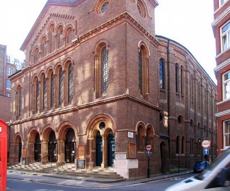
Westminster Chapel
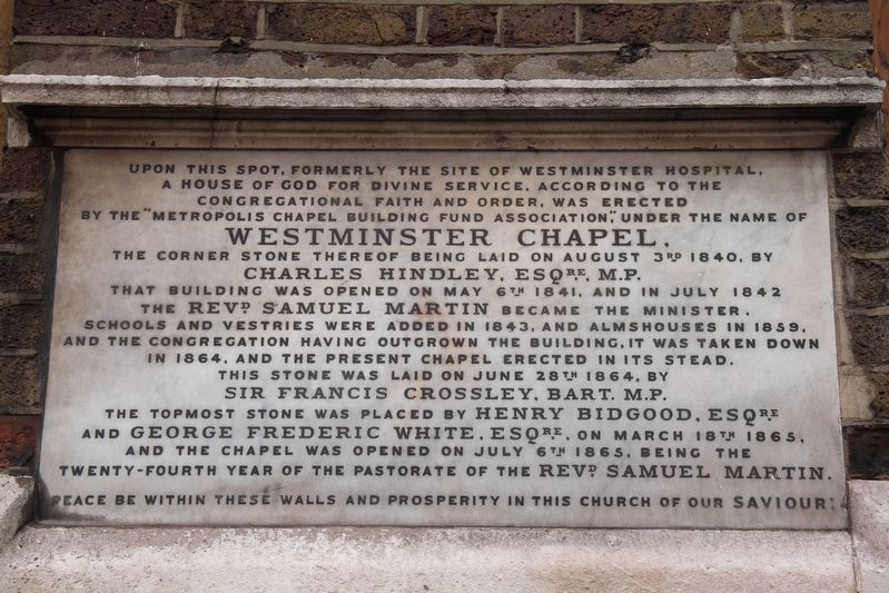
That building was opened on May 6th 1841, and in July 1842 the Revd. Samuel Martin became the minister. Schools and vestries were added in 1843, and almshouses in 1859, and the congregation having outgrown the building, it was taken down in 1864, and the present chapel erected in its stead.
This stone was laid on June 28th 1864, by Sir Francis Crossley, Bart. M.P. The topmost stone was placed by Henry Bidgood, Esqre. and George Frederic White, Esqre. on March 18th 1865, and the chapel was opened on July 6th 1865, being the twenty-fourth year of the pastorate of the Revd. Samuel Martin.
Peace be within these walls and prosperity in this church of our Saviour!
Topics. This historical marker is listed in this topic list: Churches & Religion. A significant historical date for this entry is July 6, 1865.
Location. 51° 29.942′ N, 0° 8.289′ W. Marker is in City of Westminster, England, in Greater London. Marker is at the intersection of Buckingham Gate and Castle Lane, on the right when traveling south on Buckingham Gate. Touch for map. Marker is at or near this postal address: Buckingham Gate, City of Westminster, England SW1E 6BS, United Kingdom. Touch for directions.
Other nearby markers. At least 8 other markers are within walking distance of this marker. Buckingham Palace (approx. 0.3 kilometers away); Jubilee Greenway (approx. 0.4 kilometers away); Lord Haldane (approx. 0.4 kilometers away); Lord Palmerston (approx. 0.4 kilometers away); William Smith (approx. 0.4 kilometers away); Lord Fisher (approx. 0.4 kilometers away); Charles Townley (approx. 0.4 kilometers away); Canada Memorial (approx. half a kilometer away). Touch for a list and map of all markers in City of Westminster.
Also see . . . Westminster Chapel.
Wikipedia entry on the church.(Submitted on May 28, 2022, by Duane and Tracy Marsteller of Murfreesboro, Tennessee.)

John Salmon via Wikimedia Commons (CC BY-SA 2.0), March 2, 2007
2. Westminster Chapel Marker
Marker is on the corner of the chapel.
Credits. This page was last revised on May 28, 2022. It was originally submitted on May 28, 2022, by Duane and Tracy Marsteller of Murfreesboro, Tennessee. This page has been viewed 155 times since then and 18 times this year. Photos: 1, 2. submitted on May 28, 2022, by Duane and Tracy Marsteller of Murfreesboro, Tennessee.
