City of Westminster in Greater London, England, United Kingdom — Northwestern Europe (the British Isles)
Buckingham Palace
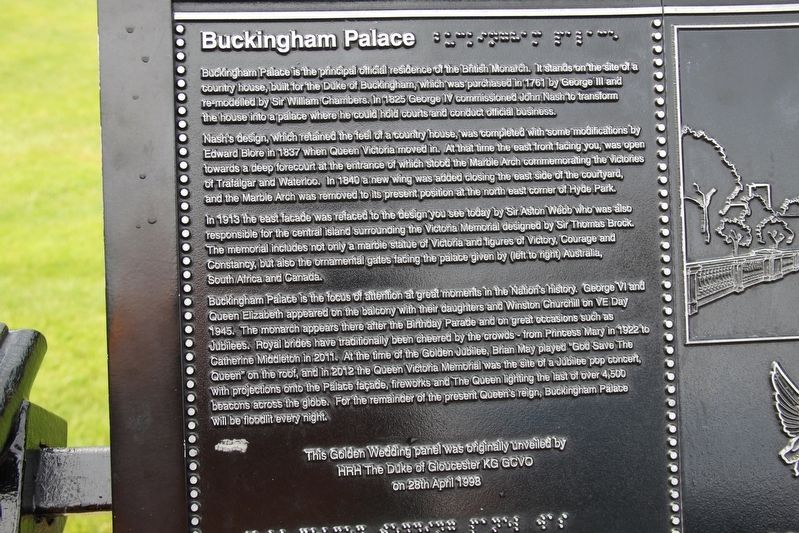
Buckingham Palace is the principal official residence of the British Monarch. It stands on the site of a country house, built for the Duke of Buckingham, which was purchased in 1761 by George III and re-modelled by Sir William Chambers. In 1825 George IV commissioned John Nash to transform the house into a palace where he could hold courts and conduct official business.
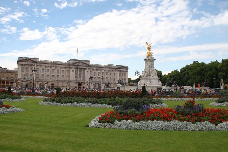
Nash's design, which retained the feel of a country house, was completed with some modifications by Edward Blore in 1837 when Queen Victoria moved in. At that time the east front facing you, was open towards a deep forecourt at the entrance of which stood the Marble Arch commemorating the victories of Trafalgar and Waterloo. In 1840 a new wing was added closing the east side of the courtyard, and the Marble Arch was removed to its present position at the north east corner of Hyde Park.
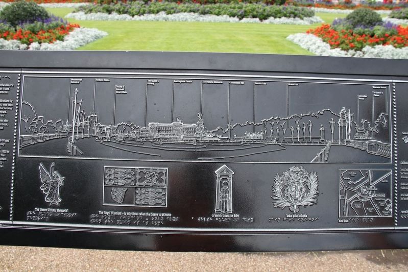
In 1913 the east facade was refaced to the design you see today by Sir Aston Webb who was also responsible for the central island surrounding the Victoria Memorial designed by Sir Thomas Brock. The memorial includes not only a marble statue of Victoria and figures of Victory, Courage and Constancy, but also the ornamental gates facing the palace given by (left to right) Australia, South Africa and Canada.
Buckingham Palace is the focus of attention at great moments in the Nation's history. George VI and Queen Elizabeth appeared on the balcony with their daughters and Winston Churchill on VE Day 1945. The monarch appears there after the Birthday Parade and on great occasions such as Jubilees. Royal brides have traditionally been cheered by the crowds — from Princess Mary in 1922 to Catherine Middleton in 2011. At the time of the Golden Jubilee, Brian May played “God Save The Queen” on the roof, and in 2012 the Queen Victoria Memorial was the site of a Jubilee pop concert, with projections onto the Palace façade, fireworks and The Queen lighting the last of over 4,500 beacons across the globe. For the remainder of the present Queen's reign, Buckingham Palace will be floodlit every night.
HRH The Duke of Gloucester KG GOVO
on 28th April 1998
[Right side]
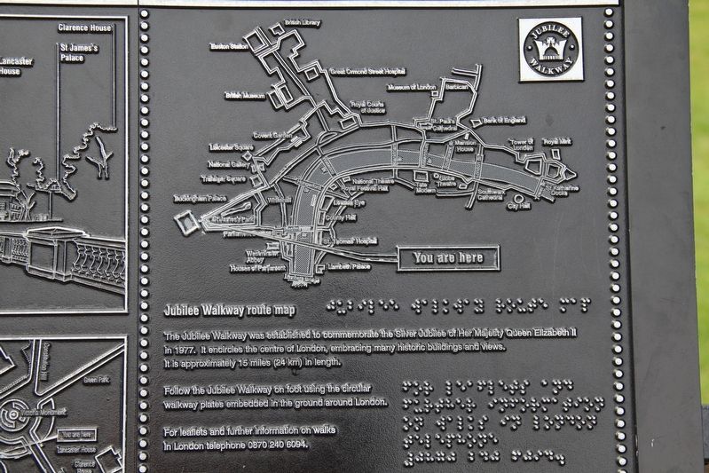
Jubilee Walkway Route Map
The Jubilee Walkway was established to commemorate the Silver Jubilee of Her Majesty Queen Elizabeth II in 1977. It encircles the centre of London, embracing many historic buildings and views. It is approximately 15 miles (24 km) in length.
Follow the Jubilee Walkway on foot using the circular walkway plates embedded in the ground around London.
For leaflets and further information on walks in London telephone 0870 240 6094.
Topics. This historical marker is listed in these topic lists: Architecture • Notable Buildings. A significant historical year for this entry is 1761.
Location. 51° 30.1′ N, 0° 8.359′ W. Marker is in City of Westminster, England, in Greater London. Marker can be reached from Spur Road just south of The Mall, on the left when traveling south. Marker is in Buckingham Palace Memorial Gardens. Touch for map. Marker is in this post office area: City of Westminster, England SW1A 1AA, United Kingdom. Touch for directions.
Other nearby markers. At least 8 other markers are within walking distance of this marker. Jubilee Greenway (about 120 meters away, measured in a direct line); Canada Memorial (approx. 0.2 kilometers away); Westminster Chapel (approx. 0.3 kilometers away); Westminster Tree Trust (approx. 0.4 kilometers away); The Commonwealth – a Family of Nations (approx. 0.4 kilometers away); Lord Haldane (approx. 0.4 kilometers away); Lord Palmerston (approx. half a kilometer away); William Smith (approx. half a kilometer away). Touch for a list and map of all markers in City of Westminster.
Credits. This page was last revised on June 2, 2022. It was originally submitted on June 2, 2022, by Duane and Tracy Marsteller of Murfreesboro, Tennessee. This page has been viewed 87 times since then and 8 times this year. Photos: 1, 2, 3, 4. submitted on June 2, 2022, by Duane and Tracy Marsteller of Murfreesboro, Tennessee.
Editor’s want-list for this marker. Wide shot of marker and surrounding area in context. • Can you help?


