Sioux Falls in Minnehaha County, South Dakota — The American Midwest (Upper Plains)
vegetate
May 23, 2022
1. vegetate Marker
header:
Photo Courtesy of Siouxland Heritage Museums in Sioux Falls, South Dakota [SHM 78.35.28]
Life of a Stonecutter
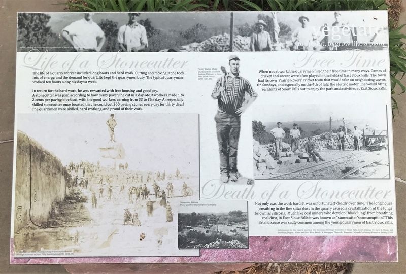
The life of a quarry worker included long hours and hard work. Cutting and moving stone took lots of energy, and the demand for quartzite kept the quarrymen busy. The typical quarryman worked ten hours a day, six days a week.
In return for the hard work, he was rewarded with free housing and good pay. A stonecutter was paid according to how many pavers he cut in a day. Most workers made 1 to 2 cents per paving block cut, with the good workers earning from $3 to $6 a day. An especially skilled stonecutter once boasted that he could cut 500 paving stones every day for thirty days! The quarrymen were skilled, hard working, and proud of their work.
photos:
Drake Quarries, 1888. Photo Courtesy of the Siouxland Heritage Museums in Sioux Falls, South Dakota [SHM 41.15.37]
Stonecutter Motions.
Photo Courtesy of Jasper Stone Company.
Free Time
When not at work, the quarrymen filled their free time in many ways. Games of cricket and soccer were often played in
this page online
photos:
Quarry Worker. Photo Courtesy of the Siouxland Heritage Museums in Sioux Falls, South Dakota [SHM 41.15.35]
Workmen at the Perry Quarry. Photo Courtesy of the Siouxland Heritage Museums in Sioux Falls, South Dakota [SHM 78.35.22]
Death of a Stonecutter
Not only was the work hard, it was unfortunately deadly over time. The long hours breathing in the fine silica dust in the quarry caused a crystallization of the lungs known as silicosis. Much like coal miners who develop "black lung" from breathing coal dust, in East Sioux Falls it was known as "stonecutter's consumption." This fatal disease was sadly common among the young quarrymen of East Sioux Falls.
Information for this sign is Courtesy the Siouxland Heritage Museums in Sioux Falls, South Dakota, Dr. Gary D. Olson, and Fanebust, Wayne. Where the Sioux River Bends: A Newspaper Chronicle. Freeman: Minnehaha County Historical Society, 1985.
Topics.
May 23, 2022
2. vegetate Marker
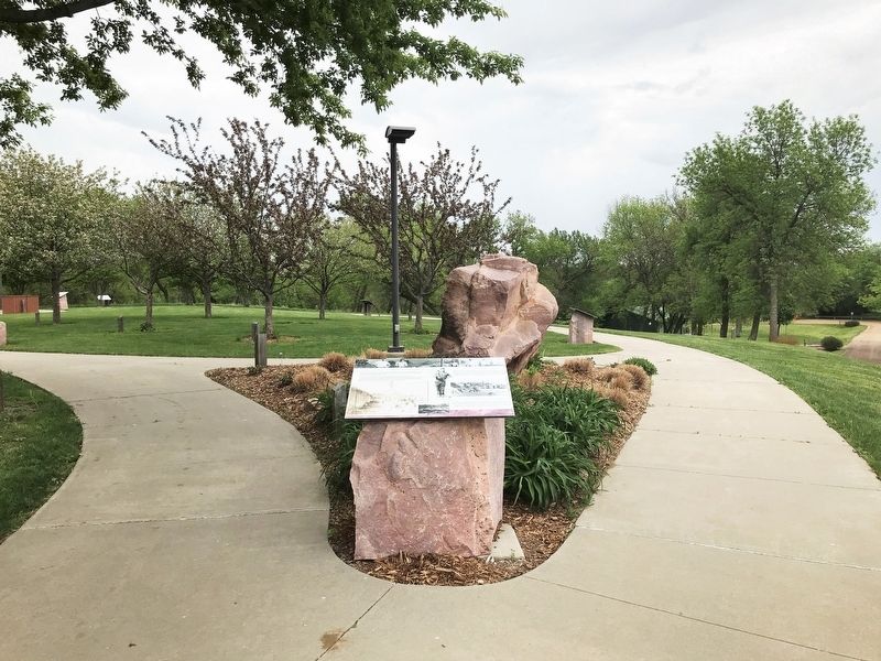
Location. 43° 31.656′ N, 96° 36.385′ W. Marker is in Sioux Falls, South Dakota, in Minnehaha County. It is on South Perry Place 0.1 miles north of State Highway 42, on the left when traveling north. Located at the Mary Jo Wegner Arboretum & East Sioux Falls Historic Site. Touch for map. Marker is at or near this postal address: 1900 S Perry Pl, Sioux Falls SD 57110, United States of America. Touch for directions.

Regionally, this marker is in East River. It is also in the American Midwest, in the Lewis & Clark Corridor, in the Corn Belt, on the prairies, and on the Northern Plains. Globally, it is in North America, the Western Hemisphere, the Western World, and the Anglosphere. Historically, it finds itself in what was once Rupert’s Land and also the Louisiana Purchase.
Other nearby markers. At least 8 other markers are within walking distance of this marker: Stonecutter John Elm (a few steps from this marker); unearth (a few steps from this marker); germinate (a few steps from this marker); foliate (a few steps from this marker); Flourish (within shouting distance of this marker); bud (within shouting distance of this marker); Seed (within shouting distance of this marker); Wilt (within shouting distance of this marker). Touch for a list and map of all markers in Sioux Falls.
Credits. This page was last revised on June 3, 2022. It was originally submitted on June 2, 2022. This page has been viewed 195 times since then and 21 times this year. Photos: 1, 2. submitted on June 2, 2022.
