Downtown Kansas City in Jackson County, Missouri — The American Midwest (Upper Plains)
Moving Settlers West
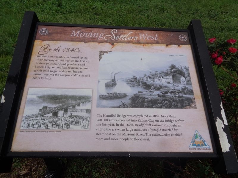
The Hannibal Bridge was completed in 1869. More than 260,000 settlers crossed into Kansas City on the bridge within the first year. In the 1870s, newly built railroads brought an end to the era when large numbers of people traveled by steamboat on the Missouri River. The railroad also enabled more and more people to flock west.
Erected by Missouri Conservation Department.
Topics. This historical marker is listed in these topic lists: Bridges & Viaducts • Railroads & Streetcars • Settlements & Settlers. A significant historical year for this entry is 1869.
Location. 39° 7.054′ N, 94° 34.39′ W. Marker is in Kansas City, Missouri, in Jackson County. It is in Downtown Kansas City. Marker can be reached from Riverfront Trail. Marker is off the trail at Berkley Riverfront. Touch for map. Marker is at or near this postal address: 1298 Riverfront Trail, Kansas City MO 64120, United States of America. Touch for directions.
Other nearby markers. At least 8 other markers are within walking distance of this marker. Moving Indians, Trappers & Traders (about 400 feet away, measured in a direct line); Moving Hearts & Minds (about 700 feet away); Moving Water (approx. 0.2 miles away); Garrison Field House (approx. half a mile away); Holy Rosary's Bell Tower Cross (approx. 0.6 miles away); Building Through the Bluffs (approx. 0.7 miles away); Gilliss House Hotel (approx. 0.7 miles away); Hannibal Bridge (approx. 0.7 miles away). Touch for a list and map of all markers in Kansas City.
Credits. This page was last revised on February 10, 2023. It was originally submitted on June 16, 2022, by Jason Voigt of Glen Carbon, Illinois. This page has been viewed 318 times since then and 12 times this year. Photos: 1. submitted on June 17, 2022, by Jason Voigt of Glen Carbon, Illinois. 2. submitted on June 20, 2022, by Jason Voigt of Glen Carbon, Illinois.

