Sterling in Loudoun County, Virginia — The American South (Mid-Atlantic)
Lanesville Architecture
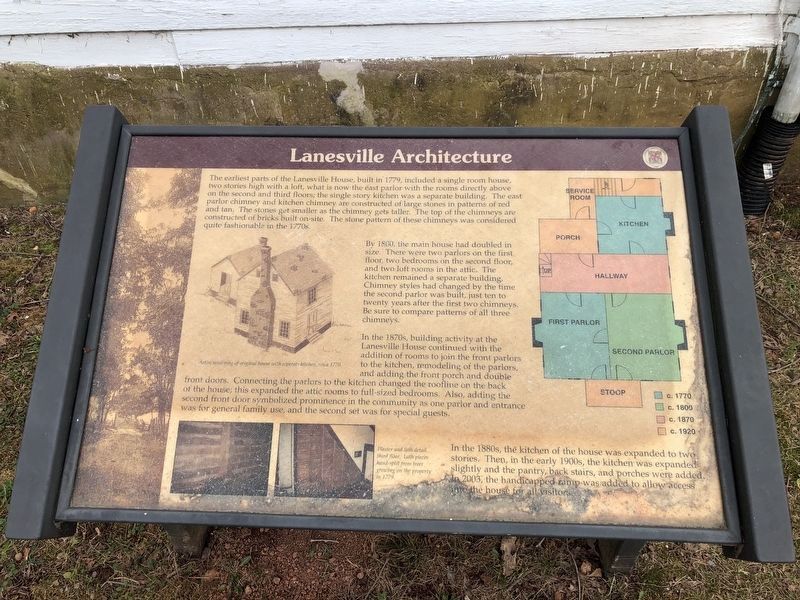
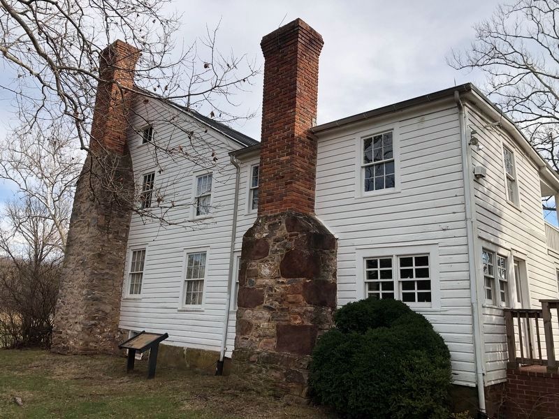
By 1800, the main house had doubled in size. There were two parlors on the first floor, two bedrooms on the second floor, and two loft rooms in the attic. The kitchen remained a separate building. Chimney styles had changed by the time the second parlor was built, just ten to twenty years after the first two chimneys. Be sure to compare patterns of all three chimneys.
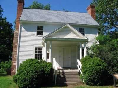
In the 1870s, building activity at the Lanesville House continued with the addition of rooms to join the front parlors to the kitchen, remodeling of the parlors, and adding the front porch and double front doors. Connecting the parlors to the kitchen changed the roofline on the back of the house; this expanded the attic rooms full-sized bedrooms. Also, adding the second front door symbolized prominence in the community as one parlor and entrance was for general family use, and the second set was for special guests.
In the 1880s, the kitchen of the house was expanded to two stories. Then, in the early 1900s, the kitchen was expanded slightly and the pantry, back stairs, and porches were added. In 2003, the handicapped ramp was added to allow access into the house for all visitors.
Topics. This historical marker is listed in this topic list: Notable Buildings. A significant historical year for this entry is 1779.
Location. 39° 1.067′ N, 77° 24.239′ W. Marker is in Sterling, Virginia, in Loudoun County. Marker is on Old Vestals Gap Road, on the right when traveling north. Located next to the Lanesville House, on the service road to the Loudoun County Farm Museum. Touch for map. Marker is in this post office area: Sterling VA 20164, United States of America. Touch for directions.
Other nearby markers. At least 8 other markers are within walking distance of this marker. Lanesville Historic Area (a few steps from this marker); Lanesville House and Vestal's Gap Road (a few steps from this marker); Lanesville Outbuildings (a few steps from this marker); Lanesville Families (a few steps from this marker); Vestal's Gap Road (a few steps from this marker); The Braddock Campaign (within shouting distance of this marker); Vestal's Gap Road in the 1800s

Photographed By Devry Becker Jones (CC0), December 30, 2020
2. Lanesville Architecture Marker
Unfortunately the marker has experienced some weather damage.
More about this marker. On the left is a Artist rendering of original house with separate kitchen, circa 1770. On the lower left are photos of Plaster and lath detail, third floor. Lath pieces hand-split from trees growing on the property in 1779. On the right is a diagram, with color coding to indicate the construction of the house in the stages mentioned in the text.
Also see . . . Vestal's Gap Road. (PDF) National Register documentation for the Old Vestal's Gap Road and Lanesville. (Submitted on June 18, 2009, by Craig Swain of Leesburg, Virginia.)
Credits. This page was last revised on December 30, 2020. It was originally submitted on June 18, 2009, by Craig Swain of Leesburg, Virginia. This page has been viewed 1,297 times since then and 28 times this year. Photos: 1. submitted on June 18, 2009, by Craig Swain of Leesburg, Virginia. 2, 3. submitted on December 30, 2020, by Devry Becker Jones of Washington, District of Columbia. 4. submitted on June 18, 2009, by Craig Swain of Leesburg, Virginia.


