Walterboro in Colleton County, South Carolina — The American South (South Atlantic)
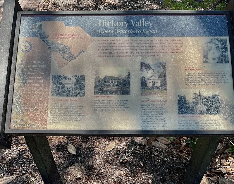
Hickory Valley
Where Walterboro Began
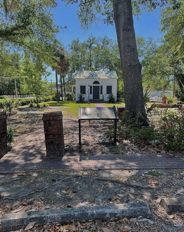
Walterboro Library Society
Directly in front of you is the Walterborough Society building originally constructed in 1820 on the present site of St. Jude’s Episcopal Church to your rear. The building was the focal point for setting the boundaries of three-quarters of a mile in every direction in 1826 when the town was incorporated.
Bedon-Lucas House
Moving clockwise stands the Badon-Lucas House built in 1820, it was on the front lawn of his home that Richard Bedon designated the site to relocate the Library Society from the St Jude’s Church lot.
Bethel Presbyterian Church
Continuing clockwise, a block away is Bethel Presbyterian Church. The preset structure, the fourth on this site, was built in 1969 to replace an 1880 white frame church which burned in 1966. The original chapel was constructed in 1821 and a frame church built in 1860 to replace it was destroyed by the 1879 tornado.
St. Jude’s Episcopal Church
To your rear is St Jude's Episcopal Church which is the successor church to St. Bartholomew's Parish established in 1706 near jacksonborough. Built in 1852 as a summer Chapel of Ease in was destroyed by a cyclone in 1879. The present Carpenter-Gothic style building was completed in 1882.
St. Peter's AME Church
Across Wichman Street stands St. Peter's AME Church, founded in 1867 to serve former slaves. The present Gothic Renewal building was rebuilt sometime after the 1879 cyclone also destroyed it.
(sidebar)
Visit our Heritage Corridor landscapes from the Blue Ridge Mountains to the Charleston Low Country - and discover South Carolina’s history, people, and places.
Begin your Journey of Discovery at our website at www.southcarolinanationalheritagecorridor.org
South Carolina
Smiling Places Beautiful Places
Topics. This historical marker is listed in this topic list: Settlements & Settlers. A significant historical year for this entry is 1784.
Location. 32° 54.269′ N, 80° 39.541′ W. Marker is in Walterboro, South Carolina, in Colleton County. Marker is at the intersection of Fishburne Street (U.S. 1) and Wichman Street (Alternate U.S. 17), on the left when traveling north on Fishburne Street. Located on the east side of the Walterboro Library Society Building (Little Library). Touch for map. Marker is at or near this postal address: 803 Wichman Street, Walterboro SC 29488, United States of America. Touch for directions.
Other nearby markers. At least 8 other markers are within walking distance of this marker. A different marker also named Hickory Valley (a few steps from this marker); St. Jude’s Episcopal Church (within shouting distance of this marker); Walterborough Library Society (within shouting distance of this marker); St. Peter’s A.M.E. Church (within shouting distance of this marker); Bethel Presbyterian Church (about 400 feet away, measured in a direct line); Walterborough Academy (approx. 0.2 miles away); Colleton County Veterans War Memorial (approx. 0.4 miles away); Colleton County Courthouse (approx. half a mile away). Touch for a list and map of all markers in Walterboro.
Also see . . . South Carolina National Heritage Corridor. (Submitted on June 24, 2022, by Brandon D Cross of Flagler Beach, Florida.)
Credits. This page was last revised on June 25, 2022. It was originally submitted on June 24, 2022, by Brandon D Cross of Flagler Beach, Florida. This page has been viewed 140 times since then and 19 times this year. Photos: 1, 2. submitted on June 24, 2022, by Brandon D Cross of Flagler Beach, Florida. • Bernard Fisher was the editor who published this page.

