
Old Colorado City in Colorado Springs in El Paso County, Colorado — The American Mountains (Southwest)
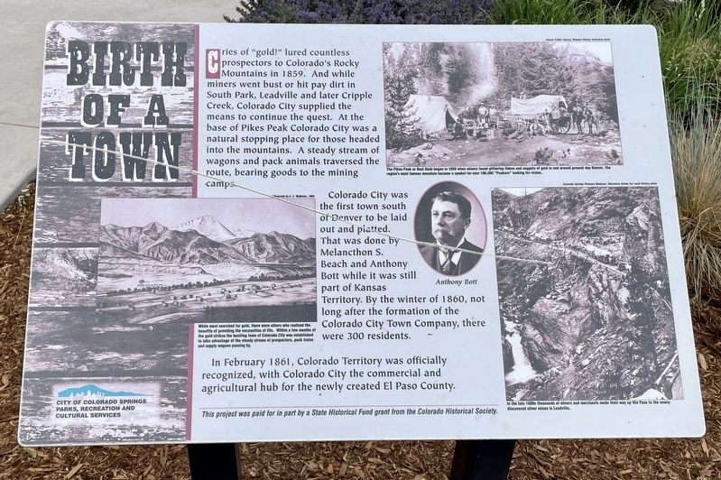
Birth of a Town
Photographed by Mark Hilton, June 20, 2022
1. Birth of a Town Marker
Colorado City was the first town south of Denver to be laid out and platted. That was done by Melancthon S. Beach and Anthony Bott while it was still part of Kansas Territory. By the winter of 1860, not long after the formation of the Colorado City Town Company, there were 300 residents.
In February 1861, Colorado Territory was officially recognized, with Colorado City the commercial and agricultural hub for the newly created El Paso County.
Photo captions:
Bottom left: While most searched for gold, there were others who realized the benefits of providing the necessities of life. Within a few months of the gold strikes the bustling town of Colorado City was established to take advantage of the steady stream of prospectors, pack trains and supply wagons passing by.
Top right: The Pikes Peak or Bust Rush began in 1858 when miners found glittering flakes and nuggets of gold in and around present day Denver. The region's most famous mountain became a symbol for over 100,000 "Peakers" looking for riches.
Bottom right: In the late 1800s thousands of miners and merchants made their way up Ute Pass to the newly-discovered silver mines in Leadville.
Erected by City
this page online
Topics. This historical marker is listed in these topic lists: Exploration • Settlements & Settlers. A significant historical month for this entry is February 1861.
Location. 38° 50.803′ N, 104° 51.694′ W. Marker is in Colorado Springs, Colorado, in El Paso County. It is in Old Colorado City. It is on Colorado Avenue west of South 24th Street, on the right when traveling west. Located in Bancroft Park, Old Colorado City. Touch for map. Marker is at or near this postal address: 2408 W Colorado Ave, Colorado Springs CO 80904, United States of America. Touch for directions.

Regionally, this marker is in Colorado’s Front Range and in Pikes Peak Region. It is also in the American Mountain West. Globally, it is in North America, the Rocky Mountains, the Western Hemisphere, the Western World, and the Anglosphere. Historically, it finds itself in what was once the Comanchería.
Other nearby markers. At least 8 other markers are within walking distance of this marker: Cabin on the Move (here, next to this marker); Old Colorado City (here, next to this marker); Log House (a
Photographed by Mark Hilton, June 20, 2022
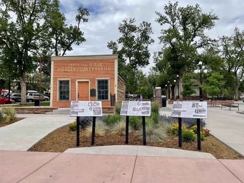
2. Birth of a Town Marker (on left) in front of Pioneer County Office.
Also see . . . History of Colorado Springs, Colorado (Wikipedia). (Submitted on July 2, 2022, by Mark Hilton of Montgomery, Alabama.)
Credits. This page was last revised on February 7, 2023. It was originally submitted on July 2, 2022, by Mark Hilton of Montgomery, Alabama. This page has been viewed 323 times since then and 26 times this year. Photos: 1, 2. submitted on July 2, 2022, by Mark Hilton of Montgomery, Alabama.
