San Felipe in Austin County, Texas — The American South (West South Central)
Welcome to San Felipe de Austin
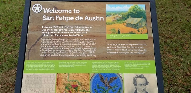
Between 1823 and 1836, San Felipe de Austin was the focal point for issues related to the immigration and settlement of American colonists in Mexican-controlled Texas.
This site marks the central business district of San Felipe de Austin and the location of the first Austin colony land office. During the colonial era many early Texas leaders walked these grounds. In the tense years between 1832 and 1835, leading up to the Texas Declaration of Independence and revolution, delegates met three times to discuss their concern at San Felipe. The Consultation, a meeting of colonial delegates held here in November of 1835, clarified the reasons for conflict, and established a provisional government based at San Felipe that would lead the revolution effort prior to the Declaration of Independence in March of 1836. The war ended badly for San Felipe de Austin, with the town burned by residents on March 29, 1836, to prevent its providing resources to the advancing Mexican army.
Captions
San Felipe townsite by Charles Shaw
Visiting the future site of San Felipe in the fall of 1821, Austin noted the tall bluff, the rolling countryside, abundant timber and the fine water that "affords the most beautiful location for a Town or settlement."
Founded in 1823, the town name San Felipe de Austin was chosen by interim governor Luciano Garcia to honor Stephen F. Austin and provisional Mexican government official Felipe de la Garza. Inhabitants referred to it as "Austin". The town plat was drawn by Seth Ingram, reflecting a dense grid with several public squares. The colonial well is located on lot 15 (arrow).
This 1830s map shows the location of Austin's colony within the Mexican state of Coahuila y Texas. The Father of Texas, Austin oversaw the distribution of nearly 6 million acres of land to incoming settlers to Texas.
During the colonial era, Texas was governed by the Republic of Mexico. Mexican Independence from Spain in 1821 was followed by Texas Independence from Mexico in 1836. The Republic of Texas lasted through 1845 when Texas became the 28th US state. The seal of the Republic of Mexico shows the iconic eagle and snake image also used on the Mexican flag.
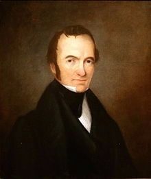
"No other of the forty-eight commonwealths composing the United States... owes its position so completely to one man as Texas does to Austin."
Eugene C. Barker, historian/Austin biographer, 1926 (Marker Number 1.)
Topics. This historical marker is listed in this topic list: War, Texas Independence. A significant historical month for this entry is March 1836.
Location. 29° 48.418′ N, 96° 5.873′ W. Marker is in San Felipe, Texas, in Austin
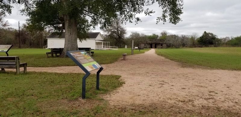
County. Marker can be reached from Farm to Market Road 1458, 0.1 miles north of Park Road 38. The marker is located in the San Felipe de Austin State Historic Site. Touch for map. Marker is in this post office area: San Felipe TX 77473, United States of America. Touch for directions.
Other nearby markers. At least 8 other markers are within walking distance of this marker. San Felipe de Austin Town Site (a few steps from this marker); Stephen F. Austin, Father of Texas (a few steps from this marker); Remembering San Felipe de Austin (a few steps from this marker); San Felipe de Austin Colonial Well (a few steps from this marker); Early Roads To San Felipe (within shouting distance of this marker); Austin's Colony: First Colony in Mexican Texas (within shouting distance of this marker); Stephen Fuller Austin (within shouting distance of this marker); John Bricker (within shouting distance of this marker). Touch for a list and map of all markers in San Felipe.
Also see . . . Stephen F. Austin. The Handbook of Texas (Submitted on December 20, 2020, by James Hulse of Medina, Texas.)
Credits. This page was last revised on July 13, 2022. It was originally submitted on December 19, 2020, by James Hulse of Medina, Texas. This page has been viewed 159 times since then and 16 times this year. Last updated on July 11, 2022, by Joe Lotz of Denton, Texas. Photos: 1, 2. submitted on December 19, 2020, by James Hulse of Medina, Texas. 3. submitted on December 20, 2020, by James Hulse of Medina, Texas. • J. Makali Bruton was the editor who published this page.


