Near Hubbardton in Rutland County, Vermont — The American Northeast (New England)
The Selleck Cabin
Hubbardton Battlefield State Historic Site
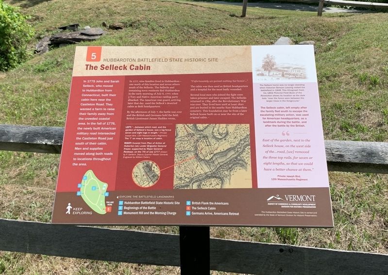
In 1775 John and Sarah Selleck, who moved to Hubbardton from Connecticut, built their cabin here near the Castleton Road. They wanted a farm to raise their family away from the crowded coastal area. In the fall of 1776, the newly built American military road intersected the Castleton Road just south of their cabin. Men and supplies moved along both roads to locations throughout the area.
In 1777, nine families lived in Hubbardton - one north of this location and seven others south of the Sellecks. The Sellecks and remaining town residents fled Hubbardton in the early morning of July 6, 1777, when a Tory and Native American raiding party attacked. The American rear guard, arriving later that day, used the Selleck's deserted cabin as field headquarters.
By the afternoon of July 7, the battle was over and the British and Germans held the field. British Lieutenant James Hadden wrote,
"Unfortunately we gained nothing but honor..."
The cabin was then used as British headquarters and a hospital for the most badly wounded.
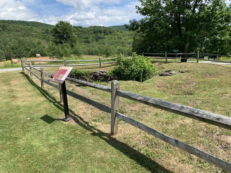
Several local men who joined the fight were taken prisoner and later escaped. The Sellecks returned in 1784, after the Revolutionary War was over. They lived here until at least 1820 and are buried in the nearby East Hubbardton cemetery. This foundation may be from a later Selleck house built on or near the site of the original cabin.
The Selleck cabin, left empty after the family fled south to escape the escalating military action, was used for American headquarters, as a landmark during the battle, and after the battle by the British.
"East of the garden, next to the Selleck house, on the west side of the...road, [we] removed the three top rails, for seven or eight lengths, so that we could have a better chance at them."
Private Joseph Bird,
12th Massachusetts Regiment
(drawing captions)
LEFT: "...between which road, and the garden of Selleck's house, was a log fence seven and eight logs in length.” (Private Joseph Bird, 12th Massachusetts Regiment) The "I” on map is location of cabin.
RIGHT: Excerpt from Plan of Action at Huberton (sic) under Brigadier General Frazer, supported by Major General Reidesel, on the 7th of July 1777 (Drawn by P. Gerlach, Deputy Quarter Master General; Engraved by William Faden)
[FAR RIGHT:]The Selleck home was no longer standing when historian Benson Lossing visited the battlefield in 1848. This lithograph from his 1852 Pictorial Field Book of the Revolution shows its location as the dark hole "near the fence seen between the larger trees in the foreground."
EXPLORE THE BATTLEFIELD LANDMARKS
1 Hubbardton Battlefield State Historic Site
2. Beginnings of the Battle
3. Monument Hill and the Morning Charge
4. British Flank the Americans
5. The Selleck Cabin
6. Germans Arrive, Americans Retreat
Erected by Vermont Division of Historic Preservation. (Marker Number 5.)
Topics. This historical marker is listed in these topic lists: Settlements & Settlers • War, US Revolutionary. A significant historical date for this entry is July 7, 1777.
Location. 43° 41.606′ N, 73° 8.313′ W. Marker is near Hubbardton, Vermont, in Rutland County. Marker is at the intersection of Monument Hill Road and St. John Road, on the left when traveling north on Monument Hill Road. Touch for map. Marker is in this post office area: Castleton VT 05735, United States of America. Touch for directions.
Other nearby markers. At least 8 other markers are within walking distance of this marker. Germans Arrive, Americans Retreat (about 600 feet away, measured in a direct line); Hubbardton Battle Monument (about 600 feet away); Battle of Hubbardton (about 600 feet away); British Flank Near Mt. Zion (approx. 0.2 miles away); Welcome to the Hubbardton Battlefield State Historic Site (approx. 0.2 miles away); British Flank The Americans (approx. 0.2 miles away); Monument Hill And The Morning Charge (approx. 0.2 miles away); Beginnings of the Battle (approx. ¼ mile away). Touch for a list and map of all markers in Hubbardton.
Also see . . . Battle of Hubbardton (Wikipedia). (Submitted on July 14, 2022, by Michael Herrick of Southbury, Connecticut.)
Credits. This page was last revised on July 14, 2022. It was originally submitted on July 11, 2022, by Steve Stoessel of Niskayuna, New York. This page has been viewed 158 times since then and 31 times this year. Photos: 1, 2, 3. submitted on July 11, 2022, by Steve Stoessel of Niskayuna, New York. • Michael Herrick was the editor who published this page.


