Montjuïc in Barcelona, Catalonia, Spain — Southwestern Europe (Iberian Peninsula)
El baluard de Sant Carles / The Sant Carles Bastion / El baluarte de Sant Carles
Le bastion de Sant Carles
Inscription.
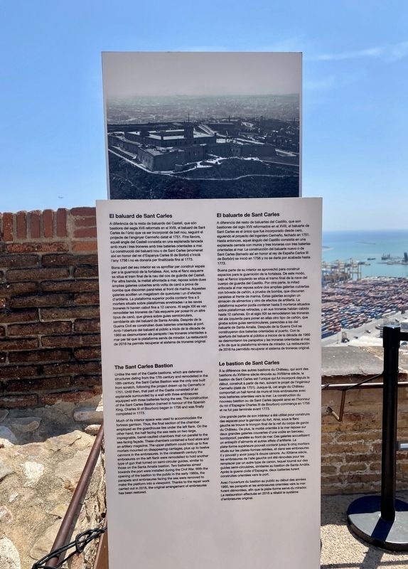
El baluard de Sant Carles
A diferència de la resta de baluards del Castell, que són bastions del segle XVII reformats en el XVIII, el baluard de Sant Carles és l'únic que va ser incorporat de bell nou, seguint el projecte de l'enginyer Cermeño datat el 1751. Fins llavors, aquell angle del Castell consistia en una esplanada tancada amb murs i tres troneres amb tres bateries orientades a mar. La construcció del baluard nou o de Sant Carles (anomenat així en honor del rei d'Espanya Carles III de Borbó) s'inicià l'any 1756 i no es donaria per finalitzada fins al 1773.
Bona part del seu interior es va aprofitar per construir espais per a la guarnició de la fortalesa. Així, sota el flanc esquerre se situa el tram final de la nau del cos de guàrdia del Castell. Per altra banda, la meitat afrontada a mar, reposa sobre dues àmplies galeries cobertes amb volta de canó a prova de bomba que discorren paral·leles al front de marina. Aquestes galeries acollien un magatzem de queviures i un d'efectes d'artilleria. La plataforma superior podia contenir fins a 5 morters situats sobre plataformes enretirades i a les seves troneres hi havien cabut fins a 12 canons. Al segle XIX es van remodelar les troneres de l'ala esquerre per posar-hi un altre tipus de canó, que girava sobre guies semicirculars, semblants als del baluard de Santa Amàlia. Després de la Guerra Civil es construïren dues bateries orientades al port. Amb l'obertura del baluard al públic a inicis de la dècada de 1960 es desmuntaren els parapets i les troneres orientades a mar per tal que la plataforma servís de mirador. La restauració de 2016 ha permès recuperar el sistema de troneres original.
The Sant Carles Bastion
Unlike the rest of the Castle bastions, which are defensive structures dating from the 17th century and remodelled in the 18th century, the Sant Carles Bastion was the only one built from scratch, following the project drawn up by Cermeño in 1751. Until then, that part of the Castle consisted of an esplanade surrounded by a wall with three embrasures equipped with three batteries facing the sea. The construction of the Sant Carles Bastion (named in honour of the Spanish King, Charles III of Bourbon) began in 1756 and was finally completed in 1773.
Much of its interior space was used to accommodate the fortress garrison. Thus, the final section of the chamber employed as the guardhouse lies under the left flank. On the other hand, the half
facing the sea rests on two large, impregnable, barrel-vaulted chambers that run parallel to the sea-facing façade. These chambers contained a food store and an artillery magazine. The upper platform could hold up to five
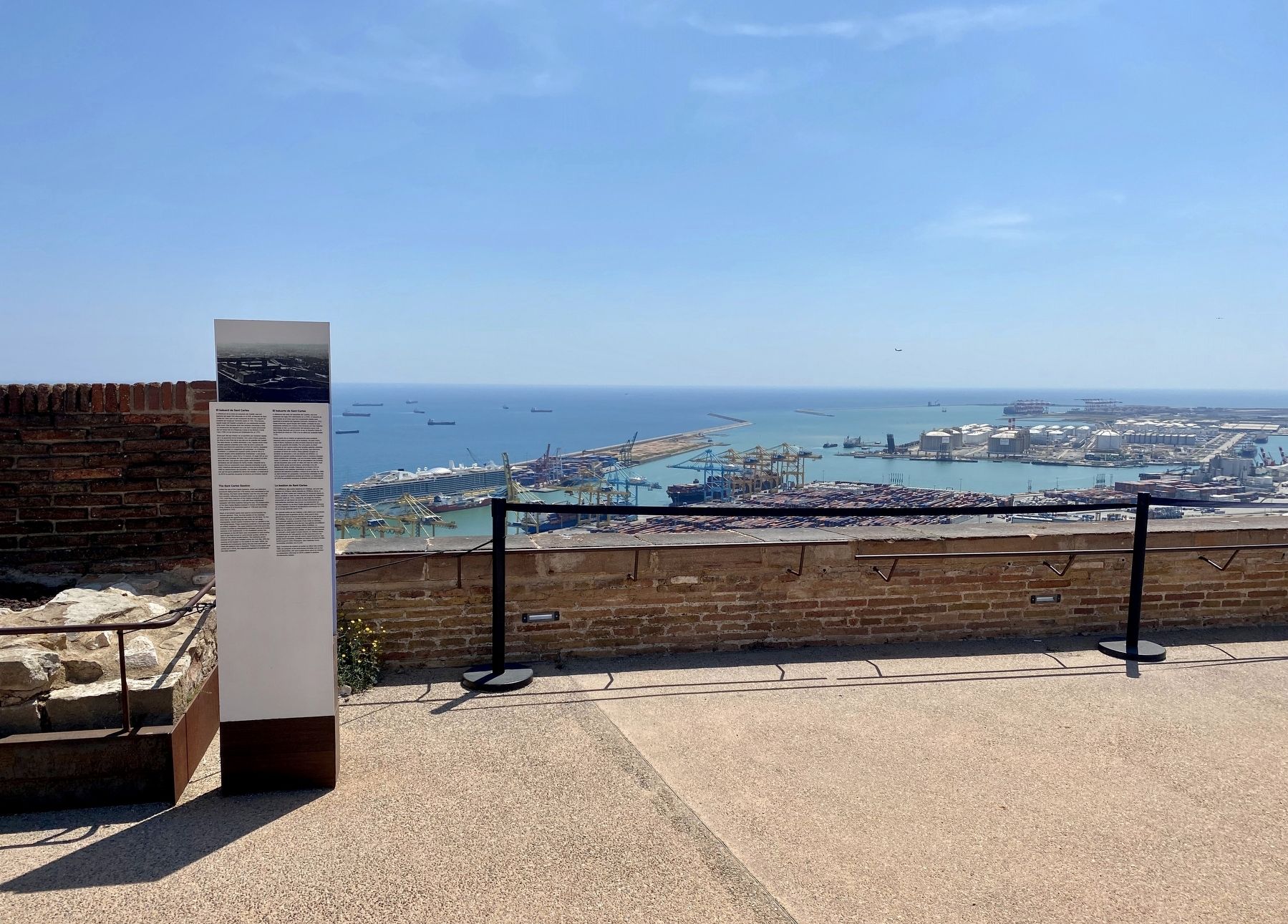
mortars mounted on disappearing carriages, plus up to twelve cannons in the embrasures. In the nineteenth century the embrasures on the left flank were remodelled to hold another type of gun that turned on semi-circular guides, similar to those on the Santa Amalia bastion. Two batteries aimed towards the port were installed during the Civil War. With the opening of the bastion to the public in the early 1960s, the parapets and embrasures facing the sea were removed to make the platform into a viewpoint. Thanks to the repair work carried out in 2016, the original arrangement of embrasures has been restored.
El baluarte de Sant Carles
A diferencia del resto de baluartes del Castillo, que son bastiones del siglo XVII reformados en el XVIII, el baluarte de Sant Carles es el único que fue incorporado desde cero, siguiendo el proyecto del ingeniero Cermeño, fechado en 1751. Hasta entonces, aquel ángulo del Castillo consistía en una explanada cerrada con muros y tres troneras con tres baterías orientadas al mar. La construcción del baluarte nuevo o de Sant Carles (llamado así en honor al rey de España Carlos III

Photographed By Andrew Ruppenstein, April 29, 2022
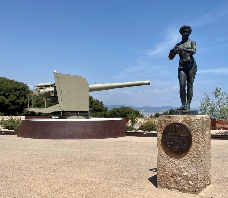
3. The Sant Carles Bastion - gun and Gaspar de Portola Memorial
In addition to the usual guns that one would expect to find at a bastion, the Sant Carles Bastion also has a memorial to Gaspar de Portola, with a dedication that reads (translated): "The City of Barcelona honors Gaspar de Portola, the first Governor of California, on his bicentennial - 1788 - 1988". As to why they would honor him, well, he was a Catalan. It should be noted that de Portola was Governor of the Californias, both Baja and Alta, with the latter only being what Americans would consider California.
Buena parte de su interior se aprovechó para construir espacios para la guarnición de la fortaleza. De este modo, bajo el flanco izquierdo se sitúa el tramo final de la nave del cuerpo de guardia del Castillo. Por otra parte, la mitad enfocada al mar reposa sobre dos amplias galerías cubiertas con bóveda de cañón, a prueba de bomba, que discurren paralelas al frente de marina. Estas galerías acogían un almacén de alimentos y otro de efectos de artillería. La plataforma superior podía contener hasta 5 morteros situados sobre plataformas retiradas, y en sus troneras habían cabido hasta 12 cañones. En el siglo XIX se remodelaron las troneras del ala izquierda para poner en ellas otro tipo de cañón, que giraba sobre guías semicirculares, parecidas a las del baluarte de Santa Amalia. Después de la Guerra Civil se construyeron dos baterías orientadas al puerto. Con la apertura del baluarte al público a inicios de la década de 1960 se desmontaron los parapetos y las troneras orientadas al mar, a fin de que la plataforma sirviera de mirador. La restauración de 2016 ha permitido recuperar el sistema de troneras original.
Le bastion de Sant Carles
À la différence des autres bastions du Château, qui sont des bastions du XVIIème siècle rénovés au XVIIIème siècle, le bastion de Sant Carles est l'unique qui fut incorporé depuis le début, construit à partir de rien, suivant le projet de l'ingénieur Cermeño (daté de 1751). Jusque-là, cet angle du Château comportait un hall fermé de murs et trois embrasures avec trois batteries orientées vers la mer. La construction du nouveau bastion ou de Sant Carles (appelé ainsi en l'honneur du roi d'Espagne Charles III de Bourbon) commença en 1756 et ne fut pas terminée avant 1773.
Une grande partie de son intérieur a été utilisé pour construire des espaces pour la garnison du fort. Ainsi, sous le flanc gauche se trouve le tronçon final de la nef du corps de garde du Château. De plus, la moitié orientée à la mer repose sur deux grandes galeries couvertes d'une voûte en berceau, bombproof, parallèle au front de mer. Ces galeries accueillaient un entrepôt d'aliments et autres effets d'artillerie. La plate-forme supérieure pouvait contenir jusqu'à cinq mortiers situés sur les plates-formes retirées, et dans ses embrasures il y pouvait y avoir jusqu'à douze canons. Au XIXème siècle, les embrasures de l'aile gauche ont été rénovées pour les remplacer par un autre type de canon, lequel tourné sur des guides semi-circulaires, similaires au bastion de Santa Amàlia. Après la guerre civile d'Espagne, deux batteries furent construites orientées vers le port. Avec l'ouverture du bastion au public au début des années 1960, les parapets et les embrasures orientées vers la mer furent démontées, afin que la plate-forme serve du mirador. La restauration effectuée en 2016 a rétabli le système d'embrasures original.
Topics. This historical marker is listed in this topic list: Forts and Castles.
Location. 41° 21.798′ N, 2° 10.038′ E. Marker is in Barcelona, Cataluña (Catalonia). It is in Montjuïc. Marker can be reached from Carretera de Montjuïc. The marker is on the top level of the fortress, in the southeast corner. Touch for map. Marker is in this post office area: Barcelona, Cataluña 08038, Spain. Touch for directions.
Other nearby markers. At least 8 other markers are within walking distance of this marker. Gaspar de Portolà (a few steps from this marker); El Pont d’accés i la façana / The Entrance Bridge and the Façade (within shouting distance of this marker); La torre de guaita / The Watchtower / La torre vigia / La tour de guet (within shouting distance of this marker); El pati d’armes o quadrat / The parade ground or courtyard (within shouting distance of this marker); Montjuic Castle (within shouting distance of this marker); Méchain Etablí les Coordenades de Barcelona / Méchain Establishes the Coordinates of Barcelona (within shouting distance of this marker); El juidici del President Lluís Companys / The Trial of President Lluís Companys (within shouting distance of this marker); Els calabossos del Castell / The Castle Dungeons / Los Calabozos del Castillo (about 90 meters away, measured in a direct line). Touch for a list and map of all markers in Barcelona.
Credits. This page was last revised on February 3, 2023. It was originally submitted on July 13, 2022, by Andrew Ruppenstein of Lamorinda, California. This page has been viewed 159 times since then and 9 times this year. Photos: 1, 2, 3, 4. submitted on July 13, 2022, by Andrew Ruppenstein of Lamorinda, California.


