Boston in Summit County, Ohio — The American Midwest (Great Lakes)
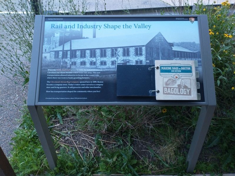
Rail and Industry Shape the Valley
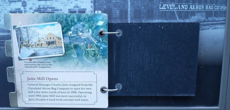
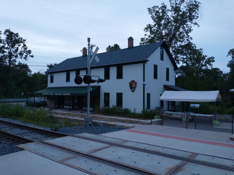
The Cleveland-Akron Bag Company opened here in 1898. Boston became a company town. Today’s visitor center served as a company store and living quarters. It sold groceries and other merchandise. How has transportation shaped the community where you live?
Caption:
Cleveland-Akron Bag Company, about 1900 (pictured above)
Flip Books
Making Bags in Boston and Beyond – Bagology
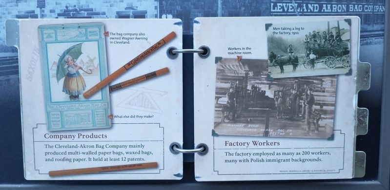
Company Products. The Cleveland-Akron Bag Company mainly produced multi-walled paper bags, waxed bags, and roofing paper. It held at least 12 patents.
Factory Workers. The factory employed as many as 200 workers, many with Polish immigrant backgrounds.
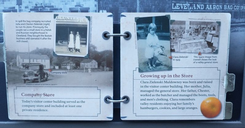
Company store. Today’s visitor center building served as he company store and included at least one private residence.
In 1918 the bag company recruited Julia and Chester Zielenski (right) to run its store. Previously the couple ran a small store in a Polish and Russian neighborhood in Cleveland. The brought the Boston business and operated it after the mill closed.
Growing up in the Store. Clara Zielenski Muldowney was born and raised in the visitor centor building. Her mother, Julia, managed the general store. Her father, Chester, worked as the butcher and managed the boots, tools, and men’s clothing. Clara remembers valley residents enjoying her family’s hamburgers, cookies, and large oranges.
Clara Zielenski in 1929.
This 1940s image from Everett shows the look of a valley general store.
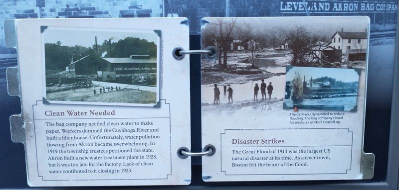
Clean Water Needed. The bag company needed clean water to make paper. Workers dammed the Cuyahoga River and built a filter house. Unfortunately, water pollution flowing from Akron became overwhelming. In 1919 the township trustees petitioned the state. Akron built a new water treatment plant in 1928, but it was too late for the factory. Lack of clean water contributed to it closing in 1923.
Disaster Strikes. The Great Flood of 1913 was the largest U.S. natural disaster at its time. As a river town, Boston felt the brunt of the flood.
The dam was dynamited to reduce flooding. The bag company closed for weeks as workers cleaned up.
Erected by U.S. Department of the Interior, National Park Service, Cuyahoga Valley National Park.
Topics. This historical marker is listed in these topic lists: Disasters • Industry & Commerce • Railroads & Streetcars. A significant historical year for this entry is 1880.
Location. 41° 15.762′ N, 81° 33.626′ W. Marker is in Boston, Ohio, in Summit County. Marker is on Boston Mills Road, on the right when traveling east. Marker is located at the Boston Mill Visitor Center in the Cuyahoga Valley National Park. Touch for map. Marker is in this post office area: Brecksville OH 44141, United States of America. Touch for directions.
Other nearby markers. At least 8 other markers are within walking distance of this marker. Boston Mills Road Bridge (a few steps from this marker); A River, Canal, and Railroad Town (within shouting distance of this marker); A River Renewed (within shouting distance of this marker); Protecting Cuyahoga Valley (within shouting distance of this marker); Cuyahoga Valley Scenic Railroad (within shouting distance of this marker); Industry Shapes the Valley (about 400 feet away, measured in a direct line); The Development of Valley Industry (about 400 feet away); Ride the Rails (about 400 feet away). Touch for a list and map of all markers in Boston.
Credits. This page was last revised on July 17, 2022. It was originally submitted on July 16, 2022, by Tom Bosse of Jefferson City, Tennessee. This page has been viewed 108 times since then and 31 times this year. Photos: 1, 2, 3, 4, 5, 6. submitted on July 16, 2022, by Tom Bosse of Jefferson City, Tennessee. • Bill Pfingsten was the editor who published this page.
