Victoria in Lunenburg County, Virginia — The American South (Mid-Atlantic)
Town of Victoria
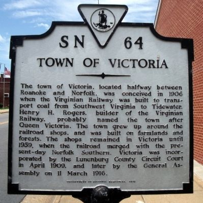
Photographed by Bernard Fisher, June 21, 2009
1. Town of Victoria Marker
Erected 1995 by Depaertment of Historic Resources. (Marker Number SN-64.)
Topics and series. This historical marker is listed in these topic lists: Political Subdivisions • Railroads & Streetcars. In addition, it is included in the Virginia Department of Historic Resources (DHR) series list. A significant historical date for this entry is March 11, 1916.
Location. 36° 59.612′ N, 78° 13.571′ W. Marker is in Victoria, Virginia, in Lunenburg County. It is at the intersection of Main Street (Virginia Route 40) and 6th Street, on the right
this page online

Regionally, this marker is in the Piedmont, in Southside Virginia, and specifically in Central Virginia. It is also in the American South and specifically in the Upper South. Globally, it is in North America, the Western Hemisphere, the Western World, and the Anglosphere. Historically, it finds itself in what was once the territory of the Mississippian Culture, one of the original Thirteen Colonies, one of the Confederate States of America, and the Antebellum South.
Other nearby markers. At least 8 other markers are within 2 miles of this marker, measured as the crow flies: Businesses & Merchants (about 300 feet away, measured in a direct line); People of Victoria (about 300 feet away); Railroad History (about 300 feet away); Places of the Past (about 300 feet away); Veterans Memorial (approx. half a mile away); The Peoples Community Center (approx. half a mile away); Nathaniel Lee Hawthorne (approx. 0.7 miles away); Lunenburg High School (approx. 1½ miles away).
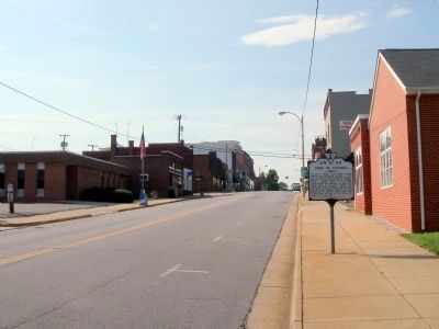
Photographed by Bernard Fisher, June 13, 2010
2. Main St (facing west)
Another marker is no longer nearby. The People's Community Center (was approx. half a mile away but has been replaced with another marker now near it).
Credits. This page was last revised on June 16, 2016. It was originally submitted on June 24, 2009, by Bernard Fisher of Richmond, Virginia. This page has been viewed 1,616 times since then and 114 times this year. Photos: 1. submitted on June 24, 2009, by Bernard Fisher of Richmond, Virginia. 2. submitted on June 14, 2010, by Bernard Fisher of Richmond, Virginia.
