Lyn-Lake in Minneapolis in Hennepin County, Minnesota — The American Midwest (Upper Plains)
Flour, Fuel and Baseball
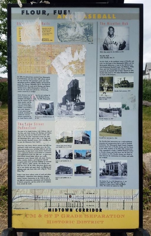
The CM&StP Grade Separation
— Midtown Corridor: CM & St P Grade Separation Historic District —
By 1890, 20 railroad lines stretched from Minneapolis in all directions, and more than 1,000 railcars entered the city each day with passengers, grain and other agricultural products, building supplies, and household goods. The Chicago, Milwaukee and St. Paul Railroad (CM&StP) built the tracks of its Hastings and Dakota division across south Minneapolis in 1879-81. In 1912-16, the tracks were placed in a 22-foot-deep trench crossed by 37 bridges.
Grain elevators were built along the new trackage by several companies, including the Sheffield Elevator Company and Baley & Cargill. By 1900, Minneapolis was the country's primary wheat market, and the city's elevators had a capacity of 30 million bushels. Local builders were early adapters of new grain-storage methods, including the reinforced concrete elevator pioneered in St. Louis Park in 1899.
The Lake Street Connection
For most of its length between Lake Calhoun, Lake of the Isles, and Cedar Avenue, the Hastings and Dakota rail tracks were laid one block north of Lake. Lake Street is the five-mile connection between the lakes, the Mississippi River, and St. Paul. In St. Paul, Lake Street becomes Marshall Avenue, which stretches east to near the Minnesota State Capitol.
From busy Lake Street, electric streetcar and later bus passengers could reach many points across the Twin Cities metropolitan area, including Stillwater and Lake Minnetonka. At Lake Street's main streetcar intersections, dense commercial districts served dotwntown commuters and neighborhood needs. By 1900, two- and three-story brick blocks housed banks, offices, apartments, department stores, Masonic halls, and shops. Grocers, tailors, jewelers, barbers, and drugstores typically occupied smaller brick and frame buildings or converted houses. Theaters, public schools, and churches also lined the street. By the 1920s, when horse liveries gave way to auto dealers and repair shops, streetlighting and widening made Lake Street what some called the "Great White Way."
Today's Lake Street reflects cycles of retail and urban development, competition from suburban shopping centers, freeway construction in the 1960s as well as new light-rail construction, reinvestment and revitalization of historic properties, and the arrival of new residents from around the world.
The Nicollet Hub
Willie Mays played for the Millers in 1951.
Nicollet Park
3048 Nicollet Ave. S.
Nicollet Park, at the southwest corner of Nicollet and Lake, was the home of the Minneapolis Millers and the Minneapolis Millerettes, a team in the All-American Girls Professional Baseball League. Ted Williams, Willie Mays, and Carl Yastrzemski were among 15 Millers honored by the Baseball Hall of Fame. Opened in 1896, Nicollet Park closed in 1955 when Metropolitan Stadium was built in Bloomington.
The Nicollet-Lake intersection was a well-established shopping and transportation hub as well as baseball destination. The Minneapolis Rapid Transit Company streetcar barns were at Nicollet Avenue and 31st Street. In the 1920s, members of the West Side Commercial Club campaigned to build a CM&StP Railroad station at Nicollet Avenue and 29th Street, but the plan was not realized. In 1978, Nicollet Avenue was closed at Lake Street for the construction of a K-Mart, and traffic was rerouted.
Fire Station No. 8, at 2749 Blaisdell Ave. S., was completed in 1885. This 1936 photo wshows an American La France tractor (1916) and pumper (1921). The station was replaced in 1940.
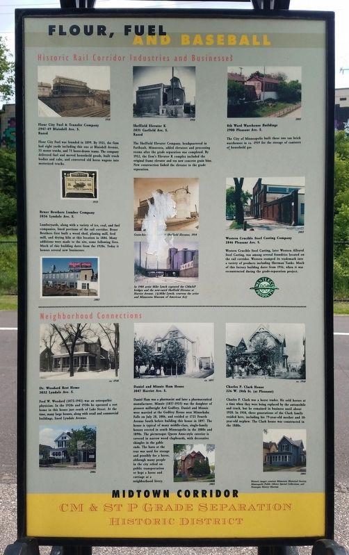
Historic Rail Corridor Industries and Businesses
Flour City Fuel & Transfer Company
2947-49 Blaisdell Ave. S.
Razed
Flour City Fuel was founded in 1899. By 1921, the firm had eight yards including this one at Blaisdell Avenue, 55 motor trucks, and 75 horse-drawn teams. The company delivered fuel and moved household goods, built truck bodies and cabs, and converted old horse wagons into motorized trucks.
Bruer Brothers Lumber Company
2836 Lyndale Ave. S.
Lumberyards, along with a variety of ice, coal, and fuel companies, lined portions of the rail corridor. Bruer Brothers first built a wood shed, planing mill, feed mill, and drying kilns at this location in 1886. Many additions were made to the site, some following fires. Much of this building dates from the 1920s. Today it houses several new businesses.
Sheffield Elevator K
2851 Garfield Ave. S.
Razed
The Sheffield Elevator Company, headquartered in Faribault, Minnesota, added elevators and processing rooms after the grade separation was completed. By 1912, the firm's Elevator K complex included the original frame elevator and ten new concrete grain bins. New construction linked the elevator to the grade separation.
8th Ward Warehouse Buildings
2900 Pleasant Ave. S.
The City of Minneapolis built these two tan brick warehouses in ca. 1919 for the storage of canisters of household gas.
Western Crucible Steel Casting Company
2846 Pleasant Ave. S.
Western Crucible Steel Casting, later Western Alloyed Steel Casting, was among several foundries located on the rail corridor. Western stamped its trademark into a variety of products including Sherman Tanks. Much of this factory building dates from 1916, when it was reconstructed during the grade-separation project.
Neighborhood Connections
Dr. Woodard Rest Home
3032 Lyndale Ave. S.
Fred W. Woodard (1872-1941) was an osteopathic physician. In the 1920s and 1930s he operated a rest home in this house just south of Lake Street. At the time, many large houses, along with retail and commercial buildings, lined Lyndale Avenue.
Daniel and Minnie Ham House
3047 Harriet Ave. S.
Daniel Ham was a pharmacist and later a pharmaceutical manufacturer. Minnie (1857-1935) was the daughter of pioneer millwright Ard Godfrey. Daniel and Minnie were married at the Godfrey House near Minnehaha Falls on July 28, 1886, and resided at 1721 Fourth Avenue South before building this house in 1897. The house is typical of many middle-class, single-family houses erected in south Minneapolis in the 1880s and 1890s. The picturesque Queen Anne-style exterior is covered in narrow wood clapboards, with decorative shingles in the gable ends. The barn at the rear was used for storage and possibly for a horse, although many people in the city relied on public transportation or kept a horse and carriage at a neighborhood livery.
Charles P. Clark House
226 W. 28th St. (at Pleasant)
Charles P. Clark was a horse trader. He sold horses at a time when they were being replaced by the automobile and truck, but he remained in business until about 1920. In 1910, three generations of the Clark family resided here, including his 79-year-old mother and 10-year-old nephew. The Clark house was constructed in the 1880s. (Marker Number 4.)
Topics. This historical marker is listed in these topic lists: Industry & Commerce • Railroads & Streetcars • Sports. A significant historical year for this entry is 1912.
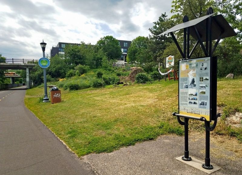
Location. 44° 57.023′ N, 93° 17.162′ W. Marker is in Minneapolis, Minnesota, in Hennepin County. It is in Lyn-Lake. Marker is on The Midtown Greenway east of Garfield Avenue, on the left when traveling east. The marker is on the Midtown Greenway rail trail, just east of the Garfield Avenue bridge and adjacent to the Soo Line Community Garden. Touch for map. Marker is at or near this postal address: 2845 Garfield Avenue, Minneapolis MN 55408, United States of America. Touch for directions.
Other nearby markers. At least 8 other markers are within walking distance of this marker. 2916 Lyndale Avenue: James J. Ballentine VFW Post 246 (about 600 feet away, measured in a direct line); Grade Separation Project (1912–16) (about 600 feet away); 609 West Lake Street: Schatzlein Saddle Shop (about 700 feet away); Lyndale Avenue and Lake Street/Crowell Building (approx. 0.2 miles away); Building the Corridor (approx. 0.3 miles away); 925 West Lake Street: The Minneapolis Mercantile Company (approx. 0.3 miles away); 1006 West Lake: The Buzza Building (approx. 0.3 miles away); 2900 Hennepin Avenue: The Uptown Theater (approx. 0.6 miles away). Touch for a list and map of all markers in Minneapolis.
Credits. This page was last revised on February 12, 2023. It was originally submitted on July 29, 2022, by McGhiever of Minneapolis, Minnesota. This page has been viewed 142 times since then and 26 times this year. Photos: 1, 2, 3. submitted on July 29, 2022, by McGhiever of Minneapolis, Minnesota. • J. Makali Bruton was the editor who published this page.


