Lenox Hill in Manhattan in New York County, New York — The American Northeast (Mid-Atlantic)
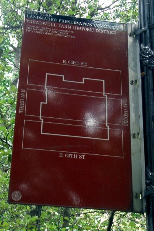
Treadwell Farm Historic District
New York Landmarks Preservation Foundation
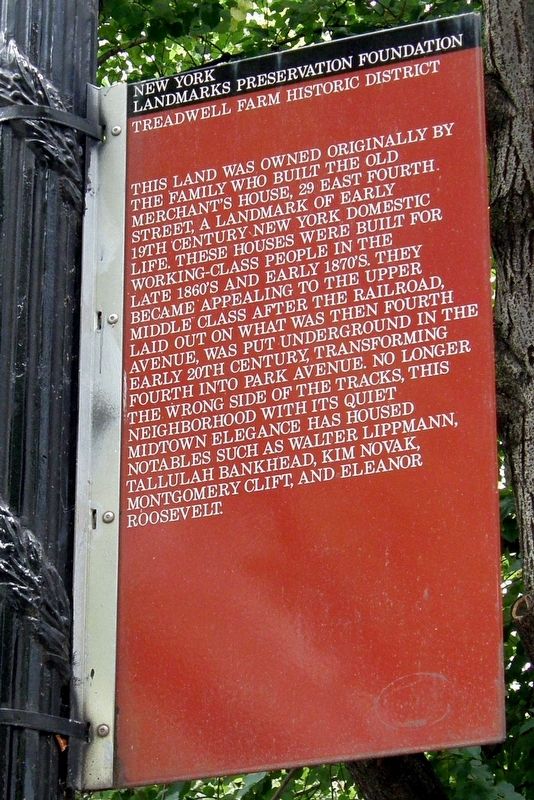
This land was owned originally by the family who built the Old Merchantís House, 29 East Fourth Street, a landmark of early 19th century domestic life. These houses were built for working-class people in the late 1860ís and early 1870ís. They became appealing to the upper middle class after the railroad, laid out on what was then Fourth Avenue, was put underground in the early 20th century, transforming Fourth into Park Avenue. No longer the wrong side of the tracks, this neighborhood with its quiet Midtown elegance has housed notables such as Walter Lippmann, Tallulah Bankhead, Kim Novak, Montgomery Clift, and Eleanor Roosevelt.
Erected by New York Landmarks Preservation Foundation.
Topics. This historical marker is listed in these topic lists: Architecture • Railroads & Streetcars.
Location. 40° 45.768′ N, 73° 57.839′ W. Marker is in Manhattan, New York, in New York County. It is in Lenox Hill. Marker is on East 62nd Street just east of Third Avenue, on the right when traveling east. Touch for map. Marker is at or near this postal address: 232 East 62nd Street, New York NY 10065, United States of America. Touch for directions.
Other nearby markers. At least 8 other markers are within walking distance of this marker. Nathan Hale (approx. 0.2 miles away); Manhattan House (approx. 0.2 miles away); The Evangeline Blashfield Fountain (approx. 0.2 miles away); Queensboro Bridge, New York (approx. 0.2 miles away); Eglise FranÁaise du St. Esprit (approx. ľ mile away); 131 East 66th Street (approx. ľ mile away); 130-134 East 67th Street (approx. 0.3 miles away); Ritz Tower (approx. 0.3 miles away). Touch for a list and map of all markers in Manhattan.
Regarding Treadwell Farm Historic District. The Historic District is included in the "AIA (American Institute of Architecture) Guide to New York City", fifth edition.
Also see . . . Treadwell Farm Historic District. Trust for Architectural Easements website entry (Submitted on August 3, 2022, by Larry Gertner of New York, New York.)
Credits. This page was last revised on January 31, 2023. It was originally submitted on August 3, 2022, by Larry Gertner of New York, New York. This page has been viewed 122 times since then and 21 times this year. Photos: 1, 2, 3, 4. submitted on August 3, 2022, by Larry Gertner of New York, New York.


