Phillips in Minneapolis in Hennepin County, Minnesota — The American Midwest (Upper Plains)
Minneapolis in the Age of Grade Separation
The CM&StP Grade Separation
— Midtown Corridor: CM & St P Grade Separation Historic District —
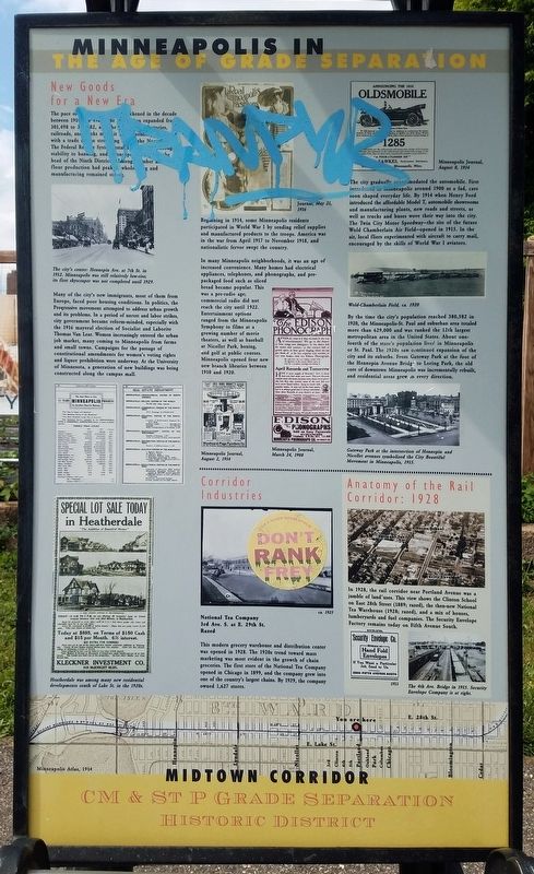
New Goods for a New Era
The pace of life in Minneapolis quickened in the decade between 1910 and 1920. The population expanded from 301,498 to 3...82, and the ... factories, railroads, and ... nks m... it ... with a trade ... n stro... ng .. the Nor... The Federal Reserve System, established in ... brought stability to banking, and Minneapolis ... the head of the Ninth District. Although lumber as well as flour production had peaked, wholesaling and manufacturing remained strong.
The city's center: Hennepin Ave. at 7th St. in 1912. Minneapolis was still relatively low-rise; its first skyscraper was not completed until 1929.
Many of the city's new immigrants, most of them from Europe, faced poor housing conditions. In politics, the Progressive movement attempted to address urban growth and its problems. In a period of unrest and labor strikes, city government became reform-minded, especially with the 1916 mayoral election of Socialist and Laborite Thomas Van Lear. Women increasingly entered the urban job market, many coming to Minneapolis from farms and small towns. Campaigns for the passage of constitutional amendments for women's voting rights and liquor prohibition were underway. At the University of Minnesota, a generation of new buildings was being constructed along the campus mall.
Beginning in 1914, some Minneapolis residents participated in World War I by sending relief supplies and manufactured products to the troops. America was in the war from April 1917 to November 1918, and nationalistic fervor swept the country.
In many Minneapolis neighborhoods, it was an age of increased convenience. Many homes had electrical appliances, telephones, and phonographs, and pre-packaged food such as sliced bread became popular. This was a pre-radio age; commercial radio did not reach the city until 1922. Entertainment options ranged from the Minneapolis Symphony to films at a growing number of movie theaters, as well as baseball at Nicollet Park, boxing, and golf at public courses. Minneapolis opened four new branch libraries between 1910 and 1920.
The city gradually accommodated the automobile. First introduced in Minneapolis around 1900 as a fad, cars soon shaped everyday life. By 1914 when Henry Ford introduced the affordable Model T, automobile showrooms and manufacturing plants, new roads and streets, as well as trucks and buses wove their way into the city. The Twin City Motor Speedway—the site of the future Wold Chamberlain Air Field—opened in 1915. In the air, local fliers experimented with aircraft to carry mail, encouraged by the skills of World War I aviators.
By the time the city's population reached 380,582 in 1920, the Minneapolis-St. Paul and suburban area totaled more than 629,000 and was ranked the 12th largest metropolitan area in the United States. About one-forth of the state's population lived in Minneapolis or St. Paul. The 1920s saw continued expansion of the city and its suburbs. From Gateway Park at the foot of the Hennepin Avenue Bridge to Loring Park, the old core of downtown Minneapolis was incrementally rebuilt, and residential areas grew in every direction.
Gateway park at the intersection of Hennepin and Nicollet avenues symbolized the City Beautiful Movement in Minneapolis, 1915.
Corridor Industries
National Tea Company
3rd Ave. S. at E. 29th St.
Razed
This modern grocery warehouse and distribution center was opened in 1928. The 1920s trend toward mass marketing was most evident in the growth of chain groceries. The firs store of the National Tea Company opened in Chicago in 1899, and the company grew into one of the country's largest chains. By 1929, the company owned 1,627 stores.
Anatomy of the Rail Corridor: 1928
In 1928, the rail corridor near Portland Avenue was a jumble of land uses. This view shows the Clinton School on East 28th Street (1889; razed), the then-new National Tea Warehouse (1928; razed), and a mix of houses, lumberyards and fuel companies. The Security Envelope Factory remains today on Fifth Avenue South.
Living on the Corridor
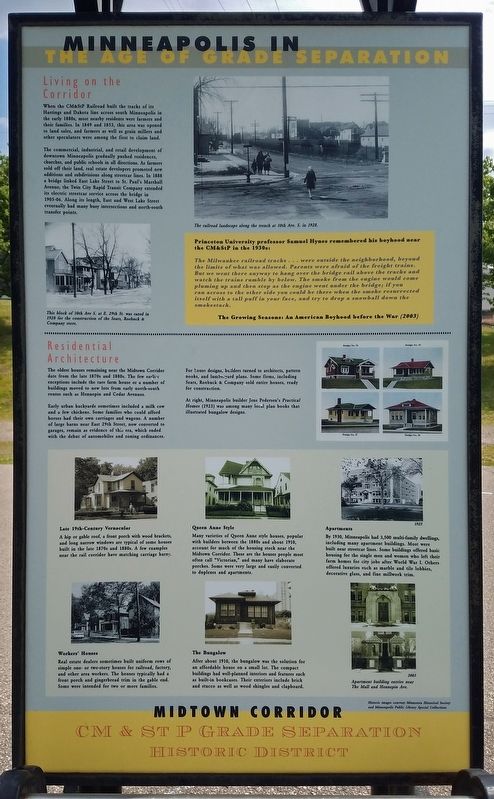
When the CM&StP Railroad built the tracks of its Hastings and Dakota line across south Minneapolis in the early 1880s, most nearby residents were farmers and their families. In 1849 and 1853, this area was opened to land sales, and farmers as well as grian millers and other speculators were among the first to claim land.
The commercial, industrial, and retail development of downtown Minneapolis gradually pushed residences, churches, and public schools in all directions. As farmers sold off their land, real estate developers promoted new additions and subdivisions along streetcar lines. In 1888 a bridge linked East Lake Street to St. Paul's Marshall Avenue; the Twin City Rapid Transit Company extended its electric streetcar service across the bridge in 1905-06. Along its length, East and West Lake Street eventually had many busy intersections and north-south transfer points.
This block of 10th Ave S. at E. 29th St. was razed in 1928 for the construction of the Sears, Roebuck & Company store.
The railroad landscape along the trench at 10th Ave. S. in 1928.
Princeton University professor Samuel Hynes remembered his boyhood near the CM&StP in the 1930s:Residential Architecture
The Milwaukee railroad tracks . . . were outside the neighborhood, beyond the limits of what was allowed. Parents were afraid of the freight trains. But we went there anyway to hang over the bridge rail above the tracks and watch the trains rumble by below. The smoke from the engine would come pluming up and then stop as the engine went under the bridge; if you ran across to the other side you could be there when the smoke resurrected itself with a tall puff in your face, and try to drop a snowball down the smokestack. The Growing Seasons: An American Boyhood before the War (2003)
The oldest houses remaining near the Midtown Corridor date from the late 1870s and 1880s. The few earlier exceptions include the rare farm house or number of buildings moved to new lots from early north-south routes such as Hennepin and Cedar Avenues.
Early urban backyards sometimes included a milk cow and a few chickens. Some families who could afford horses had their own carriages and wagons. A number of large barns near East 29th Street, now converted to garages, remain as evidence of this era, which ended with the debut of automobiles and zoning ordinances.
For house designs, builders turned to architects, pattern books, and lumberyard plans. Some firms, including Sears, Roebuck & Company sold entire houses, reader for construction.
At right, Minneapolis builder Jens Pedersen's Practical Homes (1923) was among the many local plan books that illustrated bungalow designs.
Late 19th-Century Vernacular
A hip or gable roof, a front porch with wood brackets, and long narrow windows are typical of some houses built in the late 1870s and 1880s. A few examples near the rail corridor have matching carriage barns.
Workers' Houses
Real estate dealers sometimes built uniform rows of simple one- or two-story houses for railroad, factory, and other area workers. The houses typically had a front porch and gingerbread trim in the gable end. Some were intended for two or more families.
Queen Anne Style
Many varieties of Queen Anne style houses, popular with builders between the 1880s and about 1910, account for much of the housing stock near the Midtown Corridor. These are the houses people most often call "Victorian," and many have elaborate porches. Some were very large and easily converted to duplexes and apartments.
The Bungalow
After about 1910, the bungalow was the solution for an affordable house on a small lot. The compact buildings had well-planned interiors and features such as built-in bookcases. Their exteriors include brick and stucco as well as wood shingles and clapboard.
Apartments
By 1930, Minneapolis had 3,500 multi-family dwellings, including many apartment buildings. Most were built near streetcar lines. Some buildings offered basic housing for the single men and women who left their farm homes for city jobs after World War I. Others offered luxeries such as marble and tile lobbies, decorative glass, and fine millwork trim.
Apartment building entries near The Mall and Hennepin Ave. (Marker Number 5.)
Topics. This historical marker is listed in these topic lists: Architecture • Industry & Commerce. A significant historical year for this entry is 1910.
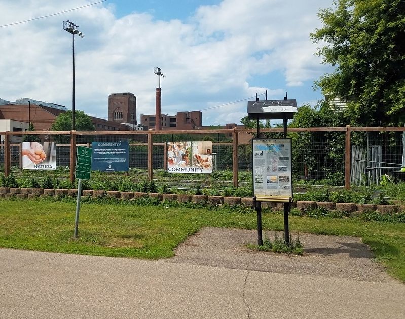
Location. 44° 57.024′ N, 93° 16.111′ W. Marker is in Minneapolis, Minnesota, in Hennepin County. It is in Phillips. Marker is on The Midtown Greenway east of South 5th Avenue, on the left when traveling east. The marker is on the Midtown Greenway rail trail, just east of South 5th Avenue and adjacent to the City Kid Farm. Touch for map. Marker is at or near this postal address: 2841 S 5th Avenue, Minneapolis MN 55408, United States of America. Touch for directions.
Other nearby markers. At least 8 other markers are within walking distance of this marker. 3009 Park Avenue: Pauline and Thomane Fjelde (approx. 0.2 miles away); Park Avenue Residential District / Distrito Residencial Avenida Park (approx. 0.2 miles away); 2627-47 Chicago Avenue: Northwestern Hospital for Women and Children (approx. 0.3 miles away); 804 East Lake: Town Treat Café / Calle Lake Este 804: Cafetería Town Treat (approx. 0.3 miles away); Midtown: A Place to Call Home (approx. 0.4 miles away); 2845 10th Avenue South: Elevator X (approx. 0.4 miles away); 2947 10th Avenue South: St. Mary's Greek Orthodox Church (approx. 0.4 miles away); An Era of New Business on the Rail Corridor (approx. 0.4 miles away). Touch for a list and map of all markers in Minneapolis.
More about this marker. The first paragraph of the sign is largely covered over with graffiti.
Credits. This page was last revised on February 11, 2024. It was originally submitted on August 14, 2022, by McGhiever of Minneapolis, Minnesota. This page has been viewed 134 times since then and 32 times this year. Last updated on February 8, 2024, by Kayla Harper of Dallas, Texas. Photos: 1, 2, 3. submitted on August 14, 2022, by McGhiever of Minneapolis, Minnesota. 4. submitted on February 8, 2024, by Kayla Harper of Dallas, Texas. • J. Makali Bruton was the editor who published this page.
Editor’s want-list for this marker. The marker text now covered by graffiti. • Can you help?


