Johnstown in Cambria County, Pennsylvania — The American Northeast (Mid-Atlantic)
Main Street and Point Stadium Ramp
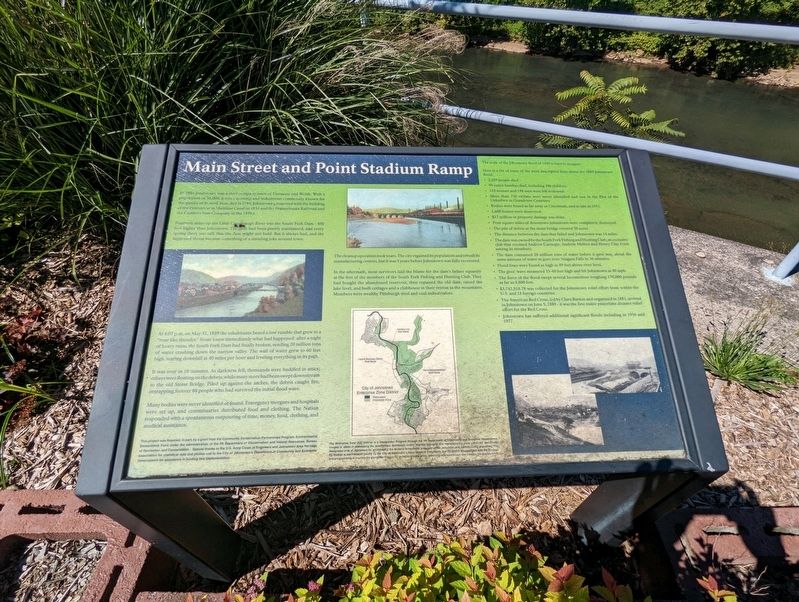
Fourteen miles up the Little Conemaugh River was the South Fork Dam - 450 feet higher than Johnstown. The dam had been poorly maintained, and every spring there was talk that the dam might not hold. But it always had, and the supposed threat became something of a standing joke around town.
At 4:07 p.m. on May 31, 1889 the inhabitants heard a low rumble that grew to a "roar like thunder." Some knew immediately what had happened: after a night of heavy rains, the South Fork Dam had finally broken, sending 20 million tons of water crashing down the narrow valley. The wall of water grew to 60 feet high, tearing downhill at 40 miles per hour and leveling everything in its path.
It was over in 10 minutes. As darkness fell, thousands were huddled in attics; others were floating on the debris, while many more had been swept downstream to the old Stone Bridge. Piled up against the arches, the debris caught fire, entrapping forever 80 people who had survived the initial flood wave.
Many bodies were never identified or found. Emergency morgues and hospitals were set up, and commissaries distributed food and clothing. The Nation responded with a spontaneous outpouring of time, money, food, clothing, and medical assistance.
The cleanup operation took years. The city regained its population and rebuilt its manufacturing centers, but it was 5 years before Johnstown was fully recovered.
In the aftermath, most survivors laid the blame for the dam's failure squarely at the feet of the members of the South Fork Fishing and Hunting Club. They had bought the abandoned reservoir, then repaired the old dam, raised the lake level, and built cottages and a clubhouse in their retreat in the mountains. Members were wealthy Pittsburgh steel and coal industrialists.
The scale of the Johnstown flood of 1889 is hard to imagine.
Here is a list of some of the most descriptive facts about the 1889 Johnstown flood.
● 2,209 people died.
● 99 entire families died, including 396 children.
● 124 women and 198 men were left widowed.
● More than 750 victims were never identified and rest in the Plot of the Unknown in Grandview Cemetery.
● Bodies were found as far away as Cincinnati, and as late as 1911.
● 1,600 homes were destroyed.
● $17 million in property damage was done.
● Four square miles of downtown Johnstown were completely destroyed.
● The pile of debris at the stone bridge covered 30 acres.
● The distance between the dam that failed and Johnstown was 14 miles.
● The dam was owned by the South Fork Fishing and Hunting Club, an exclusive club that counted Andrew Carnegie, Andrew Mellon and Henry Clay Frick among its members.
● The dam contained 20 million tons of water before it gave way, about the same amount of water that goes over Niagara Falls in 36 minutes.
● Flood lines were found as high as 89 feet above river level.
● The great wave measured 35-40 feet high and hit Johnstown at 40 mph.
● The force of the flood swept several locomotives weighing 170,000 pounds as far as 4,800 feet.
● $3,742,818.78 was collected for the Johnstown relief effort from within the U.S. and 18 foreign countries.
● The American Red Cross, led by Clara Barton and organized in 1881, arrived in Johnstown on June 5, 1889 - it was the first major peacetime disaster relief effort for the Red Cross.
● Johnstown has suffered additional significant floods including in 1936 and 1977.
Topics. This historical marker is listed in these topic lists: Disasters • Industry & Commerce. A significant historical date for this entry is May 31, 1889.
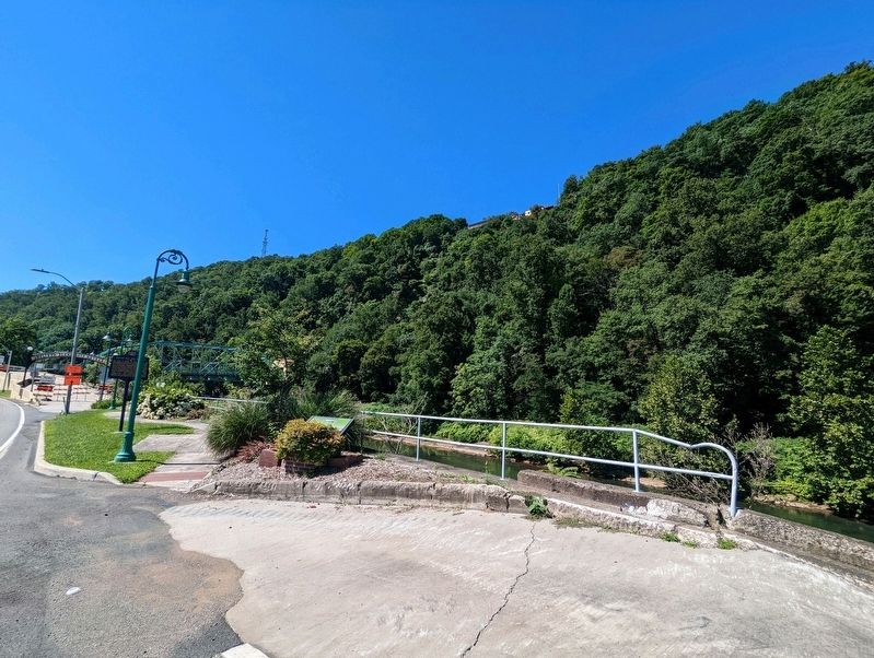
Location. 40° 19.642′ N, 78° 55.524′ W. Marker is in Johnstown, Pennsylvania, in Cambria County. Marker can be reached from the intersection of Roosevelt Boulevard (Pennsylvania Route 56) and Lincoln Street, on the right when traveling south. Located near the entrance to the Johnstown Inclined Plane. Touch for map. Marker is in this post office area: Johnstown PA 15901, United States of America. Touch for directions.
Other nearby markers. At least 8 other markers are within walking distance of this marker. Rolling Mill Mine Disaster (within shouting distance of this marker); Calamity and Prosperity (about 500 feet away, measured in a direct line); Johns Street Bridge (about 800 feet away); Johnstown Flood (approx. 0.2 miles away); Johnstown Local Flood Protection Project (approx. 0.2 miles away); Flood Prevention (approx. 0.2 miles away); Pennsylvania Railroad Stone Bridge (approx. 0.2 miles away); American Red Cross (approx. 0.2 miles away). Touch for a list and map of all markers in Johnstown.
Credits. This page was last revised on August 16, 2022. It was originally submitted on August 16, 2022, by Mike Wintermantel of Pittsburgh, Pennsylvania. This page has been viewed 82 times since then and 13 times this year. Photos: 1, 2. submitted on August 16, 2022, by Mike Wintermantel of Pittsburgh, Pennsylvania.

