Bound Brook in Somerset County, New Jersey — The American Northeast (Mid-Atlantic)
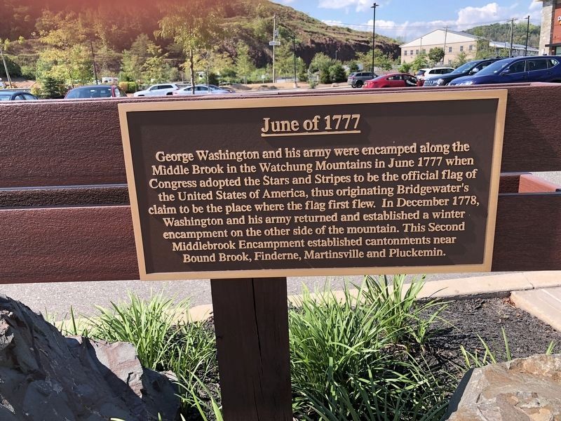
June of 1777
Topics. This historical marker is listed in this topic list: War, US Revolutionary. A significant historical month for this entry is June 1777.
Location. 40° 34.653′ N, 74° 33.533′ W. Marker is in Bound Brook, New Jersey, in Somerset County. Marker can be reached from Chimney Rock Road, on the right when traveling north. In shopping center on fence. Touch for map. Marker is at or near this postal address: 310 Chimney Rock Road, Bound Brook NJ 08805, United States of America. Touch for directions.
Other nearby markers. At least 8 other markers are within 2 miles of this marker, measured as the crow flies. 1777 Encampment (approx. one mile away); Middlebrook (approx. 1.1 miles away); Philip Van Horne House (approx. 1.2 miles away); Persian Gulf War (approx. 1.2 miles away); Bridgewater Train Station (approx. 1.3 miles away); War Memorial (approx. 1.4 miles away); The Council Oak (approx. 1.6 miles away); The Presbyterian Church at Bound Brook (approx. 1.7 miles away). Touch for a list and map of all markers in Bound Brook.
Credits. This page was last revised on October 17, 2022. It was originally submitted on August 16, 2022, by Raymond Siwek of Morristown, New Jersey. This page has been viewed 108 times since then and 22 times this year. Photo 1. submitted on August 16, 2022, by Raymond Siwek of Morristown, New Jersey. • Bill Pfingsten was the editor who published this page.
Editor’s want-list for this marker. A wide shot of the marker in context. • Can you help?
