Venice in Sarasota County, Florida — The American South (South Atlantic)
Venice
Inscription.
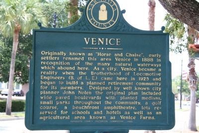
Originally known as "Horse and Chaise", early settlers renamed this area Venice in 1888 in recognition of the many natural waterways which abound here. As a city, Venice became a realty when the Brotherhood of Locomotive Engineers (B. of L.E.) came here in 1925 and began to build a planned retirement community for its members. Designed by well known city planner John Nolen the original plan included wide paved boulevards with planted medians, small parks throughout the community, a golf course, a beachfront amphitheatre, lots reserved for schools and hotels as well as an agricultural area known as Venice Farms.
Reverse:
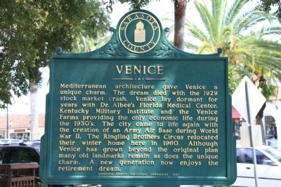
Mediterranean architecture gave Venice a unique charm. The dream died with the 1929 stock market crash. Venice lay dormant for years with Dr. Albee's Florida Medical Center, Kentucky Military Institute and the Venice Farms providing the only economic life during the 1930's. The city came to life again with the creation of an Army Air Base during World War II. The Ringling Brothers Circus relocated their winter home here in 1960. Although Venice has grown beyond the original plan many old landmarks remain as does the unique charm. A new generation now enjoys the retirement dream.
Erected 1983 by Sarasota County Historical Commission.
Topics. This historical marker is listed in these topic lists: Industry & Commerce • Settlements & Settlers. A significant historical year for this entry is 1888.
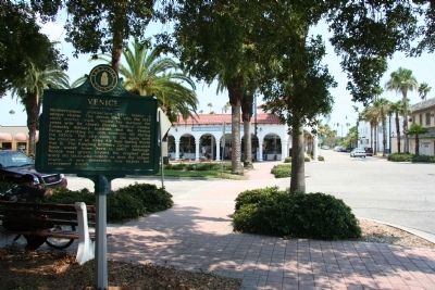
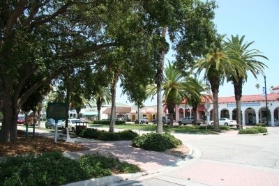
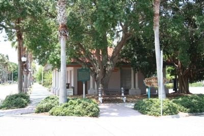
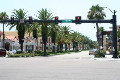
Location. 27° 6′ N, 82° 26.861′ W. Marker is in Venice, Florida, in Sarasota County. Marker is at the intersection of Venice Avenue and Nassau Avenue, on the right when traveling west on Venice Avenue. This historical marker is located in the center of the commercial district in downtown Venice, Florida, west of Business US 41, heading west towards the Venice public beach, on the northeast corner of Venice Avenue and Nassau Avenue. Touch for map. Marker is in this post office area: Venice FL 34285, United States of America. Touch for directions.
Other nearby markers. At least 8 other markers are within walking distance of this marker. Kentucky Military Institute (within shouting distance of this marker); The Hotel Venice (about 300 feet away, measured in a direct line); The Supreme Sacrifice (about 400 feet away); Ennes Arcade and Hotel Valencia 1926 (about 400 feet away); a different marker also named Kentucky Military Institute (about 500 feet away); San Marco Hotel (about 500 feet away); Johnson-Schoolcraft Building 1926 (about 700 feet away); Lord - Higel House Restoration Project (approx. ¼ mile away). Touch for a list and map of all markers in Venice.
Also see . . .
Venice Area Historical Society. Society website homepage (Submitted on July 1, 2009, by Dale K. Benington of Toledo, Ohio.)
Credits. This page was last revised on January 4, 2022. It was originally submitted on July 1, 2009, by Dale K. Benington of Toledo, Ohio. This page has been viewed 1,237 times since then and 48 times this year. Photos: 1, 2, 3, 4, 5, 6. submitted on July 1, 2009, by Dale K. Benington of Toledo, Ohio. • Bill Pfingsten was the editor who published this page.
