Near Washington Island in Door County, Wisconsin — The American Midwest (Great Lakes)
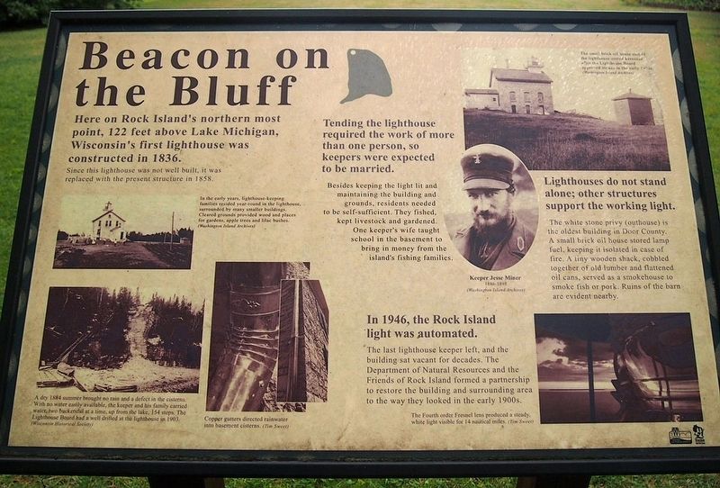
Beacon on the Bluff
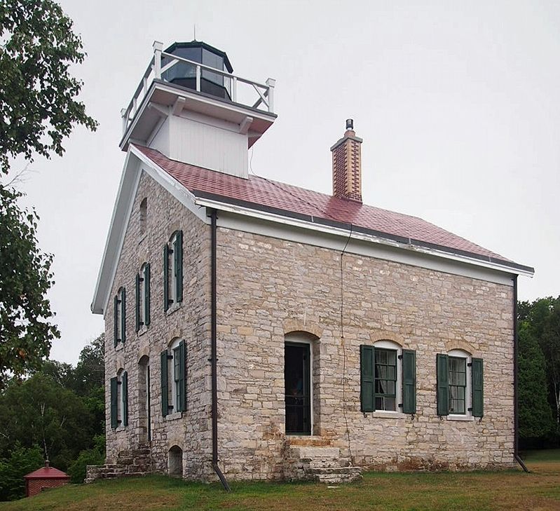
Here on Rock Island's northern most point, 122 feet above Lake Michigan, Wisconsin's first lighthouse was constructed in 1836.
Since this lighthouse was not well built, it was replaced with the present structure in 1858.
In the early years, lighthouse-keeping families resided year-round in the lighthouse, surrounded by many smaller buildings. Cleared grounds provided wood and places for garden, apple trees and lilac bushes.
A dry 1884 summer brought no rain and a defect in the cisterns. With no water easily available, the keeper and his family carried water, two bucketsful at a time, up from the lake, 154 steps. The Lighthouse Board had a well drilled at the lighthouse in 1903.
Copper gutters directed rainwater into basement cisterns.
Tending the lighthouse required the work of more than one person, so keepers were expected to be married.
Besides keeping the light lit and maintaining the building and grounds, residents needed to be self-sufficient. They fished, kept livestock and gardened. One keeper's wife taught school in the basement to bring in money from the island's fishing families.
Keeper Jesse Miner
1886-1898
Lighthouses do not stand alone; other structures support the working light.
The white stone privy (outhouse) is the oldest building in Door County. A small brick oil house stored lamp fuel, keeping it isolated in case of fire. A tiny wooden shack, cobbled together of old lumber and flattened oil cans, served as a smokehouse to smoke fish or port. Ruins of the barn are evident nearby.
The small brick oil house east of the lighthouse stored kerosene after the Lighthouse Board approved its use in the early 1900s.
In 1946, the Rock Island light was automated.
The last lighthouse keeper left, and the building sat vacant for decades. The Department of Natural Resources and the Friends of Rock Island formed a partnership to restore the building and surrounding area to the way they looked in the early 1900s.
The Fourth order Fresnel lens produced a steady, white light visible for 14 nautical miles.
Erected by Wisconsin Department of Natural Resources.
Topics. This historical marker is listed in this topic list: Notable Buildings. A significant historical year for this entry is 1836.
Location. 45° 25.627′ N, 86° 49.691′ W. Marker is near Washington Island, Wisconsin, in Door County. The marker is in Rock Island State Park, on the Thordarson Loop Trail a short distance south of the Pottawatomie Lighthouse. Touch for map. Marker is in this post office area: Washington Island WI 54246, United States of America. Touch for directions.
Other nearby markers. At least 8 other markers are within 12 miles of this marker, measured as the crow flies. Island Retreat (approx. 1.2 miles away); Washington Harbor / Schoolhouse Beach / Limestone Gems / Disappearing Treasure (approx. 5.2 miles away); Historic Shipwreck (approx. 5.2 miles away); Welcome to Den Norske Grenda (approx. 6.2 miles away); The Coffee Pot (approx. 7.1 miles away); Town of Liberty Grove (approx. 11.9 miles away); The Niagara Escarpment (approx. 11.9 miles away); Ancient Shorelines (approx. 11.9 miles away). Touch for a list and map of all markers in Washington Island.
Credits. This page was last revised on September 6, 2022. It was originally submitted on August 24, 2022, by McGhiever of Minneapolis, Minnesota. This page has been viewed 117 times since then and 12 times this year. Photos: 1, 2. submitted on August 24, 2022, by McGhiever of Minneapolis, Minnesota. • J. Makali Bruton was the editor who published this page.
Editor’s want-list for this marker. A wide view photo of the marker and the surrounding area together in context. • Can you help?

