Lester in Raleigh County, West Virginia — The American South (Appalachia)
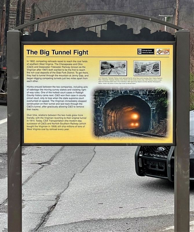
The Big Tunnel Fight
In 1902, competing railroads raced to reach the coal fields of southern West Virginia. The Chesapeake and Ohio (C&O) and Deepwater-Tidewater Railway (known as the Virginian after 1907) both wanted to be the first to reach the rich coal deposits of the Slab Fork District. To get there, they had to tunnel through the mountain at Jenny Gap, and began digging competing tunnels just two miles apart from each other.
Hijinks ensued between the two companies, including acts of sabotage like moving survey stakes and violating right-of-way rules. One of the hottest court cases in Raleigh County history came next. C&O won their case in county circuit court, only to lose when the state supreme court overturned on appeal. The Virginian immediately stopped construction on their tunnel and laid track through the C&O's tunnel, after graciously allowing C&O to remove their tracks.
Over time, relations between the two rivals grew more friendly, with the Virginian reverting to their original tunnel in 1914. Today, CSX Transportation (the modern-day successor of C&O) and Norfolk-Southern Railway (which bought the Virginian in 1959) still ship millions of tons of West Virginia coal by railroad every year.
Erected 2022 by National Coal Heritage Area Authority, Raleigh County Historical Society.
Topics. This historical marker is listed in these topic lists: Industry & Commerce • Railroads & Streetcars. A significant historical date for this entry is April 25, 1905.
Location. 37° 43.74′ N, 81° 18.323′ W. Marker is in Lester, West Virginia, in Raleigh County. Marker is on Lester Highway (West Virginia Route 54/97) 0.1 miles west of 4th Avenue (County Road 54/4), on the right when traveling west. The marker stands just west of 4th the Avenue intersection and the Norfolk-Southern RR crossing. Touch for map. Marker is at or near this postal address: 1975 Lester Hwy, Lester WV 25865, United States of America. Touch for directions.
Other nearby markers. At least 8 other markers are within 7 miles of this marker, measured as the crow flies. Site of Mark Twain High School (approx. 3 miles away); Korean War Memorial (approx. 3.2 miles away); First Church in Raleigh County (approx. 4.1 miles away); Logan, Raleigh and Monroe Turnpike (approx. 4.9 miles away); James Cecil “Little Jimmy” Dickens (approx. 6 miles away); Camp Lightfoot (approx. 6.4 miles away); Baseball (approx. 6.4 miles away); Helen (approx. 6.4 miles away).
Credits. This page was last revised on August 29, 2022. It was originally submitted on April 1, 2022, by Merle T. Cole of Daniels, West Virginia. This page has been viewed 217 times since then and 44 times this year. Last updated on August 26, 2022, by Merle T. Cole of Daniels, West Virginia. Photo 1. submitted on April 1, 2022, by Merle T. Cole of Daniels, West Virginia. • Devry Becker Jones was the editor who published this page.
