De Soto in Washington County, Missouri — The American Midwest (Upper Plains)
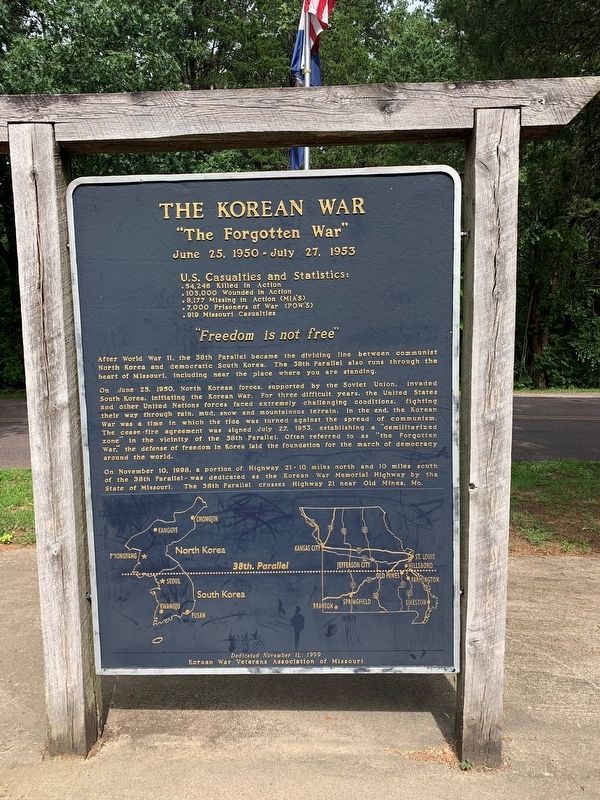
The Korean War
"The Forgotten War"
— June 25, 1950 - July 27, 1953 —
U.S. Casualties and Statistics:
54.246 Killed In Action54.246 Killed In Action • 103.000 Wounded in Action • 8,177 Missing in Action (MIA'S) • 7,000 Prisoners of War (POWS) • 919 Missouri Casualties
After World War II, the 38th Parallel became the dividing line between communist North Korea and democratic South Korea. The 38th Parallel also runs through the heart of Missouri, including near the place where you are standing.
On June 25, 1950, North Korean forces, supported by the Soviet Union, invaded South Korea, initiating the Korean War. For three difficult years, the United States and other United Nations forces faced extremely challenging conditions, fighting their way through rain, mud, snow and mountainous terrain. In the end, the Korean War was a time in which the tide was turned against the spread of communism The cease-fire agreement was signed July 27, 1953, establishing a "demilitarized zone" in the vicinity of the 38th Parallel. Often referred to as "the Forgotten War," the defense of freedom in Korea laid the foundation for the march of democracy around the world.
On November 10, 1998, a portion of Highway 21 — 10 miles north and 10 miles south of the 38th Parallel — was dedicated as the Korean War Memorial Highway by the State of Missouri. The 38th Parallel crosses Highway 21 near Old Mines, Mo.
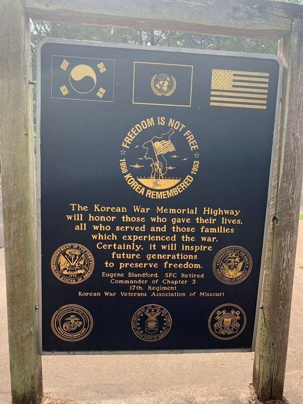
The Korean War Memorial Highway will honor those who gave their lives, all who served and those families which experienced the war. Certainly, it will inspire future generations to preserve freedom.
Erected 1999 by Korean War Association Of Missouri.
Topics. This memorial is listed in this topic list: War, Korean. A significant historical date for this entry is May 31, 1950.
Location. 38° 5.093′ N, 90° 41.05′ W. Marker is in De Soto, Missouri, in Washington County. Memorial is on Washington State Park Road just north of State Highway 104, on the right when traveling north. Touch for map. Marker is at or near this postal address: 10008 Washington State Park Rd, Cadet MO 63630, United States of America. Touch for directions.
Other nearby markers. At least 8 other markers are within 12 miles of this marker, measured as the crow flies. The Petroglyphs of Washington State Park (a few steps from this marker); Rock Carvings (approx. 0.4 miles away); Petroglyphs (approx. 0.4 miles away); Veterans Memorial (approx. 6.9 miles away); In Memory of Aime Amant Vaille (approx. 10.9 miles away); Artesian Spring / Valles Mines (approx. 10.9 miles away); Slave Cabin (approx. 10.9 miles away); a different marker also named Veterans Memorial (approx. 11.7 miles away). Touch for a list and map of all markers in De Soto.
Credits. This page was last revised on September 10, 2022. It was originally submitted on August 30, 2022, by Thomas Smith of Waterloo, Ill. This page has been viewed 121 times since then and 23 times this year. Photos: 1, 2, 3, 4. submitted on August 30, 2022, by Thomas Smith of Waterloo, Ill. • Devry Becker Jones was the editor who published this page.
Editor’s want-list for this marker. A wide shot of the marker in context. • Can you help?


