Raywick in Marion County, Kentucky — The American South (East South Central)
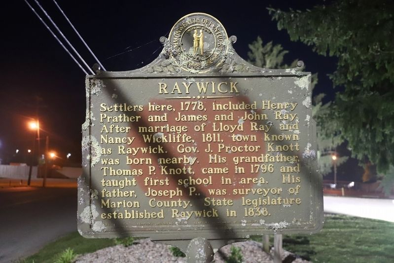
Raywick
Erected 1980 by Kentucky Historical Society / Kentucky Department of Transportation. (Marker Number 1673.)
Topics and series. This historical marker is listed in this topic list: Settlements & Settlers. In addition, it is included in the Kentucky Historical Society series list. A significant historical year for this entry is 1778.
Location. 37° 33.674′ N, 85° 25.835′ W. Marker is in Raywick, Kentucky, in Marion County. Marker is on Main Street (Kentucky Route 84) just west of Kentucky Route 527. Located near St Francis Xavier Catholic Church. Touch for map. Marker is at or near this postal address: 108 Main St, Raywick KY 40060, United States of America. Touch for directions.
Other nearby markers. At least 8 other markers are within 10 miles of this marker, measured as the crow flies. Saint Mary’s College (approx. 4.7 miles away); Loretto Sisters (approx. 5.3 miles away); Old Gristmill-Distillery (approx. 7.4 miles away); Catholic Pioneers (approx. 7.9 miles away); Camp Crittenden (approx. 8.8 miles away); The Sanders Family in the Civil War (approx. 9.3 miles away); Death of Tom Morgan (approx. 9.3 miles away); Death of a Morgan (approx. 9.3 miles away).
Credits. This page was last revised on September 1, 2022. It was originally submitted on August 31, 2022, by Dave W of Co, Colorado. This page has been viewed 133 times since then and 31 times this year. Photo 1. submitted on August 31, 2022, by Dave W of Co, Colorado. • Mark Hilton was the editor who published this page.
Editor’s want-list for this marker. Clear photo of marker & a wide shot of the marker and its surroundings. • Can you help?
