Manchester in Washtenaw County, Michigan — The American Midwest (Great Lakes)
Exchange Place
Overview
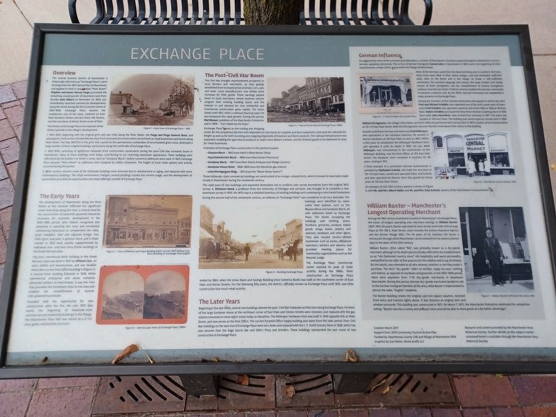
The central business district of Manchester is historically referred to as "Exchange Place", a term deriving from the 1837 Second Plat of Manchester, and applied to what is now labelled "Main Street". Stephen and James Harvey Fargo purchased the remaining unsold parcels of downtown land from founder John Gilbert on November 23, 1835, and immediately launched commerccial developments along the street during the first economic boom of 1835-1840. Exchange Place became the commercial core of the town, centered on East Main between Clinton and Ann Arbor Hill Streets, and the one block of Adrian Street south of Main.
The history of Exchange Place encompasses three distinct periods in the village's development:
1. 1833-1853, beginning with the original grist and saw mills along the River Raisin, the Fargo and Fargo General Store, and subsequent construction of Greek Revival style brick and wood structures which served both as retail businesses and homes along Main Street. The May 1853 fire in the grist mill, caused by the spontaneous combustion of accumulated grain smut, destroyed a large number of these original buildings, particularly along the north side of Exchange Place.
2. 1853-1940, consisting of significant Italianate brick construction, particularly during the post-Civil War economic boom in Manchester. Many of these buildings exist today, contributing to our charming downtown appearance. These buildings were referred to by the builder's or owner's name, such as "Goodyear Block", before numerical addresses were used. In 1925, Exchange Place became "Main Street" as addresses were assigned by utility companies. The height of local retail options and activity occurred during this period.
3. 1940-current, wherein some of the Italianate buildings were removed due to obsolescence or aging, and replaced with more contemporary buildings. The retail environment changed, several buildings moved into service usage, and the development of automobiles provided job opportunities and retail offerings outside of Exchange Place.
Figure 1 Early View of Exchange Place 1867
The Early Years
The development of Manchester along the River Raisin at this location reflected the significant water level drop along the river, a critical need for the construction of water-powered industries necessary for economic development in the 1830-1880 period. John Gilbert recognized this potential in selecting this land, and envisioned commercial structures to complement the mills, grain elevators, dam and adjacent bridge. Two mills (grist and saw), a general store, and a meat market in 1833 were quickly supplemented by individual one- and two-story frame buildings in the Greek Revival style.
The first commercial brick building in the Greek Revival-style was built in 1837 by William Carr, an early settler and businessman, and was located where the current Post Office building is (Figure 2). A second brick building followed in 1838. While commercial enterprise and social networks attracted settlers to Manchester, it was the river that provided the immediate draw to the area and enabled the establishment of several mill-powered businesses.
Provided with the opportunity for new construction after the fire, the year 1853 also marks the beginning of the Italianate-style commercial and residential buildings in the Village. The Manchester Flour Mill was rebuilt as a 2-1/2 story gable roof framed structure.
Figure 2 View of Rehfuss and Kapp Building (left) and the 1837 William Carr Brick Building on Exchange Place (right)
Figure 8 Stereoscopic View of Exchange Place, 1880s
The Post-Civil War Boom
The Civil War brought unprecedented prosperity to local farmers and merchants, as they greatly benefitted from increased prices of wheat, corn, oats and wool. Local manufacturers saw similar price increases for their goods. These earnings passed down to local merchants, whose business volume outgrew their existing building space, and the interest in and demand for new residential and commercial construction grew rapidly. The boom lasted until 1873, when a national financial panic hit and tempered this rapid growth. During this period Mat Bloser, publisher of the Manchester Enterprise, said in 1868 "Let's Build Up the Town".
Exchange Place served as the trading and shopping center for the prosperous farmers who depended on merchants for supplies and farm equipment, and used the railroads for freight as well as for both incoming and outgoing shipments of livestock and farm products. The railroad infrastructure was expanded, enabling the agricultural products to reach more distant markets, and for finished goods to be delivered to town for retail businesses.
Examples of Exchange Place construction in this period included:
- Gleason Block 1863 (now Keith's/Reed Barber Shop)
- Hoy/Unterkircher Block 1866 (now Manchester Pharmacy)
- Goodyear Block 1867 (now River Raisin Antiques and Village Laundry
- Goodyear House Hotel 1868-1869 (now the Marathon gas station)
- Lehn/Kirchgessner Bldg. 1873 (now the "Black Sheep Tavern")
The rapid pace of new buildings and expanded dimensions led to conflicts over survey boundaries from the original 1833 survey. C. DeVolson Wood, a professor from the University of Michigan and surveyor, was brought in to complete a new downtown survey in 1870. His 1870 map is a detailed inventory of existing buildings and contemporary merchants/businesses.
During the second half of the nineteenth century, an address on "Exchange Place" was considered to be very desirable. The buildings were identified by name rather than address, such as the Gleason Block and Goodyear Block, all with addresses listed as Exchange Place. The stores occupying the buildings sold clothing, shoes, furniture, groceries, produce, baked goods, drugs, books, jewelry and watches, hardware and other items. They also housed service-related businesses such as banks,, telephone operators, barbers and saloons, and provided meeting places for community organizations such as the Masonic Lodge.
The Exchange Place commercial center reached its peak of retail activity during the 1880s. Most construction on Exchange Place ended by 1894, when the Union Bank and Savings Building (now Comerica Bank) was built at the southwest corner of East Main and Adrian Streets. For the following fifty years, the district, officially known as Exchange Place until 1925, saw little construction but much retail activity.
Figure 4 Bustling Exchange Place
The Later Years
Beginning in the late 1930s, several new buildings altered the post-Civil War Italianate architecture along Exchange Place. Portions of the large Goodyear House at the northeast corner of East Main and Clinton Streets were removed, and replaced with the gas station/convenience store which exists today as Marathon. The Widmayer Hardware store was built in 1940 opposite this on Main Street, and now serves as the Post Office. The current Pyramid Office Supply building also dates from this later period. Post-Civil War buildings on the east end of Exchange Place were torn down and replaced with the C. F. Smith Grocery Store in 1938, which has now become Over the Edge Sport Bar and Ollie's Pizza and Grinders. These buildings represented the last round of new construction in Exchange Place.
German Influence
As suggestedby some of the surnames above, a number of Manchester's business people belonged to Washtenaw County's German-speaking community. The arrival of German immigrant Conrad Lehn in Manchester in 1854 marks the beginning of what would become a major ethnic group within the Village of Manchester.
Most of the Germans came from the Wuerttemberg area in southern Germany. Many knew each other in their native villages, and had developed sufficient skills, both on the farms and in the village, to create a self-sufficient community. The common language and culture, the large number and steady stream of fresh immigrants, and the establishment of several Evangelical Lutheran churches by Pastor Friedrich Schmid enabled the German community to become a cohesive unit. By the 1870s, German merchants has established a major presence on Exchange Place.
Among the members of the German community who played an active role were Fred and Michael Schaible, who operated one of the brick yards west of town, and J. Fred Schaible who operated a general store from 1902 to 1928 at 118 East Main. Walter Schaible purchased the Weurther Brothers Clothing Store in 1936 from tailor John Wuerther, who arrived from Germany in 1871. The store was located at 104 East Main. The building was constructed by Conrad Lehn in 1881. William Kirchgessner, the village's first baker, arrived in 1868 and partnered with Conrad Lehn in 1873 to build a brick business block at 115-117 East Main Street. Both the Kirchgessner and Lehn families lived above their stores in this building.
Another prominent German merchant was Fred Widmayer, who specialized in the hardware business. He worked in Norton Hardware at 109 East Main as early as 1882. Within a few years he established the Widmayer Hardware Store and operated it until his death in 1950. His son, Herb Winmayer, was instrumental in the construction of the Widmayer Building, not the Post Office, at 103 East Main Street. The hardware store remained in business for 80 years, closing in 1972.
A final example of a prominent German businessman is provided by Nathaniel Schmid, who built the structure at 110-112 East Main, owned and operated by Mack and Schmid, and later operated by the Banner Store (dry goods) for thirty years at 118 East Main Street.
An example of mid-20th Century owners is shown in Figure 6, with Mr. and Mrs. Albert Haller and Mr. and Mrs. Paul Schmid, owners of the Manchester Central Market.
Figure 5 J. Fred Schaible's Dry Goods Store
Figure 6 Manchester Central Market, 1950
William Baxter Manchester's Longest Operating Merchant
Among the 19th century businesses located on Manchester's Exchange Place, the honor of longest operating solo merchant belongs to William Baxter (1837-1901, 64 years). Baxter operated his store on the north side of Exchange Place at 134-136 E. Main Street, most recently the Sutton Insurance Agency and the former Village Gifts. The 64 years of his business life forms a microcosm through which Manchester can be viewed from its earliest pioneer days to the dawn of the 20th century.
William Baxter, often called "Bill", was primarily known as a dry-goods merchant, although at his death patrons fondly referred to his establishment as an "old-fashioned country store". His hospitality and warm personality, exemplified by the offer of free peanuts for the children and a cup of whiskey for the adults, was extended to all who entered, whether or not they made a purchase. The term "dry goods" refers to textiles, ready-to-wear clothing and notions, as opposed to hardware and groceries. In the 1870-1900 period, there were anywhere from 7-10 dry-goods merchants in downtown Manchester. During this period, German dry-goods merchants tended to attract the older, "English" residents.
The Baxter Building retains the original cast iron square columns, recessed front entry and transon lights above. It also features an original door and window surrounds. This building was constructed in 1871. On March 7, 1872, the Manchester Enterprise celebrated its completion noting: "Baxter now has a roomy and pleasant store and will be able to show goods at a far better advantage."
Figure 7 William Baxter in front of His Store, 1901
Created: March 2017
Support from 2016 Community Tourism Action Plan
Funded by: Washtenaw County CVB and Village of Manchester DDA
Graphics by Sue Maher, Moxie Grafix LLC
Research and content provided by the Manchester Area Historical Society. Further details on the subject matter contained herein is available through the Manchester Area Historical Society.
Erected 2017.
Topics. This historical marker is listed in this topic list: Industry & Commerce. A significant historical date for this entry is March 7, 1872.
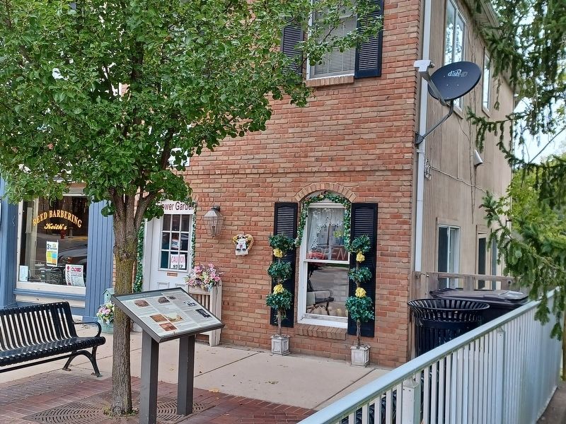
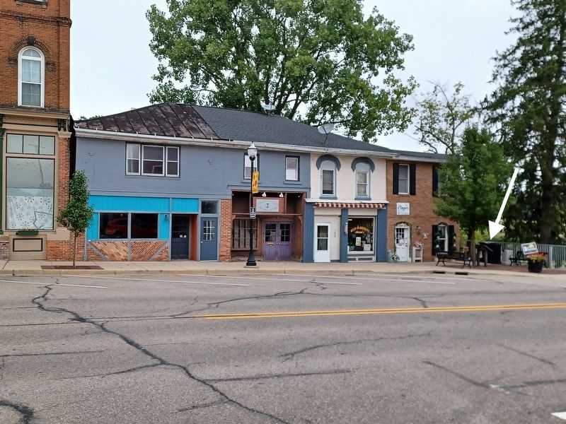
Location. 42° 9.002′ N, 84° 2.328′ W. Marker is in Manchester, Michigan, in Washtenaw County. Marker is at the intersection of East Main Street and Adrian Street, on the left when traveling east on East Main Street. Marker is next to the River Raisin bridge on the north side of the street. Touch for map. Marker is at or near this postal address: 152 East Main Street, Manchester MI 48158, United States of America. Touch for directions.
Other nearby markers. At least 8 other markers are within walking distance of this marker. The Founding of Manchester (a few steps from this marker); History of the Manchester Mill (within shouting distance of this marker); Village of Manchester (about 300 feet away, measured in a direct line); Life on a Manchester Corner (about 300 feet away); The Manchester Hotel and the Clinton Street Corner (about 400 feet away); Village of Manchester Sesquicentennial/The Kingsley-Jenter House (about 400 feet away); Fountain-Bessac House (about 500 feet away); Manchester's Railroads (about 500 feet away). Touch for a list and map of all markers in Manchester.
Credits. This page was last revised on June 21, 2023. It was originally submitted on September 9, 2022, by Joel Seewald of Madison Heights, Michigan. This page has been viewed 107 times since then and 10 times this year. Photos: 1, 2, 3. submitted on September 9, 2022, by Joel Seewald of Madison Heights, Michigan.


