Manchester in Washtenaw County, Michigan — The American Midwest (Great Lakes)
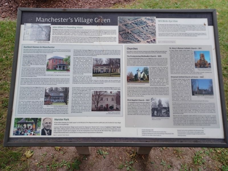
Manchester's Village Green
John Gilbert's Founding Vision
John Gilbert, the founder of the Village of Manchester, was born in Lenox Massachusetts in 1774, and grew up with the presence of a central public square in his town, where prestigious homes and large steeple churches faced an open area used for public gatherings. He carried this vision into his Original Plat of Manchester, dated 1833, conceived with the help of Hiram Burnham, a well-known surveyor of this area. Figure 1 shows the 1833 plat map with Manchester's "public square", centered in the proposed village layout, and up the hill from the central business district and water-powered mills built along the River Raisin. Gilbert's vision did not include any development east of the river.
This original vision altered slightly with the 1837 Plat of Manchester by the brothers Stephen and James Fargo, who purchased the bulk of the village land from Gilbert in 1835 and took over the development plans. These altered plans extended the village both east and north of Gilbert's original vision, but the "public square" remained and, to some extent, fulfilled Gilbert's original plan. Several churches have been built around the square, and it contains Manchester's oldest homes. The public gathering place remains today as Wurster Park, home to summer music concerts in the gazebo, church ice cream socials, and a shady, peaceful place to gather with friends and family.
Figure 1 — John Gilbert's 1833 Original Plat — Public Square is Center of Village
1872 Birds-Eye View
The 1872 Birds-Eye View of Manchester (Figure 10) accurately portrays the Village Green as it existed at the time. Working from the northwest corner of the square, we see the Farmer's Hotel, a two-story traditional tavern-style hotel, built between 1864 and 1870, and appealing to less wealthy travelers. The Farmer's Hotel existed until 1909, when it was removed and replaced with St. Mary's Roman Catholic Church. The Birds-Eye View also shows the James Lynch home (Figure 5) east of the hotel, and the original Presbyterian/Methodist church design with long horse stall (labeled as "2" in the view).
Across Jackson Street (now Main St.) sits the Fargo House (Figure 2) and the First Baptist Church (Figure 7), indicated by the numeral "3" in this view. The south side of the village green shows an original house facing Macomb Street which is no longer extant, and the two circa 1835 homes discussed below.
Figure 10 — 1872 Birds-Eye View of Village Green
Earliest Homes in Manchester
John Gilbert sold some

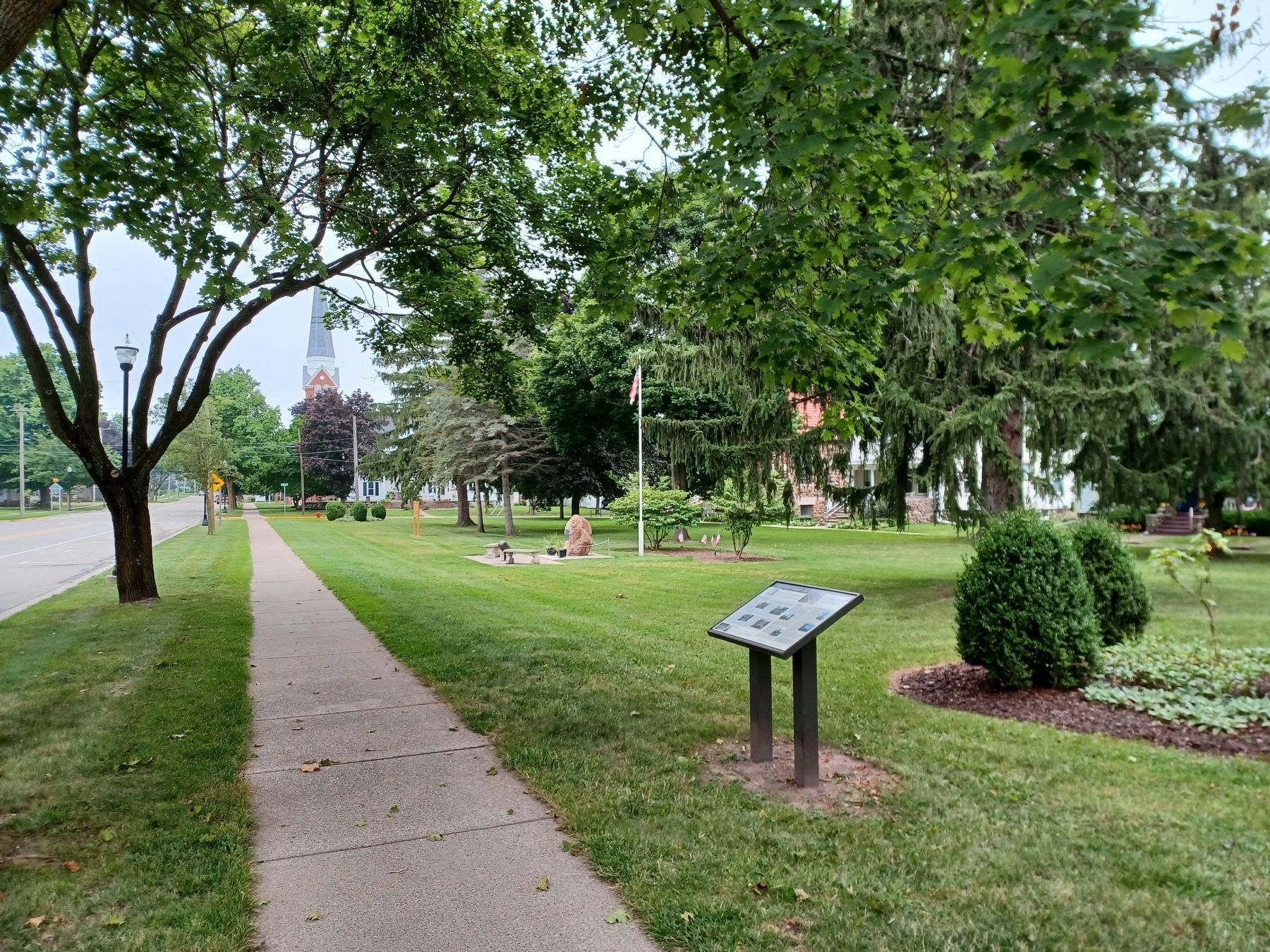
Photographed By Joel Seewald, September 4, 2022
2. Manchester's Village Green Marker
The steeple in the background down the street is Emanuel United Church of Christ (The German Church) and, in the background behind the marker, you can just see some of the fieldstones of St. Mary Roman Catholic Church.
Foremost among these is the James Harvey Fargo and Stephen Fargo Home, located on the south side of Main Street just east of the village green at 121 W. Main. This home is a classic brick Greek Revival with some later Italianate additions, built circa 1835, and is shown in Figure 2. The Fargo brothers, and James' wife Eliza Kief Fargo and children, lived here until James's death in 1840 and Stephen's relocation to Indiana circa 1845.
Figure 2 — The Fargo Home, 121 W. Main St.
The large first floor windows, extending to th floor, and the original full-length covered front porch, attest to the owner's wealth. The 1872 Bird's Eye View map clearly depicts the existing house with two, one-story gable-roofed additions at the rear of the main portion of the house. a 1˝-story, brick gable-roofed stable or carriage house at the rear of the property faces Washington Street.
Stephen Fargo was a part owner/operator of the Manchester Mill, and an investor in several real estate ventures. James H. Fargo was elected as the first supervisor of Manchester

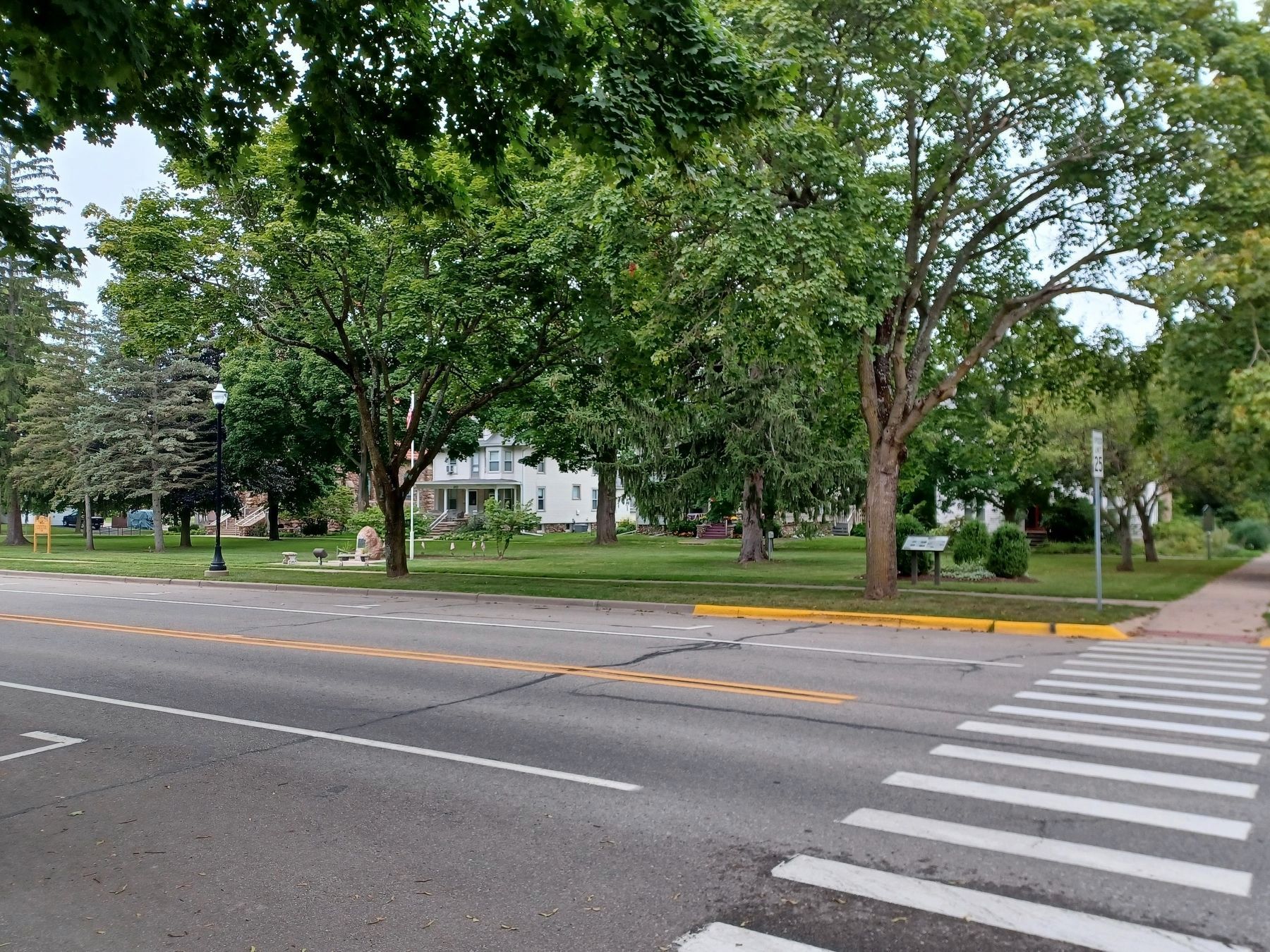
Photographed By Joel Seewald, September 4, 2022
3. Manchester's Village Green Marker
The white building in the background behind the marker is the former Manchester Township Library.
The home located at 211 W. Main (Figure 3) has at its core another of Manchester's earliest homes. Deed records show this lot excluded from John Gilbert's mass sale of lots to Stephen Fargo in October 1835, indicating it was already owned by another person and therefore likely had an occupant. However, research to date has not clearly identified this first home builder, but it is believed that the core of the existing home was constructed by mid-1835.
Figure 3 — House, 211 W. Main, Originally Built Circa 1835, Substantially Modified over the Years
This home has undergone many changes over the years. The house has a fieldstone and poured concrete foundation, and is two stories tall, with the eastern half being two bays wide and supporting a front-facing gable roof. The western half if capped by a side-gable roof. Some of the framing includes the use of hand-hewn beams. The Manchester Bird's Eye View map (1872) shows the 19th century house on this property was a rectangular structure with a front-facing gable roof, two stories tall, and three bays deep, with other additions occurring over the years. The Bird's-Eye View also shows a second house close to and facing Macomb Street, which is no longer there.
The home at 106 S. Washington (Figure 4) is another home believed constructed circa 1835, again having been excluded from the Gilbert to Fargo land sale of October 1835. It is a 1 ˝-story side-gable house situated on the south side of the public square. The block has a one-story, gable roofed wing attached to its east elevation, and a two-story carriage house/garage that is attached by a one-story rear wing. The foundation of the house is constructed of fieldstone.
The timber frame house is constructed with unpeeled cedar log joists, and lath boards consist of saplings. The construction methods employed and the Greek Revival architectural features confirm the core house was built in the 1830-1840 period. The core block is depicted on the 1872 Manchester Bird's Eye View map wit a half-width one story wing on the rear (southern) elevation and a single central chimney. According to the Sanborn maps, the rear wing was at leaast doubled in size by 1899.
For much of the first half of the 20th century, the house was occupied by members of the William Cash family (1908-1954). The house fell into disrepair during the mid-20th century, and was purchased and rehabilitated by Thomas Armstrong in 1972. In addition to extensive repairs to the core block, he added the garage and rear wing, and possibly the chimneys and west wing.
Figure 4 — House, 106 S. Washington, Originally Built Circa 1835
On the northeast corner of the square (202 W. Main) sits the James A. Lynch House (Figure 5), listed on the Michigan Register of Historic Sites. Junius Short had the house built in 1867 for his eldest daughter Elma and son-in-law Dr. James Lynch. James Lynch shared ownership of a pharmacy with John D. Van Duyn on Exchange Place. The property also included a small, one-story outbuilding at the rear by 1899. In 1934 Manchester Township purchased the house for $1200 from the Short descendants as a permanent location for the public library. The house served as the township library until 2000, when the new district library moved to the current Village Hall in 2001. The Italianate-style frame house has some Greek Revival elements, and has maintained the same massing as it is depicted in the 1872 Bird's Eye View of Manchester.
Figure 5 — James A. Lynch Home, former Manchester Township Library
Churches
John Gilbert's vision of churches centered on the Village Green has generally been fulfilled. Four churches at one time conducted services here, with two remaining.
The Presbyterian/Methodist Church - 1835
The Presbyterian/Methodist Church structure Figure 6), located on the east side of the village green at 122 W. Main, represents the second generation of a church structure at this location. The original building was constructed in 1825, and for several decades not only served as a religious center, but a public assembly place for visiting lecturers and other educational programs. Dr. B. A. Parnell, the nationally famous phrenologist, gave 15 lectures here in 1847 before suddenly dying and being buried in Manchester's Old Burying Ground.
No photographs have been located of this original structure, but the 1872 Birds-Eye View map (Figure 10) shows in accurate detail the appearance of this original building. It also had a very long gable-roofed building at the back of the lot, presumably to house the horses. The second version of the church was built by the Presbyterian congregation around 1880, and is a two-story Gothic Revival-style building with a steep front-oriented gable roof, along with a three-story bell tower with a steep pyramid cap on the west elevation.
In 1893, the Methodist congregation purchased the current building. The Queen Anne-style house north of the church, at 107 N. Washington, was built in 1904 by the Methodists for use as a parsonage. A social hall and Sunday school rooms were added to the rear of the church in 1958. The Methodist church congregation moved to a new church building built in 1972 on Ann Arbor Road, and the last service to be held in the Main Street structure took place on April 16, 1972. Since then the building has been used for various business enterprises, including doctors' and other offices.
Figure 6 — Former Presbyterian/Methodist Church
First Baptist Church - 1837
The First Baptist Church in Manchester (Figure 7) was organized on February 17, 1836, with thirty members. They erected a church building just east of the village green in 1837 at 111. W. Main Street, between Washington and Clinton Streets. In 1838, the name was changed to First Baptist Church and Society of Manchester. In 1906, the building was sold to the Evangelical Society, and the church was finally razed in 1923 and replaced by a house.
Figure 7 — First Baptist Church, south side of Main Street, circa 1910
St. Mary's Roman Catholic Church - 1911
St. Mary's Roman Catholic Church (Figure 8), a unique Manchester architectural treasure, is located at 210 W. Main Street on the north end of the village green. The church is a rectangular-shaped box with a front-facing gable roof wrapped in uncoursed cobblestone. Built in 1911, St. Mary's Catholic Church building is listed on the State Register of Historic Sites. Local craftsmen built the Neo-Gothic-inspired church from local fieldstone collected by farmers and salvaged from the foundation of a hotel that previously stood on the site. The church was designed by Father Edwin Fisher, pastor of Clinton and its missions, who became the resident pastor at Manchester in 1909. Pastor Fisher erected similar fieldstone churches in Tecumseh and Brooklyn. On January 17, 1912 the church, which cost $14,000 to build, was dedicated by Bishop Kelly. In 1952 Father William Schneider remodeled the interior of the church, replacing the main altar and the two side altars.
Figure 8 — St. Mary's Roman Catholic Church, north side of village green
Emanuel United Church of Christ - 1882
The Emanuel United Church of Christ building at 324 W. Main (Figure 9) was constructed in 1882 by the German Evangelical congregation in the block immediate northwest of the village green. The German church in Manchester was established in 1862. However, it can trace its roots back to the Bethel Church in nearby Freedom Township, which was one of many in Washtenaw County and the surrounding area to be established by Pastor Friedrich Schmid of Ann Arbor during the 1830s-1860s. Collectively, the Schmid-sponsored churches served the many German immigrants from the Wuerttemberg area that settled in Washtenaw County during the 19th century.
The 1882 church, constructed by the Immanuel United Evangelical Church, is composed of a fieldstone foundation, brick walls, and a prominent square bell tower, which is crowned with a louvered belfry and a 156-foot high pyramidal steeple. The church was built from a $60 design by Carl Schmid of Detroit, in the late Victorian Gothic style, similar to other churches in the County from that time period. The congregation purchased the entire block, known as "the flats," for $900 in April of 1882. The building was dedicated in December 1882, completing the entire process in less than a year. The construction of the building cost approximately $11,000.
Over the years the congregation added additional structures to their property. A frame schoolhouse located to the west of the church was built in 1889. In 1909 the congregation added a new parsonage and accompanying rectangular two-story stable on the eastern portion of the block. In 1927, the congregation replaced the school building with a relatively large church hall. In 1952, the congregation constructed a wing that connected the old church with the church hall. The congregation became part of the United Church of Christ in the early 1960s. A major reconstruction of the church steeple occurred in 2014.
Figure 9 — Emanuel United Church of Christ, west of the village green
Wurster Park
As John Gilbert intended, the "public square" on his 1833 plat of the village has become a public park, and a location for many village events and social gatherings.
In January 1957, the Manchester Village Council named the village green "Wurster Park", in honor of Lawrence P. "Dutch" Wurster (1883-1968), a lifelong resident and active member of the Manchester community. Wurster was an executive at Peoples Bank, and a major supporter of youth sports programs. He led the development of Carr Park and the MCS Alumni Field, captained several championship baseball teams, and led efforts to bring manufacturing businesses to Manchester.
Figure 11 — Lawrence P. "Dutch" Wurster
Created: November 2016
Support from 2016 Community Tourism Action Plan
Funded by: Washtenaw County CVB and Village of Manchester DDA
Graphics by Sue Maher, Moxie Grafix LLC
Research and content provided by the Manchester Area Historical Society. Further details on the subject matter contained herein is available through the Manchester Area Historical Society.
Erected 2017.
Topics. This historical marker is listed in these topic lists: Churches & Religion • Notable Buildings • Settlements & Settlers. A significant historical date for this entry is January 17, 1912.
Location. 42° 8.932′ N, 84° 2.497′ W. Marker is in Manchester, Michigan, in Washtenaw County. Marker is at the intersection of West Main Street and North Washington Street, on the right when traveling west on West Main Street. Marker is in Wurster Park. Touch for map. Marker is at or near this postal address: 215 West Main Street, Manchester MI 48158, United States of America. Touch for directions.
Other nearby markers. At least 8 other markers are within walking distance of this marker. Veteran's Memorial (a few steps from this marker); Manchester Township Library / James A. Lynch House (within shouting distance of this marker); Saint Mary Church (within shouting distance of this marker); George Washington (within shouting distance of this marker); Fountain-Bessac House (about 400 feet away, measured in a direct line); The German Church (about 500 feet away); The Manchester Hotel and the Clinton Street Corner (about 500 feet away); Founding Members of Immanuel United Evangelical Church (about 500 feet away). Touch for a list and map of all markers in Manchester.
Credits. This page was last revised on June 21, 2023. It was originally submitted on September 10, 2022, by Joel Seewald of Madison Heights, Michigan. This page has been viewed 101 times since then and 6 times this year. Photos: 1, 2, 3. submitted on September 10, 2022, by Joel Seewald of Madison Heights, Michigan.
