Near Andover in Day County, South Dakota — The American Midwest (Upper Plains)
Brown County / Day County
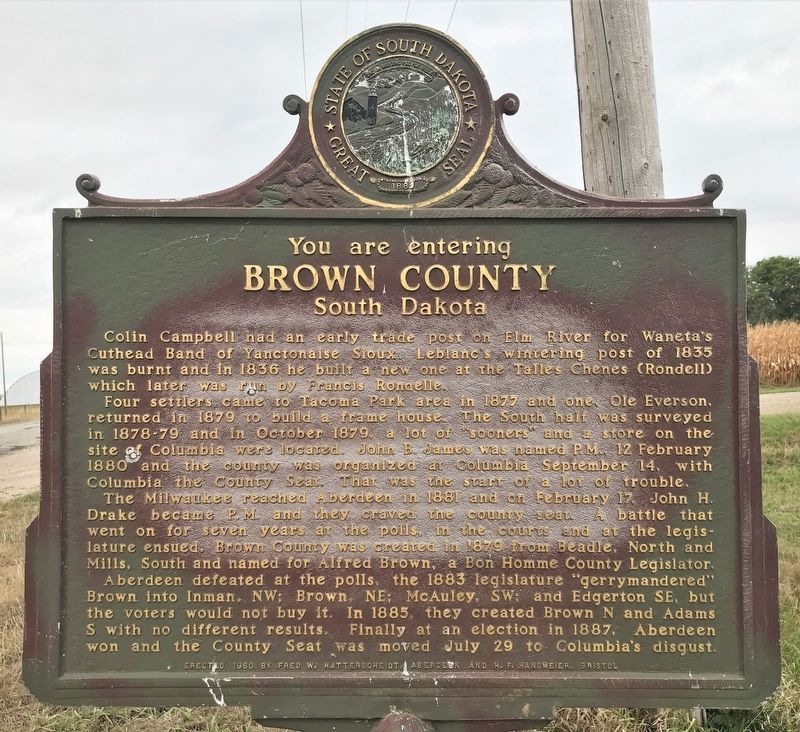
Brown County
South Dakota
Colin Campbell had an early trade post on Elm River for Waneta's Cuthead Band of Yanctonaise Sioux. Leblanc's wintering post of 1835 was burnt and in 1836 he built a new one at the Talles Chenes (Rondell) which later was run by Francis Rondelle.
Four settlers came to Tacoma Park area in 1877 and one, Ole Everson, returned in 1879 to build a frame house. The South half was surveyed in 1878-79 and in October 1879, a lot of "sooners" and a store on the site of Columbia were located. John B. James was named P.M., 12 February 1880 and the county was organized at Columbia September 14, with Columbia the County Seat. That was the start of a lot of trouble.
The Milwaukee reached Aberdeen in 1881 and on February 17, John H. Drake became P.M. and they craved the county seat. A battle that went on for seven years at the polls, in the courts and at the legislature ensued. Brown County was created in 1879 from Beadle, North and Mills, South and named for Alfred Brown, a Bon Homme County Legislator.
Aberdeen defeated at the polls, the 1883 legislature "gerrymandered" Brown into Inman, NW; Brown, NE; McAuley, SW; and Edgerton SE, but the voters would not buy it. In 1885, they created Brown N and Adams S with no different results. Finally at an election in 1887, Aberdeen won and the County Seat was moved July 29 to Columbia's disgust.
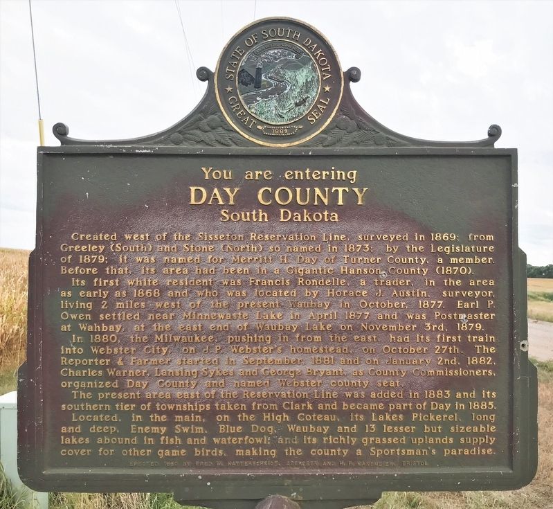
Day County
South Dakota
Created west of the Sisseton Reservation Line, surveyed in 1869; from Greeley (South) and Stone (North) so named in 1873; by the Legislature of 1879; it was named for Merritt H. Day of Turner County, a member. Before that, its area had been in a Gigantic Hanson County (1870).
Its first white resident was Francis Rondelle, a trader, in the area as early as 1868 and who was located by Horace J. Austin, surveyor, living 2 miles west of the present Waubay in October, 1877. Earl P. Owen settled near Minnewaste Lake in April 1877 and was Postmaster at Wahbay, at the east end of Waubay Lake on November 3rd, 1879.
In 1880, the Milwaukee, pushing in from the east, had its first train into Webster City, on J. P. Webster’s homestead, on October 27th. The Reporter & Farmer started in September, 1881 and on January 2nd, 1882, Charles Warner, Lansing Sykes and George Bryant, as County Commissioners, organized Day County and named Webster county seat.
The present area east of the Reservation Line was added in 1883 and its southern tier of townships taken from Clark and became part of Day in 1885.
Located, in the main, on the High Coteau, its Lakes Pickerel, long and deep, Enemy Swim, Blue Dog, Waubay and 13 lesser but sizeable lakes abound in fish and waterfowl; and its richly grassed uplands supply cover for other game birds, make the county a Sportsman’s paradise.
Erected 1960 by Fred W. Hatterscheidt, Aberdeen and H. F. Hansmeier, Bristol. (Marker Number 283.)
Topics and series. This historical marker is listed in this topic list: Settlements & Settlers. In addition, it is included in the South Dakota State Historical Society Markers series list. A significant historical year for this entry is 1835.
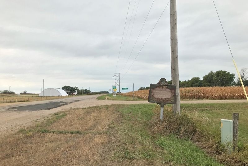
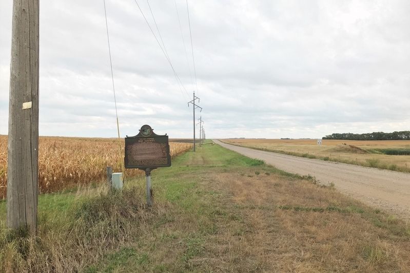
Location. 45° 26.61′ N, 97° 58.798′ W. Marker is near Andover, South Dakota, in Day County. Marker is at the intersection of 134th Street and 412th Avenue (County Highway 43), on the right when traveling west on 134th Street. Touch for map. Marker is in this post office area: Groton SD 57445, United States of America. Touch for directions.
Other nearby markers. At least 4 other markers are within 14 miles of this marker, measured as the crow flies. Groton South Dakota Veteran's Memorial (approx. 6.1 miles away); Amsden Dam (approx. 6.3 miles away); Charles H. Sheldon (approx. 8 miles away); First Presbyterian Church (approx. 13.1 miles away).
Credits. This page was last revised on September 24, 2022. It was originally submitted on September 24, 2022. This page has been viewed 77 times since then and 9 times this year. Photos: 1, 2, 3, 4. submitted on September 24, 2022.


