New Albany in Floyd County, Indiana — The American Midwest (Great Lakes)
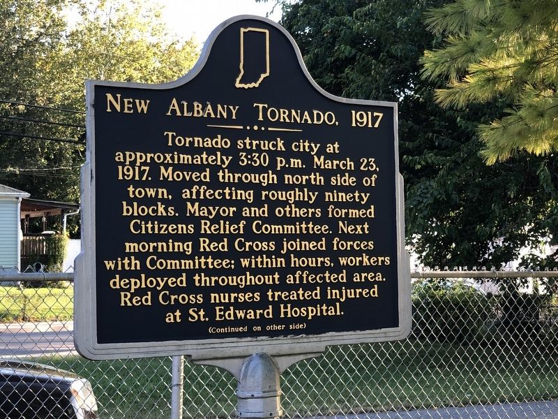
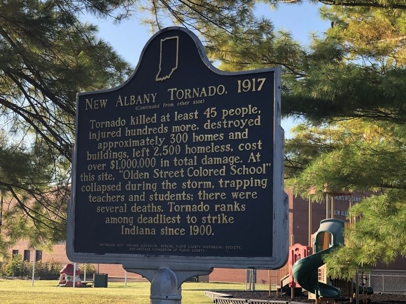
New Albany Tornado, 1917
Inscription.
Tornado struck city at approximately 3:30 p.m. March 23, 1917. Moved through north side of town, affecting roughly ninety blocks. Mayor and others formed Citizens Relief Committee. Next morning Red Cross joined forces with Committee; within hours, workers deployed throughout affected area. Red Cross nurses treated injured at St. Edward Hospital.
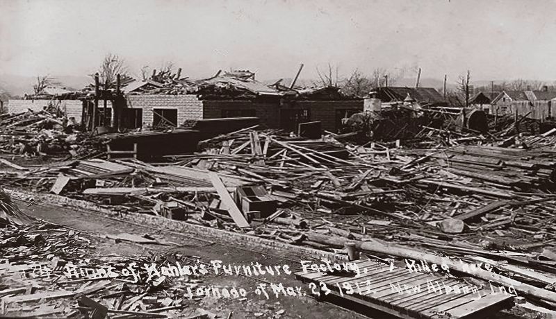
Tornado killed at least 45 people, injured hundreds more, destroyed approximately 300 homes and buildings, left 2,500 homeless, cost over $1,000,000 in total damage. At this site, "Olden Street Colored School" collapsed during the storm, trapping teachers and students; there were several deaths. Tornado ranks among deadliest to strike Indiana since 1900.
Erected 2007 by Indiana Historical Bureau • Floyd County Historical Society • Caesars Foundation of Floyd County. (Marker Number 22.2007.1.)
Topics and series. This historical marker is listed in this topic list: Disasters. In addition, it is included in the Indiana Historical Bureau Markers series list. A significant historical date for this entry is March 23, 1917.
Location. 38° 17.669′ N, 85° 49.611′ W. Marker is in New Albany, Indiana, in Floyd County. Marker is at the intersection of Pearl Street and Union Street, on the right when traveling south on Pearl Street. Touch for map. Marker is at or near this postal address: 1111 Pearl St, New Albany IN 47150, United States of America. Touch for directions.
Other nearby markers. At least 8 other markers are within walking distance of this marker. New Albany and Salem Railroad (The Monon) (approx. 0.4 miles away); Fairview Cemetery (approx. half a mile away); Carnegie's Lasting Gifts (approx. 0.6 miles away); City-County Building (approx. 0.6 miles away); Scribner High School (approx. 0.7 miles away); Floyd County's Bicentennial Bison (approx. 0.7 miles away); The Mitchell-Meyer House (approx. 0.7 miles away); New Albany Downtown Historic District (approx. 0.7 miles away). Touch for a list and map of all markers in New Albany.
Also see . . .
1. Twister: Looking back at the 1917 tornado that decimated New Albany. The massive F4 tornado cut a path of destruction three miles long by a half-mile wide, killing 45 people and destroying 300 buildings. (Robyn Davis Sekula, News and Tribune, posted March 19, 2007) (Submitted on October 1, 2022, by Duane and Tracy Marsteller of Murfreesboro, Tennessee.)
2. New Albany Cyclone of 1917 (PDF). The belief that the Knobs to the west of New Albany, Indiana would protect the city from natural disasters was proven fatally wrong on the afternoon of March 23, 1917. (Cody Moore, National Weather Service, Louisville) (Submitted on October 1, 2022, by Duane and Tracy Marsteller of Murfreesboro, Tennessee.)
3. The 1917 Cyclone (PDF). Biographical sketches
of the tornado's victims, who ranged in age from 5˝ months to 87 years old. (Kaitlyn Tisdale, 2017) (Submitted on October 1, 2022, by Duane and Tracy Marsteller of Murfreesboro, Tennessee.)
Credits. This page was last revised on October 1, 2022. It was originally submitted on October 1, 2022, by Duane and Tracy Marsteller of Murfreesboro, Tennessee. This page has been viewed 122 times since then and 37 times this year. Photos: 1, 2, 3. submitted on October 1, 2022, by Duane and Tracy Marsteller of Murfreesboro, Tennessee.


