Gananoque in Leeds and Grenville United Counties, Ontario — Central Canada (North America)
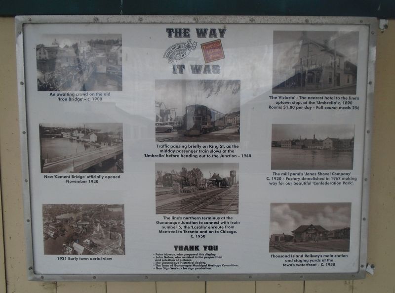
The Way It Was
[Photo captions, left column top to bottom, read]
• An awaiting crowd on the old ‘Iron Bridge’ – c. 1900
• New ‘Cement Bridge’ officially opened November 1930
• 1921 Early town aerial view
[Photo captions, center column top to bottom, read]
• Traffic pausing briefly on King St. as the midday passenger train slows
at the ‘Umbrella’ before heading out to the Junction – 1948
• The line’s northern terminus at the Gananoque Junction to connect with train
number 5, the ‘Lasalle’ enroute from Montreal to Toronto and on to Chicago. C. 1950
[Photo captions, right column top to bottom, read]
• ‘The Victoria’ – The nearest hotel to the line’s uptown stop, at the ‘Umbrella’ c. 1890
Rooms $1.00 per day – Full course meals 25¢
• The mill pond’s ‘Jones Shovel Company’ C. 1930 – Factory demolished in 1967
making way for our beautiful ‘Confederation Park.’
• Thousand Island Railway’s main station and staging yards at the town waterfront – C. 1950
Erected by Concerned Citizens and Organizations.
Topics. This historical marker is listed in these topic lists: Bridges & Viaducts • Industry & Commerce • Railroads & Streetcars • Settlements & Settlers. A significant historical month for this entry is November 1930.
Location. 44° 19.671′ N, 76° 9.882′ W. Marker is in Gananoque, Ontario, in Leeds and Grenville United Counties. Marker is on King Street East (County Highway 2) just west of Park Street, on the right when traveling west. Touch for map. Marker is in this post office area: Gananoque ON K7G 2Y5, Canada. Touch for directions.
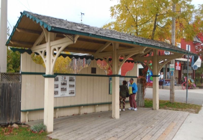
Other nearby markers. At least 8 other markers are within walking distance of this marker. The Umbrella (here, next to this marker); Engine 500 (a few steps from this marker); Raid on Gananoque (within shouting distance of this marker); A Brief History of Half Moon Bay (within shouting distance of this marker); Site of the D. F. Jones Shovel Co. (within shouting distance of this marker); Jones Shovel Factory (within shouting distance of this marker); Gananoque Town Hall (within shouting distance of this marker); Private John Henry (Harry) Brown (within shouting distance of this marker). Touch for a list and map of all markers in Gananoque.
Also see . . .
1. John Nalon – Gananoque’s “Mr. History”. (Submitted on October 9, 2022, by William Fischer, Jr. of Scranton, Pennsylvania.)
2. Thousand Islands Railway. (Submitted on October 9, 2022, by William Fischer, Jr. of Scranton, Pennsylvania.)
Credits. This page was last revised on October 9, 2022. It was originally submitted on October 9, 2022, by William Fischer, Jr. of Scranton, Pennsylvania. This page has been viewed 52 times since then and 3 times this year. Photos: 1, 2. submitted on October 9, 2022, by William Fischer, Jr. of Scranton, Pennsylvania.

